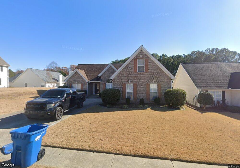
1097 Sham Pointe Dr Unit 1 Lawrenceville, GA 30043
Estimated Value: $361,666 - $396,000
3
Beds
2
Baths
1,745
Sq Ft
$215/Sq Ft
Est. Value
About This Home
This home is located at 1097 Sham Pointe Dr Unit 1, Lawrenceville, GA 30043 and is currently estimated at $375,667, approximately $215 per square foot. 1097 Sham Pointe Dr Unit 1 is a home located in Gwinnett County with nearby schools including Woodward Mill Elementary School, Twin Rivers Middle School, and Mountain View High School.
Ownership History
Date
Name
Owned For
Owner Type
Purchase Details
Closed on
Apr 30, 1999
Sold by
G & B Builders Inc
Bought by
Elam Marvin
Current Estimated Value
Home Financials for this Owner
Home Financials are based on the most recent Mortgage that was taken out on this home.
Original Mortgage
$125,500
Outstanding Balance
$30,763
Interest Rate
6.9%
Mortgage Type
New Conventional
Estimated Equity
$344,904
Create a Home Valuation Report for This Property
The Home Valuation Report is an in-depth analysis detailing your home's value as well as a comparison with similar homes in the area
Home Values in the Area
Average Home Value in this Area
Purchase History
| Date | Buyer | Sale Price | Title Company |
|---|---|---|---|
| Elam Marvin | $132,200 | -- |
Source: Public Records
Mortgage History
| Date | Status | Borrower | Loan Amount |
|---|---|---|---|
| Open | Elam Marvin | $125,500 |
Source: Public Records
Tax History Compared to Growth
Tax History
| Year | Tax Paid | Tax Assessment Tax Assessment Total Assessment is a certain percentage of the fair market value that is determined by local assessors to be the total taxable value of land and additions on the property. | Land | Improvement |
|---|---|---|---|---|
| 2025 | $5,180 | $136,680 | $23,920 | $112,760 |
| 2024 | $4,664 | $120,480 | $32,000 | $88,480 |
| 2023 | $4,664 | $120,480 | $32,000 | $88,480 |
| 2022 | $4,036 | $103,800 | $26,800 | $77,000 |
| 2021 | $3,444 | $85,960 | $18,400 | $67,560 |
| 2020 | $2,905 | $70,600 | $13,760 | $56,840 |
| 2019 | $2,801 | $70,600 | $13,760 | $56,840 |
| 2018 | $2,800 | $70,600 | $13,760 | $56,840 |
| 2016 | $2,474 | $60,800 | $13,760 | $47,040 |
| 2015 | $2,022 | $47,320 | $9,600 | $37,720 |
| 2014 | -- | $45,280 | $8,000 | $37,280 |
Source: Public Records
Map
Nearby Homes
- 2283 Infield Ln
- 1988 Greensferry Glen
- 3034 Brookgreen Trail
- 2681 Whistler Way NE
- 1731 Harper Lily Ln Unit LOT 50
- 1051 Bullpen Bluffs
- 2907 Beaconwood Ct
- 3215 Willow Glade Trail
- 1045 Bullpen Bluffs
- 1057 Bullpen Bluffs
- 2921 Beaconwood Ct
- 1049 Bullpen Bluffs
- 2905 Beaconwood Ct
- 1047 Bullpen Bluffs
- 2901 Beaconwood Ct
- 2917 Beaconwood Ct
- 2903 Beaconwood Ct
- 1722 Harper Lily Ln Unit LOT 200
- 1334 Taylor Knoll Ln
- 1314 Taylor Knoll Ln
- 1087 Sham Pointe Dr
- 1021 Wicker Pine Dr
- 1011 Wicker Pine Dr
- 1031 Wicker Pine Dr
- 1031 Wicker Pine Dr Unit 32
- 1031 Wicker Pine Dr NE
- 1077 Sham Pointe Dr
- 1041 Wicker Pine Dr Unit 1
- 991 Wicker Pine Dr
- 1096 Sham Pointe Dr
- 991 Wicker Pine Dr NE
- 1001 Stonekirk Trace Unit 1
- 1001 Stonekirk Trace
- 1076 Sham Pointe Dr Unit 1
- 981 Wicker Pine Dr
- 1022 Wicker Pine Dr
- 1067 Sham Pointe Dr
- 1012 Wicker Pine Dr Unit 1012
- 1012 Wicker Pine Dr Unit 1
- 1012 Wicker Pine Dr