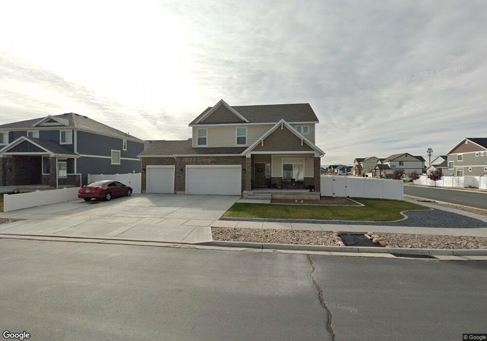
1097 W 1875 S Unit 221 Syracuse, UT 84075
Estimated Value: $686,834 - $775,000
4
Beds
3
Baths
3,747
Sq Ft
$191/Sq Ft
Est. Value
About This Home
This home is located at 1097 W 1875 S Unit 221, Syracuse, UT 84075 and is currently estimated at $717,459, approximately $191 per square foot. 1097 W 1875 S Unit 221 is a home located in Davis County with nearby schools including Cook School, Legacy Junior High School, and Clearfield High School.
Ownership History
Date
Name
Owned For
Owner Type
Purchase Details
Closed on
Dec 11, 2018
Sold by
Clayton Properties Group Ii Inc
Bought by
Uson Rolando and Uson Mary Jean
Current Estimated Value
Home Financials for this Owner
Home Financials are based on the most recent Mortgage that was taken out on this home.
Original Mortgage
$297,500
Outstanding Balance
$261,591
Interest Rate
4.8%
Mortgage Type
VA
Estimated Equity
$455,868
Purchase Details
Closed on
Aug 17, 2016
Sold by
G M W Development Inc
Bought by
Oakwood Homes Of Utah Llc
Create a Home Valuation Report for This Property
The Home Valuation Report is an in-depth analysis detailing your home's value as well as a comparison with similar homes in the area
Home Values in the Area
Average Home Value in this Area
Purchase History
| Date | Buyer | Sale Price | Title Company |
|---|---|---|---|
| Uson Rolando | -- | Cottonwood Title | |
| Oakwood Homes Of Utah Llc | -- | Cottonwood Title |
Source: Public Records
Mortgage History
| Date | Status | Borrower | Loan Amount |
|---|---|---|---|
| Open | Uson Rolando | $297,500 |
Source: Public Records
Tax History Compared to Growth
Tax History
| Year | Tax Paid | Tax Assessment Tax Assessment Total Assessment is a certain percentage of the fair market value that is determined by local assessors to be the total taxable value of land and additions on the property. | Land | Improvement |
|---|---|---|---|---|
| 2025 | -- | $359,150 | $114,704 | $244,446 |
| 2024 | -- | $352,000 | $91,190 | $260,810 |
| 2023 | $860 | $606,000 | $127,269 | $478,731 |
| 2022 | $860 | $367,400 | $73,759 | $293,641 |
| 2021 | $56 | $506,000 | $108,586 | $397,414 |
| 2020 | $1,149 | $440,000 | $96,427 | $343,573 |
| 2019 | $1,149 | $421,000 | $92,013 | $328,987 |
| 2018 | $1,149 | $90,062 | $90,062 | $0 |
Source: Public Records
Map
Nearby Homes
- 1153 W 1875 S
- 992 W 1910 S
- 1142 W 2050 S
- 1148 W 2050 S
- 929 W 1920 S Unit A
- 1079 W 2050 S
- 891 W 1840 S Unit A
- 1154 W 1700 S
- 891 W 1920 S Unit C
- 877 W 1920 S Unit C
- 1622 S 1000 W
- 2232 S 1000 W
- Everglade Plan at Wilcox Farms
- Echo Plan at Wilcox Farms
- Granite Plan at Wilcox Farms
- 1553 S 900 W
- 1553 S 900 W Unit 139
- 1137 W 2275 S
- 1656 Marilyn Dr
- 1116 W 2325 S
- 1081 W 1875 S
- 1094 W Tivoli Way
- 1127 W 1875 S
- 1072 W Tivoli Way
- 1092 W 1875 S
- 1104 W 1875 S
- 1063 W 1875 S
- 1120 W Tivoli Way
- 1070 W 1875 S
- 1122 W 1875 S
- 1048 W Tivoli Way
- 1048 W Tivoli Way Unit 102
- 1153 W 1875 S Unit 223
- 1905 S 1100 W
- 1144 W Tivoli Way
- 1906 S 1050 W Unit 126
- 1035 W 1875 S
- 1906 S 1100 W Unit 120
- 1026 W Tivoli Way
- 1179 W 1875 S