Estimated Value: $285,000 - $337,604
3
Beds
2
Baths
1,320
Sq Ft
$240/Sq Ft
Est. Value
About This Home
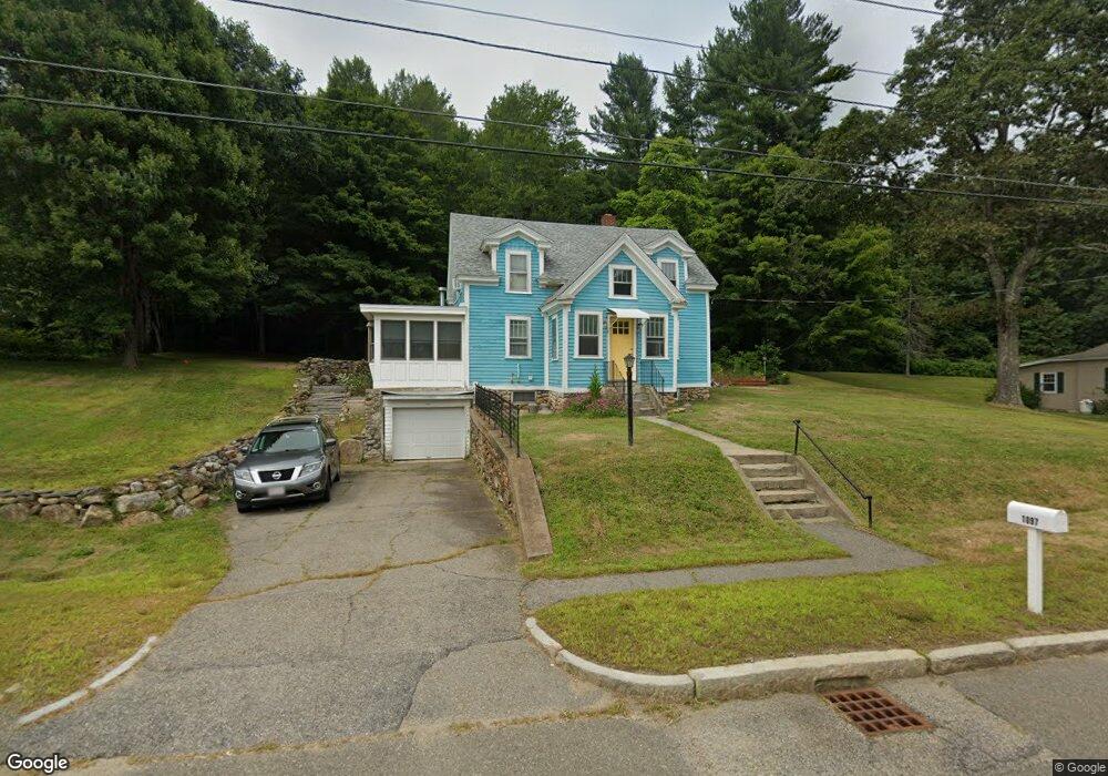
This home is located at 1097 Worcester Rd, Barre, MA 01005 and is currently estimated at $316,151, approximately $239 per square foot. 1097 Worcester Rd is a home located in Worcester County with nearby schools including Quabbin Regional Middle School and Quabbin Regional High School.
Ownership History
Date
Name
Owned For
Owner Type
Purchase Details
Closed on
Oct 31, 2005
Sold by
Trepkus Stella E
Bought by
Molt Kevin K
Current Estimated Value
Home Financials for this Owner
Home Financials are based on the most recent Mortgage that was taken out on this home.
Original Mortgage
$210,000
Outstanding Balance
$111,236
Interest Rate
5.79%
Mortgage Type
Purchase Money Mortgage
Estimated Equity
$204,915
Create a Home Valuation Report for This Property
The Home Valuation Report is an in-depth analysis detailing your home's value as well as a comparison with similar homes in the area
Home Values in the Area
Average Home Value in this Area
Purchase History
| Date | Buyer | Sale Price | Title Company |
|---|---|---|---|
| Molt Kevin K | $210,000 | -- | |
| Molt Kevin K | $210,000 | -- |
Source: Public Records
Mortgage History
| Date | Status | Borrower | Loan Amount |
|---|---|---|---|
| Open | Molt Kevin K | $210,000 | |
| Closed | Molt Kevin K | $210,000 |
Source: Public Records
Tax History
| Year | Tax Paid | Tax Assessment Tax Assessment Total Assessment is a certain percentage of the fair market value that is determined by local assessors to be the total taxable value of land and additions on the property. | Land | Improvement |
|---|---|---|---|---|
| 2025 | $3,369 | $247,900 | $52,800 | $195,100 |
| 2024 | $3,313 | $237,000 | $50,400 | $186,600 |
| 2023 | $3,299 | $208,000 | $39,000 | $169,000 |
| 2022 | $3,014 | $179,000 | $33,400 | $145,600 |
| 2021 | $2,750 | $152,800 | $33,400 | $119,400 |
| 2020 | $2,650 | $148,300 | $33,400 | $114,900 |
| 2019 | $2,602 | $143,600 | $30,200 | $113,400 |
| 2018 | $2,453 | $130,500 | $30,200 | $100,300 |
| 2017 | $2,338 | $125,000 | $30,200 | $94,800 |
| 2016 | $2,156 | $121,100 | $27,400 | $93,700 |
| 2015 | $2,367 | $127,000 | $37,100 | $89,900 |
| 2014 | $2,070 | $128,900 | $44,600 | $84,300 |
Source: Public Records
Map
Nearby Homes
- 621 Woods Rd
- 38 Edson Rd
- 23 Trafalgar Square Unit 23
- 256 Worcester Rd
- 6 Elm St S
- 865 S Barre Rd
- 0 Bullard Rd
- 926 Old Turnpike Rd
- 141 Peach St
- 106 Peach St
- 1215 South St
- 5 Old Coldbrook Rd
- 278 Oakham Rd
- 0 Station Rd
- 178 James St
- 190 Summer St
- 474 Valley Rd
- 0 Agnese Ct Unit 73478399
- 50 Grove St N
- 15 Primrose Rd
- 1079 Worcester Rd
- 1109 Worcester Rd
- 1067 Worcester Rd
- 1049 Worcester Rd
- 1035 Worcester Rd
- 1019 Worcester Rd
- 999 Worcester Rd
- 973 Worcester Rd
- 965 Worcester Rd
- 953 Worcester Rd
- 939 Worcester Rd
- 931 Worcester Rd
- 931 Worcester Rd Unit 1
- 906 Worcester Rd
- 920 Worcester Rd
- 901 Worcester Rd
- 351 Chapman Rd
- 475-477 Vernon Ave
- 470 Chapman Rd
- 287 Chapman Rd
Your Personal Tour Guide
Ask me questions while you tour the home.