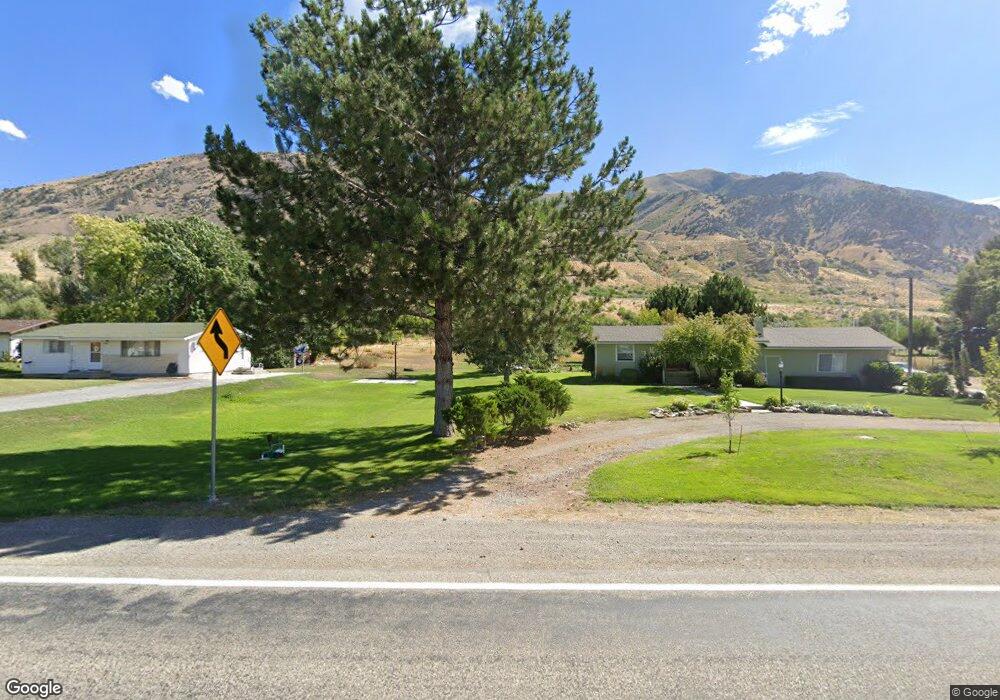
10970 N Highway 38 Deweyville, UT 84309
Estimated Value: $399,000 - $562,000
--
Bed
--
Bath
--
Sq Ft
1.89
Acres
About This Home
This home is located at 10970 N Highway 38, Deweyville, UT 84309 and is currently estimated at $493,696. 10970 N Highway 38 is a home located in Box Elder County with nearby schools including Fielding School, Bear River Middle School, and Alice C. Harris Intermediate School.
Ownership History
Date
Name
Owned For
Owner Type
Purchase Details
Closed on
Mar 19, 2018
Sold by
Marble Marble H and Marble Mauretta L
Bought by
Marble Alan
Current Estimated Value
Purchase Details
Closed on
Aug 28, 2015
Sold by
Esplin Robyn M and Marble Alan Richard
Bought by
Marble Alan and Marble Richard
Home Financials for this Owner
Home Financials are based on the most recent Mortgage that was taken out on this home.
Original Mortgage
$32,000
Interest Rate
4.05%
Mortgage Type
Unknown
Create a Home Valuation Report for This Property
The Home Valuation Report is an in-depth analysis detailing your home's value as well as a comparison with similar homes in the area
Home Values in the Area
Average Home Value in this Area
Purchase History
| Date | Buyer | Sale Price | Title Company |
|---|---|---|---|
| Marble Alan | -- | American Secure Title Tremon | |
| Marble Alan | -- | Accomodation |
Source: Public Records
Mortgage History
| Date | Status | Borrower | Loan Amount |
|---|---|---|---|
| Closed | Marble Alan | $32,000 |
Source: Public Records
Tax History Compared to Growth
Tax History
| Year | Tax Paid | Tax Assessment Tax Assessment Total Assessment is a certain percentage of the fair market value that is determined by local assessors to be the total taxable value of land and additions on the property. | Land | Improvement |
|---|---|---|---|---|
| 2025 | $2,025 | $358,046 | $171,700 | $186,346 |
| 2024 | $1,767 | $356,419 | $171,700 | $184,719 |
| 2023 | $1,630 | $353,479 | $160,680 | $192,799 |
| 2022 | $1,450 | $162,255 | $38,874 | $123,381 |
| 2021 | $1,176 | $190,209 | $70,680 | $119,529 |
| 2020 | $1,102 | $190,209 | $70,680 | $119,529 |
| 2019 | $1,068 | $21,360 | $10,680 | $10,680 |
| 2018 | $612 | $54,170 | $27,123 | $27,047 |
| 2017 | $634 | $95,942 | $27,123 | $49,177 |
| 2016 | $636 | $52,882 | $27,123 | $25,759 |
Source: Public Records
Map
Nearby Homes
- 10135 N Highway 38
- 9791 N Highway 38 Unit 10
- 9835 N Highway 38 Unit 11
- 9743 N Highway 38 Unit 8
- 5069 W 10200 N Unit 5
- 5055 W 10200 N
- 5161 W 10200 N
- 9605 N Highway 38
- 11990 N 4800 W
- 8955 N Highway 38
- 1740 E Main St Unit 502
- 1740 E Main St Unit 501
- 1740 E Main St Unit 504
- 4979 W 12000 N
- 4693 W 9120 N
- 1143 S 1335 E Unit 78
- 161 N 870 E Unit 29
- 839 E 180 N Unit 30
- 408 N 775 E
- Auburn Plan at River's Edge - Tremonton
- 10990 N Highway 38
- 10960 N Highway 38
- 10975 N Highway 38
- 11010 N Highway 38
- 10965 N Highway 38
- 2785 N Highway 38
- 10995 N Highway 38
- 10935 N Highway 38
- 10935 N Hwy 38
- 11030 N Highway 38
- 10920 N Highway 38
- 11040 N Highway 38
- 11025 N Highway 38
- 11045 N Highway 38
- 10905 N Highway 38
- 11060 N Highway 38
- 0 06-069-0057 Unit 1817340
- 11080 N Highway 38
- 10885 N Highway 38
- 11090 N Highway 38