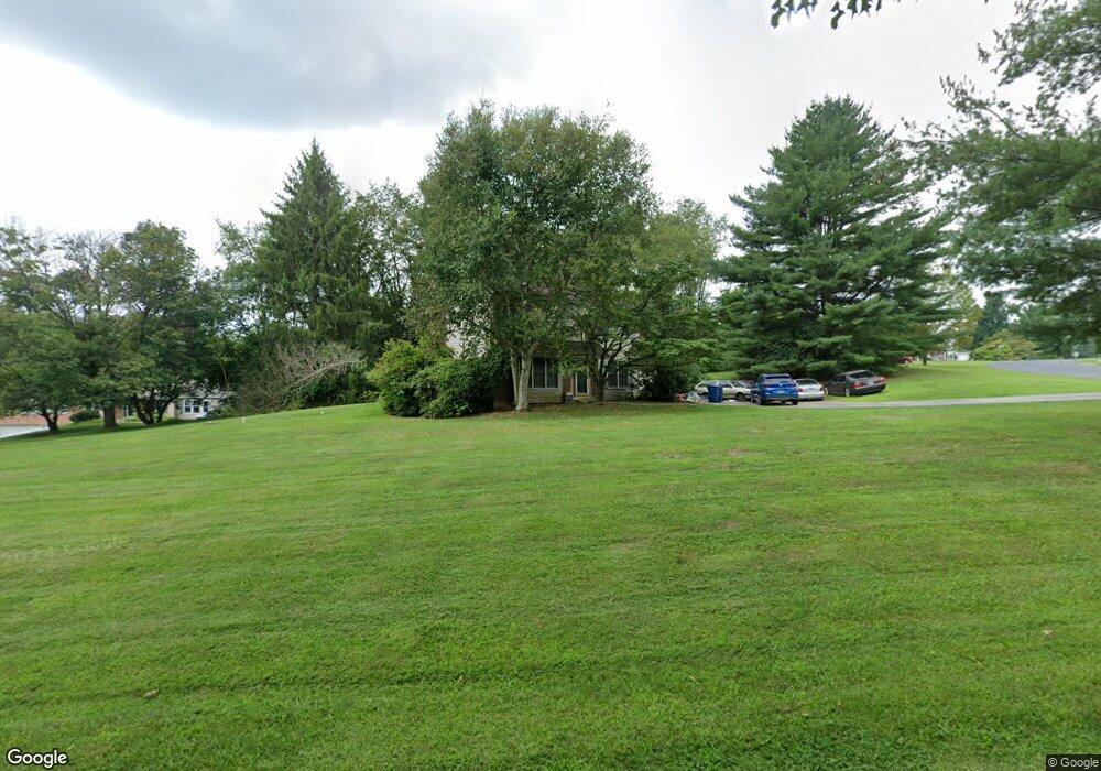
1098 Birnam Place West Chester, PA 19380
Estimated Value: $562,001 - $645,000
3
Beds
3
Baths
1,642
Sq Ft
$367/Sq Ft
Est. Value
About This Home
This home is located at 1098 Birnam Place, West Chester, PA 19380 and is currently estimated at $602,000, approximately $366 per square foot. 1098 Birnam Place is a home located in Chester County with nearby schools including East Bradford Elementary School, E.N. Peirce Middle School, and Henderson High School.
Ownership History
Date
Name
Owned For
Owner Type
Purchase Details
Closed on
Jan 6, 2022
Sold by
Jean G Smith Revocable Trust
Bought by
Lanza Amy Grey
Current Estimated Value
Purchase Details
Closed on
Nov 19, 2009
Sold by
Smith Jean G
Bought by
Smith Jean G and The Jean G Smith Revocable Tru
Purchase Details
Closed on
Nov 8, 2002
Sold by
Lanza Perry and Lanza Amy
Bought by
Smith Jean G
Purchase Details
Closed on
Jun 29, 2001
Sold by
Bittle John P and Bittle Jeanne
Bought by
Lanza Pery and Lanza Amy
Home Financials for this Owner
Home Financials are based on the most recent Mortgage that was taken out on this home.
Original Mortgage
$132,000
Interest Rate
7.21%
Create a Home Valuation Report for This Property
The Home Valuation Report is an in-depth analysis detailing your home's value as well as a comparison with similar homes in the area
Home Values in the Area
Average Home Value in this Area
Purchase History
| Date | Buyer | Sale Price | Title Company |
|---|---|---|---|
| Lanza Amy Grey | -- | None Listed On Document | |
| Smith Jean G | -- | None Available | |
| Smith Jean G | $225,000 | -- | |
| Lanza Pery | $217,000 | -- |
Source: Public Records
Mortgage History
| Date | Status | Borrower | Loan Amount |
|---|---|---|---|
| Previous Owner | Lanza Pery | $132,000 |
Source: Public Records
Tax History Compared to Growth
Tax History
| Year | Tax Paid | Tax Assessment Tax Assessment Total Assessment is a certain percentage of the fair market value that is determined by local assessors to be the total taxable value of land and additions on the property. | Land | Improvement |
|---|---|---|---|---|
| 2025 | $4,703 | $162,250 | $45,520 | $116,730 |
| 2024 | $4,703 | $162,250 | $45,520 | $116,730 |
| 2023 | $4,663 | $162,250 | $45,520 | $116,730 |
| 2022 | $4,602 | $162,250 | $45,520 | $116,730 |
| 2021 | $4,496 | $162,250 | $45,520 | $116,730 |
| 2020 | $4,467 | $162,250 | $45,520 | $116,730 |
| 2019 | $4,323 | $162,250 | $45,520 | $116,730 |
| 2018 | $4,227 | $162,250 | $45,520 | $116,730 |
| 2017 | $4,132 | $162,250 | $45,520 | $116,730 |
| 2016 | $3,634 | $162,250 | $45,520 | $116,730 |
| 2015 | $3,634 | $162,250 | $45,520 | $116,730 |
| 2014 | $3,634 | $162,250 | $45,520 | $116,730 |
Source: Public Records
Map
Nearby Homes
- 4 Amanda Ln
- 1280 Cardinal Ave
- Lot 1 Susan Dr
- 1252 Memory Ln
- 530 Legion Dr
- 479 Douglas Dr
- 1430 Grove Ave
- 510 Pine Needle Dr
- 1432 Grove Ave
- 48 Sheffield Ln
- 806 Downingtown Pike
- 81 Four Leaf Dr
- 141 Four Leaf Dr
- 112 Crosspointe Dr
- 1500 Cardiff Terrace
- 1354 Old Pottstown Pike
- 456 Cardigan Terrace Unit 456
- 306 Greenhill Rd
- 1402 Redwood Ct Unit 57
- 1020 Boot Rd
- 1096 Birnam Place
- 1099 Nobb Hill Dr
- 1099 Birnam Place
- 1097 Cambridge Ct
- 1104 Nobb Hill Dr
- 1094 Birnam Place
- 1110 Nobb Hill Dr
- 1102 Nobb Hill Dr
- 1095 Birnam Place
- 1095 Cambridge Ct
- 1111 Nobb Hill Dr
- 1097 Birnam Place
- 1098 Cambridge Ct
- 1114 Nobb Hill Dr
- 1100 Nobb Hill Dr
- 1096 Cambridge Ct
- 1093 Cambridge Ct
- 1113 Nobb Hill Dr
- 1109 Nobb Hill Dr
- 1092 Cambridge Ct