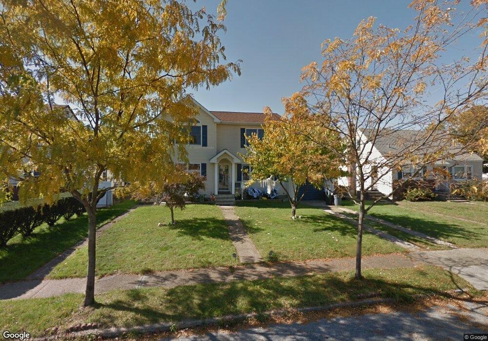
1098 Logan Rd Wantagh, NY 11793
Estimated Value: $750,000 - $764,183
--
Bed
3
Baths
1,588
Sq Ft
$477/Sq Ft
Est. Value
About This Home
This home is located at 1098 Logan Rd, Wantagh, NY 11793 and is currently estimated at $757,092, approximately $476 per square foot. 1098 Logan Rd is a home located in Nassau County with nearby schools including Lee Road Elementary School, Jonas E. Salk Middle School, and Gen. Douglas MacArthur Senior High School.
Ownership History
Date
Name
Owned For
Owner Type
Purchase Details
Closed on
Jul 2, 1999
Sold by
Magnes Alan
Bought by
Davie Peter and Davie Valerie
Current Estimated Value
Home Financials for this Owner
Home Financials are based on the most recent Mortgage that was taken out on this home.
Original Mortgage
$179,400
Outstanding Balance
$49,577
Interest Rate
7.39%
Estimated Equity
$707,515
Purchase Details
Closed on
Jan 15, 1999
Sold by
Estate - Dillingham Bernice
Bought by
Magnes Alan
Create a Home Valuation Report for This Property
The Home Valuation Report is an in-depth analysis detailing your home's value as well as a comparison with similar homes in the area
Home Values in the Area
Average Home Value in this Area
Purchase History
| Date | Buyer | Sale Price | Title Company |
|---|---|---|---|
| Davie Peter | $188,900 | -- | |
| Magnes Alan | $115,000 | -- |
Source: Public Records
Mortgage History
| Date | Status | Borrower | Loan Amount |
|---|---|---|---|
| Open | Davie Peter | $179,400 |
Source: Public Records
Tax History Compared to Growth
Tax History
| Year | Tax Paid | Tax Assessment Tax Assessment Total Assessment is a certain percentage of the fair market value that is determined by local assessors to be the total taxable value of land and additions on the property. | Land | Improvement |
|---|---|---|---|---|
| 2025 | $16,531 | $524 | $239 | $285 |
| 2024 | $3,462 | $501 | $229 | $272 |
| 2023 | $14,613 | $530 | $242 | $288 |
| 2022 | $14,613 | $524 | $239 | $285 |
| 2021 | $16,294 | $562 | $256 | $306 |
| 2020 | $17,659 | $661 | $488 | $173 |
| 2019 | $11,866 | $661 | $410 | $251 |
| 2018 | $11,146 | $787 | $0 | $0 |
| 2017 | $8,741 | $787 | $488 | $299 |
| 2016 | $12,176 | $787 | $448 | $339 |
| 2015 | $3,447 | $858 | $488 | $370 |
| 2014 | $3,447 | $858 | $488 | $370 |
| 2013 | $3,187 | $858 | $488 | $370 |
Source: Public Records
Map
Nearby Homes
- 2794 Janet Ave
- 985 Douglas Ave
- 2960 Morgan Dr
- 1200 Roger Rd
- 1243 Peapond Rd
- 930 W Shelley Rd
- 1253 Raymond Rd
- 899 Brent Dr
- 2874 Michael Rd
- 859 Brent Dr
- 2846 Walter Rd
- 236 Duckpond Dr S
- 84 Stanford Ct
- 886 Bellmore Ave
- 2889 Anderson St
- 2720 Elm Dr
- 86 Weaving Ln
- 875 Woodside Dr
- 231 Willowood Dr
- 27 Wildflower Ln
- 1092 Logan Rd
- 1104 Logan Rd
- 1110 Logan Rd
- 1086 Logan Rd
- 1099 Logan Rd
- 1091 Logan Rd
- 1105 Logan Rd
- 1116 Logan Rd
- 1080 Barrie Ave
- 1098 Oakfield Ave
- 2882 Janet Ave
- 1111 Logan Rd
- 1104 Oakfield Ave
- 1122 Logan Rd
- 1074 Barrie Ave
- 1100 Douglas Ave
- 1092 Barrie Ave
- 2883 Janet Ave
- 1110 Oakfield Ave
- 1117 Logan Rd