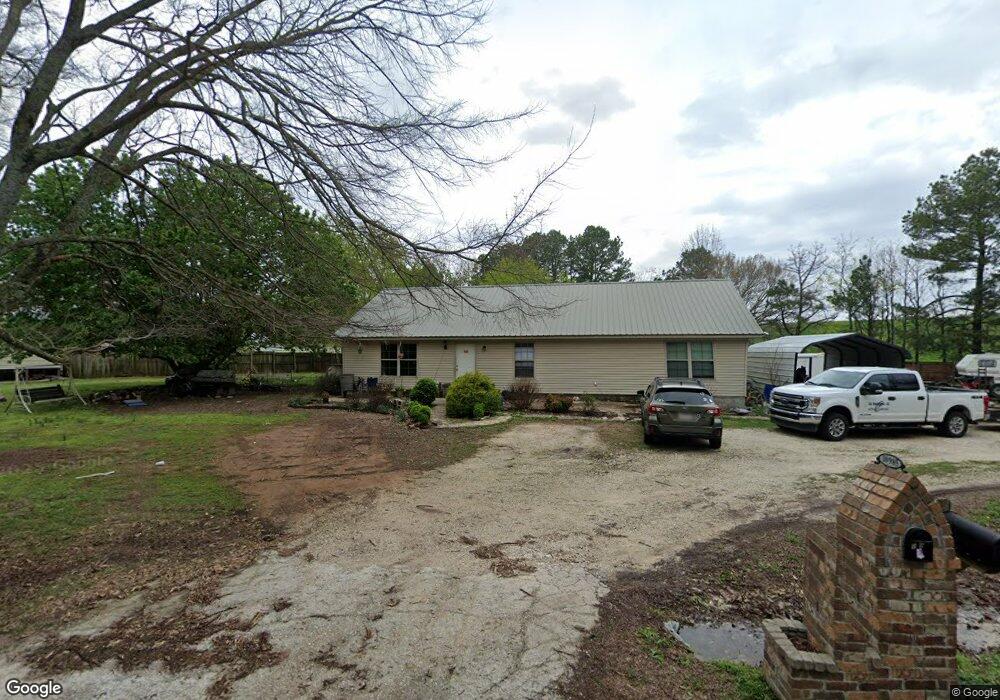
10985 Bobb Kidd Lake Rd Prairie Grove, AR 72753
Estimated Value: $209,000 - $333,000
--
Bed
--
Bath
1,728
Sq Ft
$157/Sq Ft
Est. Value
About This Home
This home is located at 10985 Bobb Kidd Lake Rd, Prairie Grove, AR 72753 and is currently estimated at $270,611, approximately $156 per square foot. 10985 Bobb Kidd Lake Rd is a home with nearby schools including Prairie Grove Elementary School, Prairie Grove Middle School, and Prairie Grove Junior High School.
Ownership History
Date
Name
Owned For
Owner Type
Purchase Details
Closed on
Jul 2, 2025
Sold by
Contreras Carlos Christian and Contreras Landen Isiah
Bought by
Contreras Bernardo
Current Estimated Value
Purchase Details
Closed on
Jun 20, 2019
Sold by
Smith Jenny Lee
Bought by
Contreras Crystal
Home Financials for this Owner
Home Financials are based on the most recent Mortgage that was taken out on this home.
Original Mortgage
$90,000
Interest Rate
4.1%
Mortgage Type
Purchase Money Mortgage
Purchase Details
Closed on
Oct 4, 1995
Bought by
Lee Billy J
Purchase Details
Closed on
May 16, 1990
Bought by
Moore James A
Purchase Details
Closed on
Apr 9, 1989
Bought by
Michael Beckcom H and Michael Michael
Create a Home Valuation Report for This Property
The Home Valuation Report is an in-depth analysis detailing your home's value as well as a comparison with similar homes in the area
Home Values in the Area
Average Home Value in this Area
Purchase History
| Date | Buyer | Sale Price | Title Company |
|---|---|---|---|
| Contreras Bernardo | -- | None Listed On Document | |
| Contreras Crystal | $111,750 | None Available | |
| Lee Billy J | $22,000 | -- | |
| Moore James A | $60,000 | -- | |
| Michael Beckcom H | $7,000 | -- |
Source: Public Records
Mortgage History
| Date | Status | Borrower | Loan Amount |
|---|---|---|---|
| Previous Owner | Contreras Crystal | $90,000 |
Source: Public Records
Tax History Compared to Growth
Tax History
| Year | Tax Paid | Tax Assessment Tax Assessment Total Assessment is a certain percentage of the fair market value that is determined by local assessors to be the total taxable value of land and additions on the property. | Land | Improvement |
|---|---|---|---|---|
| 2024 | $1,448 | $39,110 | $9,750 | $29,360 |
| 2023 | $939 | $39,110 | $9,750 | $29,360 |
| 2022 | $974 | $26,510 | $5,270 | $21,240 |
| 2021 | $974 | $26,510 | $5,270 | $21,240 |
| 2020 | $974 | $26,510 | $5,270 | $21,240 |
| 2019 | $779 | $22,350 | $4,380 | $17,970 |
| 2018 | $1,154 | $22,350 | $4,380 | $17,970 |
| 2017 | $1,093 | $22,350 | $4,380 | $17,970 |
| 2016 | $705 | $22,350 | $4,380 | $17,970 |
| 2015 | $660 | $22,350 | $4,380 | $17,970 |
| 2014 | $614 | $18,690 | $4,560 | $14,130 |
Source: Public Records
Map
Nearby Homes
- 15944 Bill Campbell Rd
- 16256 W Highway 62
- 0 Applehill Tract 4 Rd Unit 4 1315344
- 11561 Old Apple Hill Rd
- 16655 W Highway 62
- 16477 Parks Corner
- 301 Hindman Dr
- 0 S Industrial Park Rd
- 606 Hindman Dr
- 0 Rd Unit 3 1315347
- 16603 Parks Corner Rd
- 816 Custer St
- 815 Custer St
- 813 Grant Ave
- 16453 Stonewall Rd
- 402 Maya St
- 0 Greasy Valley Rd Unit 1324390
- 1021 Vista Ave
- 581 Crystal Dr
- DENTON Plan at Hudson Heights
- 10979 Bobb Kidd Lake Rd
- 11013 Bobb Kidd Lake Rd
- 11029 Bobb Kidd Lake Rd
- 11099 Bobb Kidd Lake Rd
- 11107 Bobb Kidd Lake Rd
- 16046 Bill Campbell Rd
- 15914 Bill Campbell Rd
- 16148 Bill Campbell Rd
- 16148 Bill Campbell Rd
- 15840 Bill Campbell Rd
- 16190 Bill Campbell Rd
- 16091 Bill Campbell Rd
- 16297 Bill Campbell Rd
- 50 ac Sharp Mountain Rd Cr 3238
- 0 30ac Sharp Mountain Rd Cr 3238 Unit 1081077
- 16010 W Highway 62
- Tract 1 Highway 62
- 4 Acres Hwy 62
- 7.19 Ac Hwy 62
- 0 Hwy 62 Bypass 10 46a Unit 687788