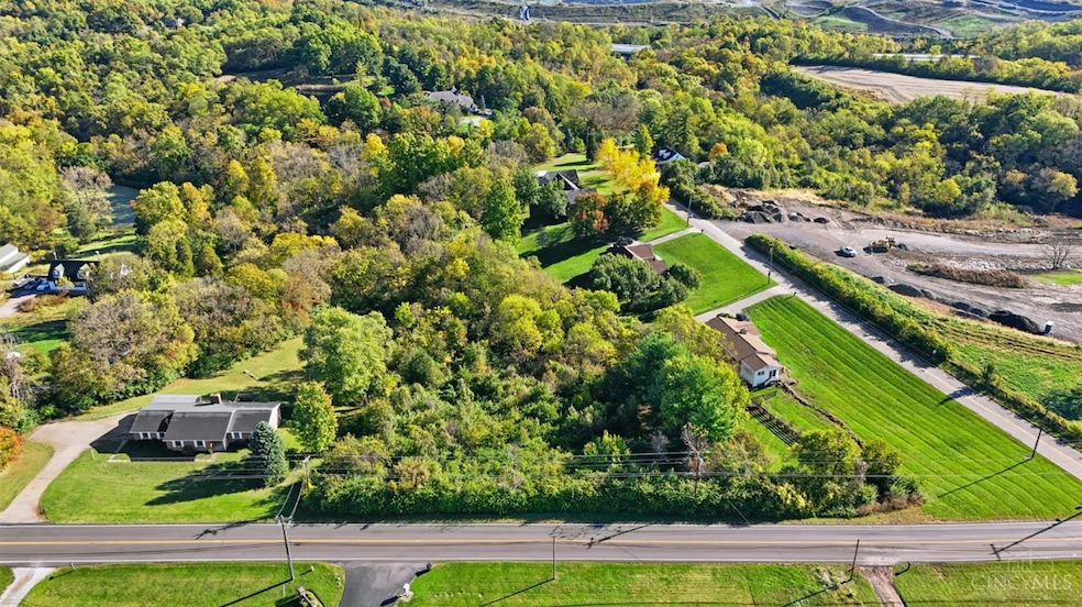
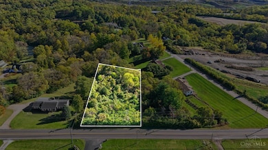
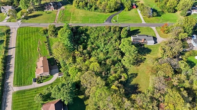
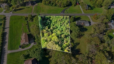
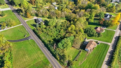
10989 Colerain Ave Cincinnati, OH 45252
Estimated payment $249/month
Highlights
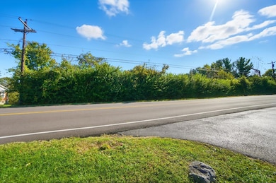
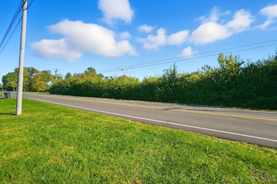
- 1.27 Acre Lot
- Heavily Wooded Lot
- No HOA
About This Lot
Beautiful 1.227-acre wooded lot surrounded by mature trees and natural scenery. Peaceful setting with convenient access to shopping, dining, and highways. Ample road frontage. Perfect site for your custom home or weekend retreat quiet, private, and full of potential!
Listing Agent
Keller Williams Seven Hills Re License #2009002208 Listed on: 10/27/2025

Property Details
Property Type
- Land
Est. Annual Taxes
- $894
Lot Details
- 1.27 Acre Lot
- Heavily Wooded Lot
Utilities
- Gas Available at Street
Community Details
- No Home Owners Association
Map
Home Values in the Area
Average Home Value in this Area
Tax History
| Year | Tax Paid | Tax Assessment Tax Assessment Total Assessment is a certain percentage of the fair market value that is determined by local assessors to be the total taxable value of land and additions on the property. | Land | Improvement |
|---|---|---|---|---|
| 2024 | $894 | $15,946 | $15,946 | -- |
| 2023 | $884 | $15,946 | $15,946 | $0 |
| 2022 | $1,090 | $16,097 | $16,097 | $0 |
| 2021 | $1,101 | $16,097 | $16,097 | $0 |
| 2020 | $1,088 | $16,097 | $16,097 | $0 |
| 2019 | $1,105 | $15,187 | $15,187 | $0 |
| 2018 | $994 | $15,187 | $15,187 | $0 |
| 2017 | $955 | $15,187 | $15,187 | $0 |
| 2016 | $959 | $14,882 | $14,882 | $0 |
| 2015 | $954 | $14,882 | $14,882 | $0 |
| 2014 | $957 | $14,882 | $14,882 | $0 |
| 2013 | $931 | $15,187 | $15,187 | $0 |
Property History
| Date | Event | Price | List to Sale | Price per Sq Ft |
|---|---|---|---|---|
| 10/27/2025 10/27/25 | For Sale | $33,000 | -- | -- |
Purchase History
| Date | Type | Sale Price | Title Company |
|---|---|---|---|
| Warranty Deed | $19,000 | Columbia Title | |
| Warranty Deed | $19,000 | Columbia Title | |
| Certificate Of Transfer | -- | None Available |
Source: MLS of Greater Cincinnati (CincyMLS)
MLS Number: 1859139
APN: 510-0170-0153
Disclaimer: Certain information contained herein is derived from information provided by parties other than Homes.com. All information provided is deemed reliable, but is not guaranteed to be accurate and should be independently verified.
![]() The data relating to real estate for sale on this website comes in part from the Broker Reciprocity programs of the MLS of Greater Cincinnati, Inc.. Those listings held by brokerage firms other than Ten-X are marked with the Broker Reciprocity logo and house icon. The properties displayed may not be all of the properties available through Broker Reciprocity.
The data relating to real estate for sale on this website comes in part from the Broker Reciprocity programs of the MLS of Greater Cincinnati, Inc.. Those listings held by brokerage firms other than Ten-X are marked with the Broker Reciprocity logo and house icon. The properties displayed may not be all of the properties available through Broker Reciprocity.
IDX information is provided exclusively for personal, non-commercial use, and may not be used for any purpose other than to identify prospective properties consumers may be interested in purchasing.
Information is deemed reliable but not guaranteed.
Ten-X does not display the entire Cincinnati MLS Broker Reciprocity™ database on this web site. The listings of some real estate brokerage firms have been excluded.
Copyright 2025, MLS of Greater Cincinnati, Inc. All rights reserved
- 11115 Colerain Ave
- 5285 Yeatman Rd
- 5567 Day Rd
- 26 Rylan Dr
- 5865 Day Rd
- 10263 Colerain Ave
- 11881 Stone Mill Rd
- 0 Stone Mill Rd Unit 1846428
- 1 Stone Mill Rd
- 10054 Prechtel Rd
- 6037 Dunlap Rd
- 0 Miamitrail Ln Unit 1852362
- 5630 Dry Ridge Rd
- 4198 Intrepid Dr
- 4493 Summerwind Ct
- 10085 Pottinger Rd
- 3834 Enterprise Cir
- 4352 Courageous Cir Unit 59
- 5077 Pebblevalley Dr
- 9995 Weatherly Ct
- 2937 Overdale Dr
- 2782 Redharvest Ln
- 2763 Quaker Ct
- 2753 Townterrace Dr
- 3374 Deshler Dr
- 2300 Walden Glen Cir
- 11955 Merrion Ct
- 2512 Grosvenor Dr
- 11605 Passage Way
- 9311 Marker Dr
- 11448 Raphael Place
- 3962 Woodsong Dr
- 2470 Berthbrook Dr
- 11720 Elkwood Dr
- 1711 W Kemper Rd
- 11616 Manford Ct
- 1663 W Kemper Rd
- 10737 Silverbrook Dr
- 3231-3243 Sovereign Dr
- 5249 Cherry Mill Ct