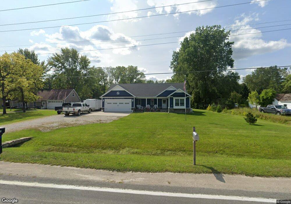
1099 Allen Rd Kimball, MI 48074
Estimated Value: $290,000 - $405,000
3
Beds
2
Baths
1,884
Sq Ft
$180/Sq Ft
Est. Value
About This Home
This home is located at 1099 Allen Rd, Kimball, MI 48074 and is currently estimated at $338,867, approximately $179 per square foot. 1099 Allen Rd is a home located in St. Clair County with nearby schools including Kimball Elementary School, Central Middle School, and Port Huron High School.
Ownership History
Date
Name
Owned For
Owner Type
Purchase Details
Closed on
Feb 4, 2022
Sold by
Stein Stoney L and Stein Brenda L
Bought by
Stein Stoney L and Stein Stoney L
Current Estimated Value
Purchase Details
Closed on
Feb 6, 2019
Sold by
Karen Terracina
Bought by
Stein Brenda L and Stein Stoney L
Purchase Details
Closed on
Jan 15, 2019
Sold by
Karen Terracina
Bought by
Stein Brenda L and Stein Stoney L
Purchase Details
Closed on
Aug 15, 2017
Sold by
Vincent Donald P and Vincent Gloria J
Bought by
Vincent Donald P and Vincent Gloria J
Create a Home Valuation Report for This Property
The Home Valuation Report is an in-depth analysis detailing your home's value as well as a comparison with similar homes in the area
Home Values in the Area
Average Home Value in this Area
Purchase History
| Date | Buyer | Sale Price | Title Company |
|---|---|---|---|
| Stein Stoney L | -- | -- | |
| Stein Brenda L | -- | None Listed On Document | |
| Stein Brenda L | -- | None Listed On Document | |
| Vincent Donald P | -- | -- |
Source: Public Records
Tax History
| Year | Tax Paid | Tax Assessment Tax Assessment Total Assessment is a certain percentage of the fair market value that is determined by local assessors to be the total taxable value of land and additions on the property. | Land | Improvement |
|---|---|---|---|---|
| 2025 | $2,318 | $182,400 | $0 | $0 |
| 2024 | $2,249 | $166,400 | $0 | $0 |
| 2023 | $2,060 | $162,000 | $0 | $0 |
| 2022 | $3,391 | $139,300 | $0 | $0 |
| 2020 | $1,429 | $30,900 | $30,900 | $0 |
| 2019 | $801 | $30,700 | $0 | $0 |
| 2018 | $788 | $29,500 | $0 | $0 |
| 2016 | $434 | $36,500 | $0 | $0 |
| 2015 | -- | $34,300 | $34,300 | $0 |
| 2014 | -- | $34,300 | $34,300 | $0 |
| 2013 | -- | $36,800 | $0 | $0 |
Source: Public Records
Map
Nearby Homes
- 1091 Allen Rd
- 5117 Ravenswood Rd
- 0 Ravenswood Rd Unit 20251017048
- 0000 Ravenswood Rd
- 1604 Allen Rd
- 183 Nevada Ave
- 656 Wadhams Rd
- V/L Allen
- 00 Range Rd
- 1786 Omar Rd
- 240 Oregon Ave
- 1405 Range Rd
- 000 Montana Ave
- 265 Westbrook Ct
- 174 Meadow Ln
- 42 Liberty Ave
- 0000 Wisconsin Wisconsin Ave
- 153 Meadow Ln
- 354 Marion Ave
- 277 Liberty Ave
- 1088 Allen Rd
- 1117 Allen Rd
- 1111 Allen Rd
- 1079 Allen Rd
- 1096 Allen Rd
- 1070 Allen Rd
- 1130 Allen Rd
- 1080 Allen Rd
- 1106 Allen Rd
- 1069 Allen Rd
- 1089 Broad ax Ln
- 1066 Allen Rd
- 1116 Allen Rd
- 1131 Allen Rd
- 1060 Allen Rd
- 1063 Allen Rd
- 1081 Broad ax Ln
- 1143 Allen Rd
- 1093 Broad ax Ln
- 1073 Broad ax Ln Unit Bldg-Unit
Your Personal Tour Guide
Ask me questions while you tour the home.