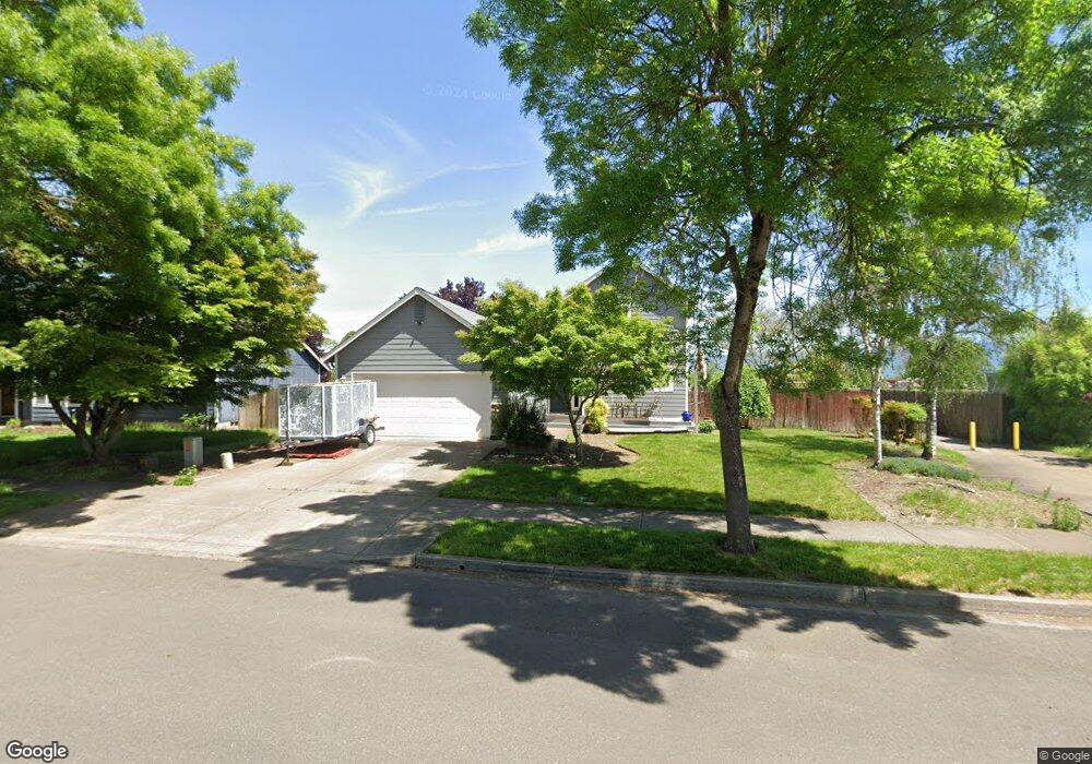
1099 S 11th St Harrisburg, OR 97446
Estimated Value: $444,167 - $482,000
3
Beds
2
Baths
1,817
Sq Ft
$255/Sq Ft
Est. Value
About This Home
This home is located at 1099 S 11th St, Harrisburg, OR 97446 and is currently estimated at $463,084, approximately $254 per square foot. 1099 S 11th St is a home located in Linn County with nearby schools including Harrisburg Elementary School, Harrisburg Middle School, and Harrisburg High School.
Ownership History
Date
Name
Owned For
Owner Type
Purchase Details
Closed on
Jul 26, 2016
Sold by
Tatum Jamie R and Tatum Lindsey D
Bought by
Magnuson Norman D and Magnuson Debra K
Current Estimated Value
Home Financials for this Owner
Home Financials are based on the most recent Mortgage that was taken out on this home.
Original Mortgage
$144,750
Outstanding Balance
$15,499
Interest Rate
3.54%
Mortgage Type
New Conventional
Estimated Equity
$447,585
Purchase Details
Closed on
Jan 13, 2004
Sold by
Harriswood Properties Inc
Bought by
Tatum Jamie R and Tatum Lindsey D
Home Financials for this Owner
Home Financials are based on the most recent Mortgage that was taken out on this home.
Original Mortgage
$132,750
Interest Rate
6.02%
Mortgage Type
Unknown
Create a Home Valuation Report for This Property
The Home Valuation Report is an in-depth analysis detailing your home's value as well as a comparison with similar homes in the area
Home Values in the Area
Average Home Value in this Area
Purchase History
| Date | Buyer | Sale Price | Title Company |
|---|---|---|---|
| Magnuson Norman D | $193,000 | Cascade Title Co | |
| Tatum Jamie R | $165,987 | Ticor Title |
Source: Public Records
Mortgage History
| Date | Status | Borrower | Loan Amount |
|---|---|---|---|
| Open | Magnuson Norman D | $144,750 | |
| Previous Owner | Tatum Jamie R | $132,750 |
Source: Public Records
Tax History Compared to Growth
Tax History
| Year | Tax Paid | Tax Assessment Tax Assessment Total Assessment is a certain percentage of the fair market value that is determined by local assessors to be the total taxable value of land and additions on the property. | Land | Improvement |
|---|---|---|---|---|
| 2024 | $4,479 | $245,720 | -- | -- |
| 2023 | $4,356 | $238,570 | $0 | $0 |
| 2022 | $4,260 | $231,630 | $0 | $0 |
| 2021 | $4,135 | $224,890 | $0 | $0 |
| 2020 | $4,083 | $218,340 | $0 | $0 |
| 2019 | $3,980 | $211,990 | $0 | $0 |
| 2018 | $3,488 | $205,820 | $0 | $0 |
| 2017 | $3,347 | $199,830 | $0 | $0 |
| 2016 | $3,099 | $194,010 | $0 | $0 |
| 2015 | $3,014 | $188,360 | $0 | $0 |
| 2014 | $2,984 | $182,880 | $0 | $0 |
Source: Public Records
Map
Nearby Homes
- 30540 Priceboro Dr
- 961 S 9th St
- 1033 Sommerville Loop
- 1001 Sommerville Loop
- 1025 S 6th St Unit 25
- 1025 S 6th St
- 1025 S 6th St Unit 83
- 888 S 9th St
- 970 Lasalle St
- 950 Lasalle St
- 855 Spurlock St
- Lot 7 Territorial St
- 340 Moore St
- 190 N 1st St
- 735 N Periander
- 741 N Periander
- 881 Arrow Leaf Place
- 24315 Peoria Rd
- 1010 Birch Place
- 346 E 10th Place
- 1089 S 11th St
- 1109 S 11th St
- 1079 S 11th St
- 1125 S 11th St
- 1093 Applegate Place
- 1094 S 11th St
- 1084 S 11th St
- 1074 S 11th St
- 1069 S 11th St
- 1137 S 11th St
- 1083 Applegate Place
- 1082 Applegate Place
- 1093 Siuslaw St
- 1080 Applegate Place
- 1067 Applegate Place
- 1065 Applegate Place
- 1073 Applegate Place
- 1088 Siuslaw St
- 1063 Applegate Place
- 1078 Applegate Place