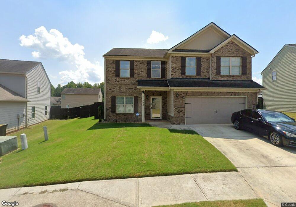
10992 Station Dr Unit 173 Hampton, GA 30228
Estimated Value: $296,000 - $320,000
4
Beds
3
Baths
2,528
Sq Ft
$122/Sq Ft
Est. Value
About This Home
This home is located at 10992 Station Dr Unit 173, Hampton, GA 30228 and is currently estimated at $309,516, approximately $122 per square foot. 10992 Station Dr Unit 173 is a home located in Clayton County with nearby schools including Michelle Obama STEM Elementary Academy, Eddie White Academy, and Lovejoy High School.
Ownership History
Date
Name
Owned For
Owner Type
Purchase Details
Closed on
Jan 29, 2016
Sold by
Builders Professional Grp Llc
Bought by
Barnes Edward L
Current Estimated Value
Home Financials for this Owner
Home Financials are based on the most recent Mortgage that was taken out on this home.
Original Mortgage
$165,000
Outstanding Balance
$130,872
Interest Rate
4.04%
Mortgage Type
VA
Estimated Equity
$178,644
Purchase Details
Closed on
May 21, 2015
Sold by
The Bank Of Georgia
Bought by
Builders Professional Grp Llc
Home Financials for this Owner
Home Financials are based on the most recent Mortgage that was taken out on this home.
Original Mortgage
$116,250
Interest Rate
3.77%
Mortgage Type
New Conventional
Purchase Details
Closed on
Jun 12, 2014
Sold by
Mcdonough Road Development Llc
Bought by
The Bank Of Georgia
Create a Home Valuation Report for This Property
The Home Valuation Report is an in-depth analysis detailing your home's value as well as a comparison with similar homes in the area
Home Values in the Area
Average Home Value in this Area
Purchase History
| Date | Buyer | Sale Price | Title Company |
|---|---|---|---|
| Barnes Edward L | $169,900 | -- | |
| Barnes Edward L | $169,900 | -- | |
| Builders Professional Grp Llc | $19,000 | -- | |
| Builders Professional Grp Llc | $19,000 | -- | |
| The Bank Of Georgia | -- | -- | |
| The Bank Of Georgia | -- | -- |
Source: Public Records
Mortgage History
| Date | Status | Borrower | Loan Amount |
|---|---|---|---|
| Open | Barnes Edward L | $165,000 | |
| Previous Owner | Builders Professional Grp Llc | $116,250 |
Source: Public Records
Tax History
| Year | Tax Paid | Tax Assessment Tax Assessment Total Assessment is a certain percentage of the fair market value that is determined by local assessors to be the total taxable value of land and additions on the property. | Land | Improvement |
|---|---|---|---|---|
| 2025 | $63 | $125,160 | $10,400 | $114,760 |
| 2024 | $244 | $129,600 | $10,400 | $119,200 |
| 2023 | $0 | $136,840 | $10,400 | $126,440 |
| 2022 | $472 | $126,280 | $10,400 | $115,880 |
| 2021 | $309 | $89,600 | $10,400 | $79,200 |
| 2020 | $309 | $89,712 | $10,400 | $79,312 |
| 2019 | $309 | $82,531 | $9,600 | $72,931 |
| 2018 | $0 | $77,946 | $9,600 | $68,346 |
| 2017 | $0 | $65,948 | $9,600 | $56,348 |
| 2016 | $309 | $7,600 | $7,600 | $0 |
| 2015 | $24 | $0 | $0 | $0 |
| 2014 | $24 | $600 | $600 | $0 |
Source: Public Records
Map
Nearby Homes
- 10997 Big Sky Dr
- 10941 Station Dr
- 11092 Cornerstone Way
- 11205 Cornerstone Ln
- 11149 Cornerstone Ln
- 11201 Cornerstone Ln
- 11164 Cornerstone Ln
- 11168 Cornerstone Ln
- 100 Lake Haven Dr
- 2582 Rosecommons Dr
- 11058 Hunters Ln
- 823 Cambridge Pkwy
- 915 Bel Air Blvd
- 815 Cambridge Pkwy
- 1060 Fairmont Dr
- 2316 Hastings Manor Ln
- 10779 Wheeler Trace
- 10834 Wheeler Trace
- 953 Mystic Way
- 2981 Cleburne Terrace
- 10992 Station Dr
- 10998 Station Dr Unit 172
- 10998 Station Dr
- 10986 Station Dr Unit 174
- 10986 Station Dr
- 2682 Calvary Dr Unit 159
- 2682 Calvary Dr
- 2688 Calvary Dr Unit 158
- 2688 Calvary Dr
- 11004 Station Dr Unit 171
- 11004 Station Dr
- 2670 Calvary Dr Unit 161
- 2670 Calvary Dr
- 10980 Station Dr
- 2513 Cornerstone Ln Unit 110
- 2517 Cornerstone Ln
- 2529 Cornerstone Ln Unit 106
- 2533 Cornerstone Ln Unit 105
- 11136 Cornerstone Ln
- 11124 Cornerstone Ln
Your Personal Tour Guide
Ask me questions while you tour the home.