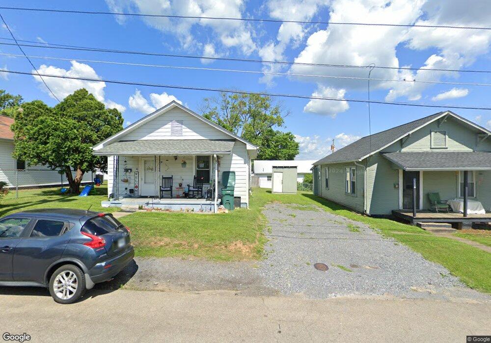
11 19th St Bristol, VA 24201
Estimated Value: $104,045 - $187,000
2
Beds
1
Bath
1,005
Sq Ft
$141/Sq Ft
Est. Value
About This Home
This home is located at 11 19th St, Bristol, VA 24201 and is currently estimated at $141,761, approximately $141 per square foot. 11 19th St is a home located in Bristol City with nearby schools including Virginia High School, Tri-Cities Christian School, and Brookside Academy.
Ownership History
Date
Name
Owned For
Owner Type
Purchase Details
Closed on
Jan 14, 2008
Sold by
Wells Fargo Bank Na
Bought by
Martin Tim
Current Estimated Value
Home Financials for this Owner
Home Financials are based on the most recent Mortgage that was taken out on this home.
Original Mortgage
$26,000
Outstanding Balance
$16,454
Interest Rate
6.21%
Mortgage Type
Land Contract Argmt. Of Sale
Estimated Equity
$125,307
Purchase Details
Closed on
Apr 30, 2007
Sold by
Clark Donald and Wood Sub Tr Stephen B
Bought by
Wells Fargo Bank Na
Create a Home Valuation Report for This Property
The Home Valuation Report is an in-depth analysis detailing your home's value as well as a comparison with similar homes in the area
Home Values in the Area
Average Home Value in this Area
Purchase History
| Date | Buyer | Sale Price | Title Company |
|---|---|---|---|
| Martin Tim | $20,200 | -- | |
| Wells Fargo Bank Na | $37,500 | -- |
Source: Public Records
Mortgage History
| Date | Status | Borrower | Loan Amount |
|---|---|---|---|
| Open | Wells Fargo Bank Na | $26,000 |
Source: Public Records
Tax History Compared to Growth
Tax History
| Year | Tax Paid | Tax Assessment Tax Assessment Total Assessment is a certain percentage of the fair market value that is determined by local assessors to be the total taxable value of land and additions on the property. | Land | Improvement |
|---|---|---|---|---|
| 2025 | $754 | $81,100 | $12,500 | $68,600 |
| 2024 | $384 | $34,300 | $10,000 | $24,300 |
| 2023 | $401 | $34,300 | $10,000 | $24,300 |
| 2022 | $384 | $34,300 | $10,000 | $24,300 |
| 2021 | $384 | $34,300 | $10,000 | $24,300 |
| 2020 | $351 | $30,000 | $10,000 | $20,000 |
| 2019 | $351 | $30,000 | $10,000 | $20,000 |
| 2018 | $176 | $30,000 | $10,000 | $20,000 |
| 2016 | -- | $35,100 | $0 | $0 |
| 2015 | -- | $0 | $0 | $0 |
| 2014 | -- | $0 | $0 | $0 |
Source: Public Records
Map
Nearby Homes
- 60 Peters St
- 2000 Euclid Ave
- 1057 Moorland Ave
- 1614 Broad St
- 1724 & 1728 Euclid Ave
- 2121 2123 Randolph St
- 420 Douglas St
- 2177 Randolph St
- 728 Randolph St
- 461 Douglas St
- 000 Hemlock Dr
- 1216 Norway St
- 1227 Shelby St
- 1224 Shelby St
- 2228 Bay St
- 460 Vance St
- 401 Crockett St
- 2241 Bradley St
- 2412,14,16 Bradley St
- Tbd Clifton Rd