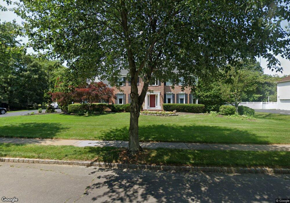
11 Abbington Ln Princeton Junction, NJ 08550
Estimated Value: $1,233,057 - $1,402,000
--
Bed
--
Bath
3,316
Sq Ft
$403/Sq Ft
Est. Value
About This Home
This home is located at 11 Abbington Ln, Princeton Junction, NJ 08550 and is currently estimated at $1,334,764, approximately $402 per square foot. 11 Abbington Ln is a home located in Mercer County with nearby schools including Maurice Hawk Elementary School, Millstone River School, and Community Middle School.
Ownership History
Date
Name
Owned For
Owner Type
Purchase Details
Closed on
Mar 30, 2001
Sold by
Nicieza Fabian
Bought by
Everett Thomas and Everett Andrea
Current Estimated Value
Home Financials for this Owner
Home Financials are based on the most recent Mortgage that was taken out on this home.
Original Mortgage
$320,000
Outstanding Balance
$118,228
Interest Rate
7.05%
Mortgage Type
Purchase Money Mortgage
Estimated Equity
$1,216,536
Create a Home Valuation Report for This Property
The Home Valuation Report is an in-depth analysis detailing your home's value as well as a comparison with similar homes in the area
Home Values in the Area
Average Home Value in this Area
Purchase History
| Date | Buyer | Sale Price | Title Company |
|---|---|---|---|
| Everett Thomas | $575,000 | -- |
Source: Public Records
Mortgage History
| Date | Status | Borrower | Loan Amount |
|---|---|---|---|
| Open | Everett Thomas | $320,000 |
Source: Public Records
Tax History Compared to Growth
Tax History
| Year | Tax Paid | Tax Assessment Tax Assessment Total Assessment is a certain percentage of the fair market value that is determined by local assessors to be the total taxable value of land and additions on the property. | Land | Improvement |
|---|---|---|---|---|
| 2025 | $20,033 | $653,600 | $259,700 | $393,900 |
| 2024 | $19,196 | $653,600 | $259,700 | $393,900 |
| 2023 | $19,196 | $653,600 | $259,700 | $393,900 |
| 2022 | $18,824 | $653,600 | $259,700 | $393,900 |
| 2021 | $18,667 | $653,600 | $259,700 | $393,900 |
| 2020 | $18,327 | $653,600 | $259,700 | $393,900 |
| 2019 | $20,175 | $727,800 | $259,700 | $468,100 |
| 2018 | $19,985 | $727,800 | $259,700 | $468,100 |
| 2017 | $19,571 | $727,800 | $259,700 | $468,100 |
| 2016 | $19,148 | $727,800 | $259,700 | $468,100 |
| 2015 | $18,704 | $727,800 | $259,700 | $468,100 |
| 2014 | $18,486 | $727,800 | $259,700 | $468,100 |
Source: Public Records
Map
Nearby Homes
- 32 W Kincaid Dr
- 10 Manor Ridge Dr
- 5 Glengarry Way
- 22 Slayback Dr
- 19 Shadow Dr
- 42 Nassau Place
- 7 Camas Ct
- 12 Ziff Ln
- 12 Ziff La
- 90 Princeton Hightstown Rd
- 2 Joanne St
- 20 Berkshire Dr
- 16 Spruce St
- 3103 Justin Dr
- 1005 Justin Dr Unit 1002
- 2902 Justin Dr
- 1402 Justin Dr Unit 1403
- 3102 Justin Dr
- 2904 Justin Dr Unit 2903
- 1402 Justin Dr