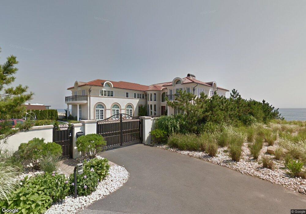
11 Adam St Long Branch, NJ 07740
Estimated Value: $3,140,000
7
Beds
4
Baths
8,800
Sq Ft
$357/Sq Ft
Est. Value
About This Home
This home is located at 11 Adam St, Long Branch, NJ 07740 and is currently estimated at $3,140,000, approximately $356 per square foot. 11 Adam St is a home located in Monmouth County with nearby schools including Long Branch High School, Holy Trinity School, and Bet Yaakov of the Jersey Shore.
Ownership History
Date
Name
Owned For
Owner Type
Purchase Details
Closed on
Oct 21, 2009
Sold by
Kushner Seryl
Bought by
Kushner Seryl
Current Estimated Value
Purchase Details
Closed on
Aug 11, 2009
Sold by
Kushner Charles and Kushner Seryl
Bought by
Kushner Seryl
Purchase Details
Closed on
Oct 19, 1993
Sold by
Glastein Deborah
Bought by
Kushner Charles and Kushner Seryl
Create a Home Valuation Report for This Property
The Home Valuation Report is an in-depth analysis detailing your home's value as well as a comparison with similar homes in the area
Home Values in the Area
Average Home Value in this Area
Purchase History
| Date | Buyer | Sale Price | Title Company |
|---|---|---|---|
| Kushner Seryl | -- | Scott Title Services Llc | |
| Kushner Seryl | -- | Scott Title Services Llc | |
| Kushner Charles | $760,000 | -- |
Source: Public Records
Tax History Compared to Growth
Tax History
| Year | Tax Paid | Tax Assessment Tax Assessment Total Assessment is a certain percentage of the fair market value that is determined by local assessors to be the total taxable value of land and additions on the property. | Land | Improvement |
|---|---|---|---|---|
| 2025 | $186,134 | $12,680,300 | $10,084,000 | $2,596,300 |
| 2024 | $186,571 | $12,110,200 | $9,984,000 | $2,126,200 |
| 2023 | $186,571 | $12,013,600 | $9,984,000 | $2,029,600 |
| 2022 | $185,695 | $9,904,600 | $7,984,000 | $1,920,600 |
| 2021 | $185,695 | $9,280,100 | $7,484,000 | $1,796,100 |
| 2020 | $178,060 | $8,519,600 | $6,734,000 | $1,785,600 |
| 2019 | $162,579 | $7,734,500 | $6,034,000 | $1,700,500 |
| 2018 | $161,135 | $7,622,300 | $5,984,000 | $1,638,300 |
| 2017 | $158,316 | $7,681,500 | $5,984,000 | $1,697,500 |
| 2016 | $154,724 | $7,655,800 | $5,984,000 | $1,671,800 |
| 2015 | $149,383 | $6,707,800 | $4,742,000 | $1,965,800 |
| 2014 | $137,345 | $6,500,000 | $3,375,000 | $3,125,000 |
Source: Public Records
Map
Nearby Homes
- 807 Ocean Ave
- 787 Ocean Ave Unit 314
- 787 Ocean Ave Unit 508
- 787 Ocean Ave Unit 1712
- 735 Greens Ave Unit 18A
- 35 Sternberger Ave Unit P
- 717 Ocean Ave Unit 512
- 717 Ocean Ave Unit 705
- 3 Reid St
- 45 Cedar Ave
- 2 Jim Lynch Dr
- 675 Ocean Ave Unit 9F
- 675 Ocean Ave Unit 5J
- 251 Highland Ave
- 1 Private Dr
- 65 Cedar Ave Unit C11
- 665 2nd Ave Unit 202
- 665 2nd Ave Unit 201
- 21 Riviera Dr
- 280 Cummings Ave