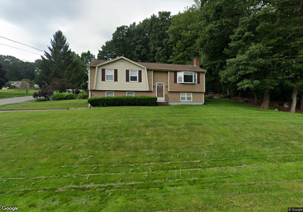
11 Allen Rd Holden, MA 01520
Estimated Value: $455,000 - $490,000
3
Beds
2
Baths
1,108
Sq Ft
$422/Sq Ft
Est. Value
About This Home
This home is located at 11 Allen Rd, Holden, MA 01520 and is currently estimated at $467,198, approximately $421 per square foot. 11 Allen Rd is a home located in Worcester County with nearby schools including Wachusett Regional High School, Abby Kelley Foster Charter Public School, and Bancroft School.
Create a Home Valuation Report for This Property
The Home Valuation Report is an in-depth analysis detailing your home's value as well as a comparison with similar homes in the area
Home Values in the Area
Average Home Value in this Area
Tax History Compared to Growth
Tax History
| Year | Tax Paid | Tax Assessment Tax Assessment Total Assessment is a certain percentage of the fair market value that is determined by local assessors to be the total taxable value of land and additions on the property. | Land | Improvement |
|---|---|---|---|---|
| 2025 | $5,559 | $401,100 | $147,700 | $253,400 |
| 2024 | $5,335 | $377,000 | $143,300 | $233,700 |
| 2023 | $5,058 | $337,400 | $124,600 | $212,800 |
| 2022 | $4,950 | $298,900 | $97,300 | $201,600 |
| 2021 | $4,731 | $271,900 | $92,700 | $179,200 |
| 2020 | $4,476 | $263,300 | $88,300 | $175,000 |
| 2019 | $4,326 | $247,900 | $88,300 | $159,600 |
| 2018 | $4,006 | $227,500 | $84,100 | $143,400 |
| 2017 | $3,784 | $215,100 | $84,100 | $131,000 |
| 2016 | $3,545 | $205,500 | $80,100 | $125,400 |
| 2015 | $3,649 | $201,400 | $80,100 | $121,300 |
| 2014 | $3,575 | $201,400 | $80,100 | $121,300 |
Source: Public Records
Map
Nearby Homes
- 7 Otter Trail
- 17 Leslie Rd
- 9 Emily St
- 27 Tea Party Cir Unit 27
- 308 Holden St
- 2 Explorers Way Unit 2
- 8 Indian Cir Unit 8
- 189 Holden St
- 12 Tattan Farm Rd
- 314 Main St
- 23 Gail Dr
- 122 Holden St
- 303 Greenwich Ct Unit 303
- 3901 Knightsbridge Close Unit 3901
- 4004 Brompton Cir
- 113 Indian Hill Rd
- 27 Mayflower Cir
- 6 Hingham Rd
- 97 Parkton Ave
- 96 Indian Hill Rd