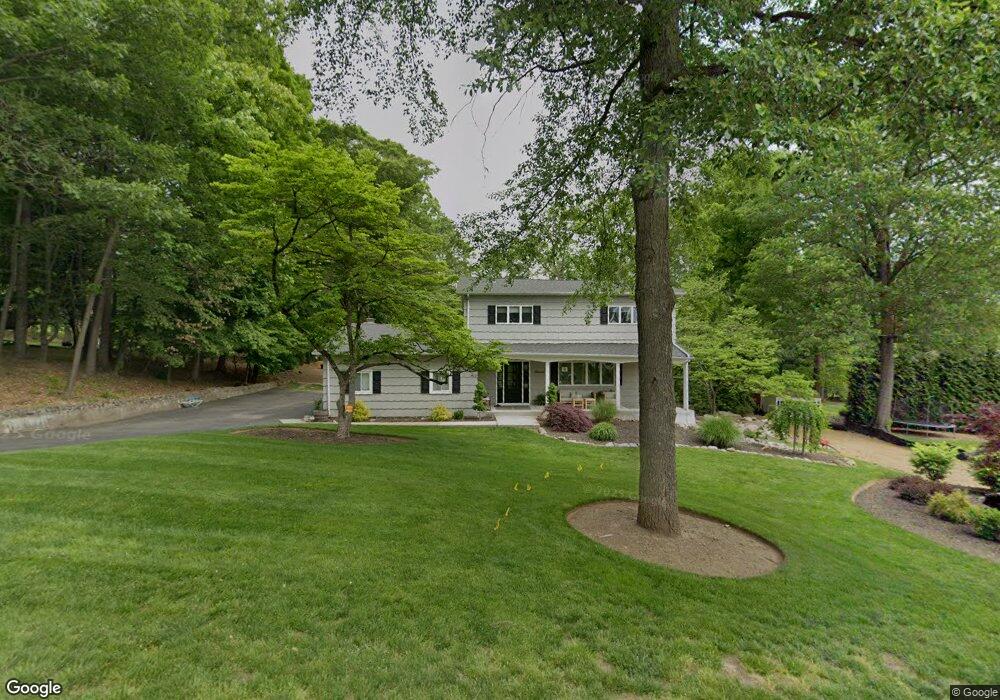
11 Angus Ln New City, NY 10956
Estimated Value: $877,000 - $931,000
4
Beds
3
Baths
2,400
Sq Ft
$377/Sq Ft
Est. Value
About This Home
This home is located at 11 Angus Ln, New City, NY 10956 and is currently estimated at $904,465, approximately $376 per square foot. 11 Angus Ln is a home located in Rockland County with nearby schools including Woodglen Elementary School, Felix Festa Middle School, and Clarkstown North Senior High School.
Ownership History
Date
Name
Owned For
Owner Type
Purchase Details
Closed on
Dec 14, 2016
Sold by
Seltzer Sylvia
Bought by
Crisci Adam J and Pospisil Amie
Current Estimated Value
Home Financials for this Owner
Home Financials are based on the most recent Mortgage that was taken out on this home.
Original Mortgage
$390,400
Outstanding Balance
$319,260
Interest Rate
3.94%
Mortgage Type
New Conventional
Estimated Equity
$585,205
Purchase Details
Closed on
Feb 20, 2001
Sold by
Seltzer Raymond and Seltzer Sylvia
Bought by
Seltzer Sylvia
Create a Home Valuation Report for This Property
The Home Valuation Report is an in-depth analysis detailing your home's value as well as a comparison with similar homes in the area
Home Values in the Area
Average Home Value in this Area
Purchase History
| Date | Buyer | Sale Price | Title Company |
|---|---|---|---|
| Crisci Adam J | $488,000 | None Available | |
| Seltzer Sylvia | -- | -- |
Source: Public Records
Mortgage History
| Date | Status | Borrower | Loan Amount |
|---|---|---|---|
| Open | Crisci Adam J | $390,400 |
Source: Public Records
Tax History Compared to Growth
Tax History
| Year | Tax Paid | Tax Assessment Tax Assessment Total Assessment is a certain percentage of the fair market value that is determined by local assessors to be the total taxable value of land and additions on the property. | Land | Improvement |
|---|---|---|---|---|
| 2024 | $20,529 | $177,210 | $49,500 | $127,710 |
| 2023 | $20,529 | $177,210 | $49,500 | $127,710 |
| 2022 | $16,105 | $172,100 | $49,500 | $122,600 |
| 2021 | $16,105 | $172,100 | $49,500 | $122,600 |
| 2020 | $16,864 | $172,100 | $49,500 | $122,600 |
| 2019 | $16,232 | $172,100 | $49,500 | $122,600 |
| 2018 | $16,232 | $172,100 | $49,500 | $122,600 |
| 2017 | $15,839 | $172,100 | $49,500 | $122,600 |
| 2016 | $14,743 | $172,100 | $49,500 | $122,600 |
| 2015 | -- | $172,100 | $49,500 | $122,600 |
| 2014 | -- | $172,100 | $49,500 | $122,600 |
Source: Public Records
Map
Nearby Homes
- 19 Lombardi Dr
- 369 Phillips Hill Rd
- 183 New Hempstead Rd
- 4 Susan Dr
- 352 Phillips Hill Rd
- 30 James St
- 9 John St
- 28 Nob Hill Rd
- 5 Bellows Ln
- 20 Badger St
- 31 Concord Dr
- 11 Old Phillips Hill Rd
- 57 Havermill Rd
- 40 Ruth Dr
- 39 Old Phillips Hill Rd
- 54 New Hempstead Rd
- 31 Verdin Dr
- 8 Liberty Cir
- 11 Ungava Dr
- 13 (formerly 19A) Deerfield Dr