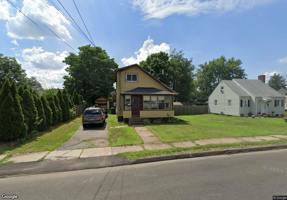
11 Ann St East Hartford, CT 06108
Estimated Value: $249,000 - $315,000
3
Beds
1
Bath
1,221
Sq Ft
$223/Sq Ft
Est. Value
About This Home
This home is located at 11 Ann St, East Hartford, CT 06108 and is currently estimated at $271,726, approximately $222 per square foot. 11 Ann St is a home located in Hartford County with nearby schools including Dr. John A. Langford School, East Hartford Middle School, and East Hartford High School.
Ownership History
Date
Name
Owned For
Owner Type
Purchase Details
Closed on
Oct 20, 2017
Sold by
Cockfield Latanya S
Bought by
Warner Clifton C
Current Estimated Value
Home Financials for this Owner
Home Financials are based on the most recent Mortgage that was taken out on this home.
Original Mortgage
$98,188
Outstanding Balance
$82,942
Interest Rate
4.25%
Mortgage Type
FHA
Estimated Equity
$188,784
Purchase Details
Closed on
Nov 12, 2009
Sold by
Smith Emma C Est
Bought by
Durant Latanya S
Home Financials for this Owner
Home Financials are based on the most recent Mortgage that was taken out on this home.
Original Mortgage
$98,090
Interest Rate
4.98%
Mortgage Type
Purchase Money Mortgage
Purchase Details
Closed on
Sep 26, 1997
Sold by
Keeney Gordon F and Keeney Helen C
Bought by
Barrett Francis J and Barrett Constance C
Home Financials for this Owner
Home Financials are based on the most recent Mortgage that was taken out on this home.
Original Mortgage
$99,120
Interest Rate
6.63%
Mortgage Type
Unknown
Create a Home Valuation Report for This Property
The Home Valuation Report is an in-depth analysis detailing your home's value as well as a comparison with similar homes in the area
Home Values in the Area
Average Home Value in this Area
Purchase History
| Date | Buyer | Sale Price | Title Company |
|---|---|---|---|
| Warner Clifton C | $100,000 | -- | |
| Durant Latanya S | $99,900 | -- | |
| Barrett Francis J | $123,900 | -- |
Source: Public Records
Mortgage History
| Date | Status | Borrower | Loan Amount |
|---|---|---|---|
| Open | Barrett Francis J | $98,188 | |
| Previous Owner | Barrett Francis J | $98,090 | |
| Previous Owner | Barrett Francis J | $99,120 |
Source: Public Records
Tax History Compared to Growth
Tax History
| Year | Tax Paid | Tax Assessment Tax Assessment Total Assessment is a certain percentage of the fair market value that is determined by local assessors to be the total taxable value of land and additions on the property. | Land | Improvement |
|---|---|---|---|---|
| 2025 | $4,818 | $104,970 | $26,940 | $78,030 |
| 2024 | $4,619 | $104,970 | $26,940 | $78,030 |
| 2023 | $4,465 | $104,970 | $26,940 | $78,030 |
| 2022 | $4,304 | $104,970 | $26,940 | $78,030 |
| 2021 | $4,013 | $81,310 | $25,120 | $56,190 |
| 2020 | $4,059 | $81,310 | $25,120 | $56,190 |
| 2019 | $3,993 | $81,310 | $25,120 | $56,190 |
| 2018 | $3,875 | $81,310 | $25,120 | $56,190 |
| 2017 | $3,826 | $81,310 | $25,120 | $56,190 |
| 2016 | $3,721 | $81,130 | $25,120 | $56,010 |
| 2015 | $3,721 | $81,130 | $25,120 | $56,010 |
| 2014 | $3,683 | $81,130 | $25,120 | $56,010 |
Source: Public Records
Map
Nearby Homes
- 265 Burnside Ave
- 10 Kenyon Place
- 30 Oakwood St
- 181 Burnside Ave
- 85R Olmsted St
- 98 Olmsted St
- 453 Burnside Ave
- 51 Daniel St
- 506 Burnside Ave
- 509 Burnside Ave Unit A18
- 52 Burnside Ave
- 67 Laurel St
- 1589 Main St
- 47 Elm St
- 15 Michael Ave
- 41 Bissell St
- 421 Tolland St
- 421 Tolland St Unit 209
- 89 Henderson Dr
- 22 Matthew Rd
- 15 Ann St
- 21 Ann St
- 262 Burnside Ave
- 18 Signor St
- 12 Ann St
- 18 Ann St Unit 20
- 14 Ann St
- 25 Ann St
- 274 Burnside Ave Unit 276
- 26 Ann St
- 255 Burnside Ave
- 254 Burnside Ave
- 284 Burnside Ave
- 251 Burnside Ave
- 30 Ann St
- 280 Burnside Ave
- 269 Burnside Ave
- 261 Burnside Ave
- 145 Tolland St Unit 1
- 145 Tolland St Unit 6