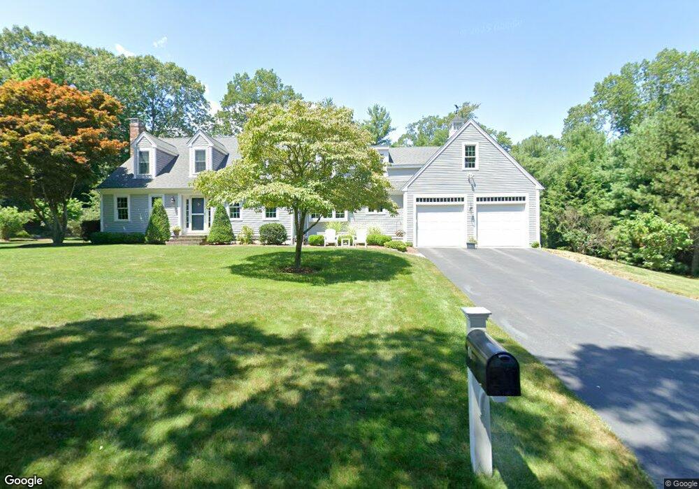
11 Back River Way Duxbury, MA 02332
Estimated Value: $1,468,358 - $1,686,000
3
Beds
2
Baths
2,864
Sq Ft
$556/Sq Ft
Est. Value
About This Home
This home is located at 11 Back River Way, Duxbury, MA 02332 and is currently estimated at $1,591,590, approximately $555 per square foot. 11 Back River Way is a home located in Plymouth County with nearby schools including Chandler Elementary School, Alden School, and Duxbury Middle School.
Ownership History
Date
Name
Owned For
Owner Type
Purchase Details
Closed on
Oct 14, 2021
Sold by
Murphy William P and Murphy Joanne M
Bought by
Joanne M Murphy T
Current Estimated Value
Purchase Details
Closed on
Jul 17, 2009
Sold by
Clement Alexander M and Clement Carolyn S
Bought by
Murphy William P and Murphy Joanne M
Create a Home Valuation Report for This Property
The Home Valuation Report is an in-depth analysis detailing your home's value as well as a comparison with similar homes in the area
Home Values in the Area
Average Home Value in this Area
Purchase History
| Date | Buyer | Sale Price | Title Company |
|---|---|---|---|
| Joanne M Murphy T | -- | None Available | |
| Murphy William P | $620,000 | -- |
Source: Public Records
Mortgage History
| Date | Status | Borrower | Loan Amount |
|---|---|---|---|
| Previous Owner | Murphy William P | $395,000 | |
| Previous Owner | Murphy William P | $400,000 |
Source: Public Records
Tax History Compared to Growth
Tax History
| Year | Tax Paid | Tax Assessment Tax Assessment Total Assessment is a certain percentage of the fair market value that is determined by local assessors to be the total taxable value of land and additions on the property. | Land | Improvement |
|---|---|---|---|---|
| 2025 | $12,752 | $1,257,600 | $567,600 | $690,000 |
| 2024 | $11,764 | $1,169,400 | $486,400 | $683,000 |
| 2023 | $11,746 | $1,098,800 | $578,000 | $520,800 |
| 2022 | $11,309 | $880,800 | $447,000 | $433,800 |
| 2021 | $11,132 | $768,800 | $363,600 | $405,200 |
| 2020 | $11,171 | $762,000 | $330,500 | $431,500 |
| 2019 | $11,195 | $762,600 | $321,200 | $441,400 |
| 2018 | $10,783 | $711,300 | $282,600 | $428,700 |
| 2017 | $10,485 | $676,000 | $273,100 | $402,900 |
| 2016 | $10,160 | $653,400 | $250,500 | $402,900 |
| 2015 | $10,115 | $648,400 | $245,500 | $402,900 |
Source: Public Records
Map
Nearby Homes
- Two Railroad Ave Unit 9
- Two Railroad Ave Unit 1
- Two Railroad Ave Unit 8
- Two Railroad Ave Unit 2
- 1141 Tremont St
- 10 Hawthorn Hill
- 9 S Pasture Ln
- 68 Abrams Hill Rd
- 74 Abrams Hill Rd
- 56 Chapel St
- 387 Lot 2A Old Cove Rd
- 387 Lot 3A Old Cove Rd
- 387 Lot 4A Old Cove Rd
- 32 Harrison St
- 39 Bay Pond Rd
- 62 Teakettle Ln
- 205 Surplus St
- 33 Herring Weir Rd
- 20 Possum Run
- 17 Winsor St
- 10 S St (Rear)
- 9 Back River Way
- 5 Back River Way
- 19 Saltmeadow Ln
- 3 Back River Way
- 12 Back River Way
- 13 Saltmeadow Ln
- 294 Saint George St
- 7 Back River Way
- 14 Saltmeadow Ln
- 282 St George Unit 1
- 16 Back River Way
- 301 Saint George St
- 18 Saltmeadow Ln
- 26 Saltmeadow Ln
- 295 Saint George St
- 295 Saint George St Unit 1
- 21 Back River Way
- 334 Saint George St
- 272 Saint George St