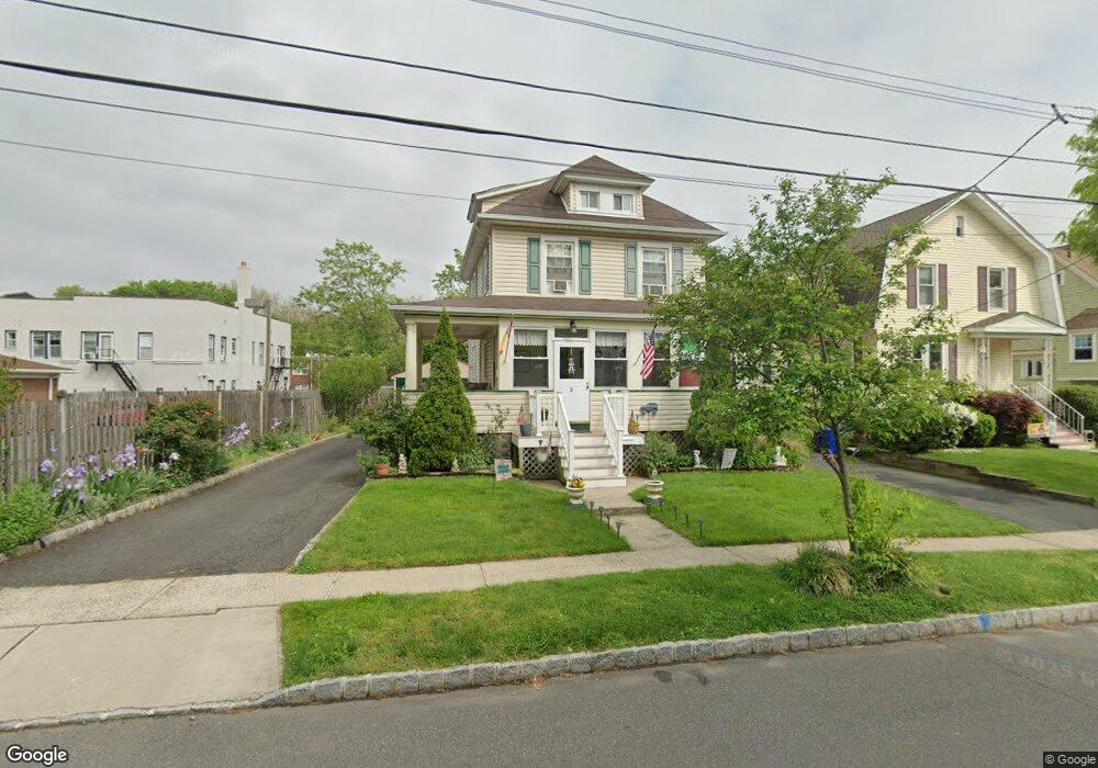
11 Battle Hill Ave Springfield, NJ 07081
Estimated Value: $508,000 - $560,000
--
Bed
--
Bath
1,494
Sq Ft
$354/Sq Ft
Est. Value
About This Home
This home is located at 11 Battle Hill Ave, Springfield, NJ 07081 and is currently estimated at $528,864, approximately $353 per square foot. 11 Battle Hill Ave is a home located in Union County with nearby schools including Jonathan Dayton High School and St James The Apostle School.
Ownership History
Date
Name
Owned For
Owner Type
Purchase Details
Closed on
Sep 28, 1995
Sold by
Smith Daniel J and Smith Anna G
Bought by
Mancuso Anthony and Mancuso Elisa
Current Estimated Value
Create a Home Valuation Report for This Property
The Home Valuation Report is an in-depth analysis detailing your home's value as well as a comparison with similar homes in the area
Home Values in the Area
Average Home Value in this Area
Purchase History
| Date | Buyer | Sale Price | Title Company |
|---|---|---|---|
| Mancuso Anthony | $140,000 | -- |
Source: Public Records
Tax History Compared to Growth
Tax History
| Year | Tax Paid | Tax Assessment Tax Assessment Total Assessment is a certain percentage of the fair market value that is determined by local assessors to be the total taxable value of land and additions on the property. | Land | Improvement |
|---|---|---|---|---|
| 2025 | $9,704 | $408,600 | $187,700 | $220,900 |
| 2024 | $9,545 | $408,600 | $187,700 | $220,900 |
| 2023 | $9,545 | $408,600 | $187,700 | $220,900 |
| 2022 | $8,863 | $408,600 | $187,700 | $220,900 |
| 2021 | $8,137 | $109,300 | $53,500 | $55,800 |
| 2020 | $8,011 | $109,300 | $53,500 | $55,800 |
| 2019 | $7,902 | $109,300 | $53,500 | $55,800 |
| 2018 | $7,760 | $109,300 | $53,500 | $55,800 |
| 2017 | $7,547 | $109,300 | $53,500 | $55,800 |
| 2016 | $7,401 | $109,300 | $53,500 | $55,800 |
| 2015 | $7,314 | $109,300 | $53,500 | $55,800 |
| 2014 | $7,177 | $109,300 | $53,500 | $55,800 |
Source: Public Records
Map
Nearby Homes
- 19 Warner Ave
- 67 Battle Hill Ave
- 17 Alvin Terrace
- 6 Joanne Way
- 97 Battle Hill Ave
- 73 S Maple Ave
- 20 Maple Ave
- 1066 Mayfair Rd
- 2785 Larchmont Rd
- 798 Pinewood Rd
- 1042 Battle Hill Terrace
- 1071 Battle Hill Terrace
- 980 Moessner Ave
- 960 Moessner Ave
- 15 Center St
- 807 Andover Rd
- 2636 Frederick Terrace
- 2670 Bancroft Ave
- 2641 Burns Place
- 2620 Eleanor Terrace
- 450 Morris Ave
- 15 Battle Hill Ave
- 19 Battle Hill Ave
- 19 Morris Ave
- 23 Battle Hill Ave
- 8 Washington Ave
- 46 Washington Ave
- 46 Washington Ave
- 46 Washington Ave Unit 6B
- 16 Washington Ave
- 37 Morris Ave
- 6 Washington Ave Unit 6B
- 6 Washington Ave
- 12 Battle Hill Ave
- 4 Washington Ave
- 18 Washington Ave
- 27 Battle Hill Ave
- 14 Battle Hill Ave
- 20 Washington Ave
- 18 Battle Hill Ave