Estimated Value: $1,467,000 - $2,095,000
4
Beds
2
Baths
2,230
Sq Ft
$751/Sq Ft
Est. Value
About This Home
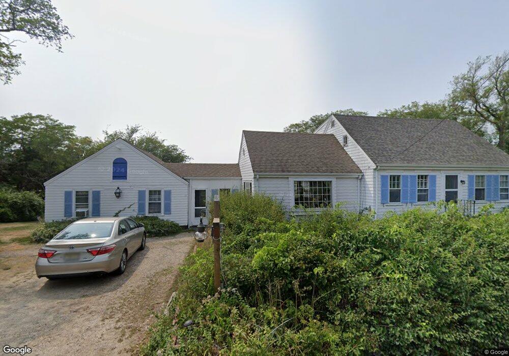
This home is located at 11 Benson Rd, Truro, MA 2666 and is currently estimated at $1,675,193, approximately $751 per square foot. 11 Benson Rd is a home located in Barnstable County.
Ownership History
Date
Name
Owned For
Owner Type
Purchase Details
Closed on
May 13, 2019
Sold by
Joan F Fox T
Bought by
11 Benson Road Llc
Current Estimated Value
Home Financials for this Owner
Home Financials are based on the most recent Mortgage that was taken out on this home.
Original Mortgage
$600,000
Outstanding Balance
$526,450
Interest Rate
4.1%
Mortgage Type
Purchase Money Mortgage
Estimated Equity
$1,148,743
Purchase Details
Closed on
Nov 13, 2017
Sold by
Fox Joan F
Bought by
Joan F Fox T
Purchase Details
Closed on
Aug 13, 2009
Sold by
Joan F Residence T and Fox Joan F
Bought by
Fox Joan F
Create a Home Valuation Report for This Property
The Home Valuation Report is an in-depth analysis detailing your home's value as well as a comparison with similar homes in the area
Home Values in the Area
Average Home Value in this Area
Purchase History
| Date | Buyer | Sale Price | Title Company |
|---|---|---|---|
| 11 Benson Road Llc | $749,900 | -- | |
| Joan F Fox T | -- | -- | |
| Fox Joan F | -- | -- |
Source: Public Records
Mortgage History
| Date | Status | Borrower | Loan Amount |
|---|---|---|---|
| Open | 11 Benson Road Llc | $600,000 |
Source: Public Records
Tax History Compared to Growth
Tax History
| Year | Tax Paid | Tax Assessment Tax Assessment Total Assessment is a certain percentage of the fair market value that is determined by local assessors to be the total taxable value of land and additions on the property. | Land | Improvement |
|---|---|---|---|---|
| 2025 | $7,957 | $1,287,500 | $819,100 | $468,400 |
| 2024 | $7,625 | $1,273,000 | $810,900 | $462,100 |
| 2023 | $6,800 | $1,039,800 | $641,000 | $398,800 |
| 2022 | $6,581 | $851,300 | $552,500 | $298,800 |
| 2021 | $6,148 | $833,100 | $552,500 | $280,600 |
| 2020 | $6,083 | $829,900 | $547,000 | $282,900 |
| 2019 | $6,096 | $818,300 | $547,000 | $271,300 |
| 2018 | $5,549 | $752,900 | $503,300 | $249,600 |
| 2017 | $5,182 | $742,400 | $503,300 | $239,100 |
| 2016 | $4,986 | $736,500 | $498,400 | $238,100 |
| 2015 | $4,813 | $725,900 | $493,500 | $232,400 |
Source: Public Records
Map
Nearby Homes
- 9 Kinnikinnick Rd
- 4 Resolution Rd
- 25 Resolution Rd
- 2 Meetinghouse Rd Unit 2
- 6 Long Nook Ln
- 2 Aldrich Rd
- 2 Amanda Ln
- 5 Sylvan Ln
- 52 Corn Hill Rd
- 208 Route 6
- 34 Truro Center Rd
- 3 N Union Field Rd
- 32 Depot Rd
- 7 Great Hollow Rd Unit 50
- 63 Old Kings Hwy
- 7 Great Hollow Rd Unit 50
- 6 Deer Path
- 5 Depot Rd
- 57 Old Kings Hwy
- 35A Higgins Hollow Rd