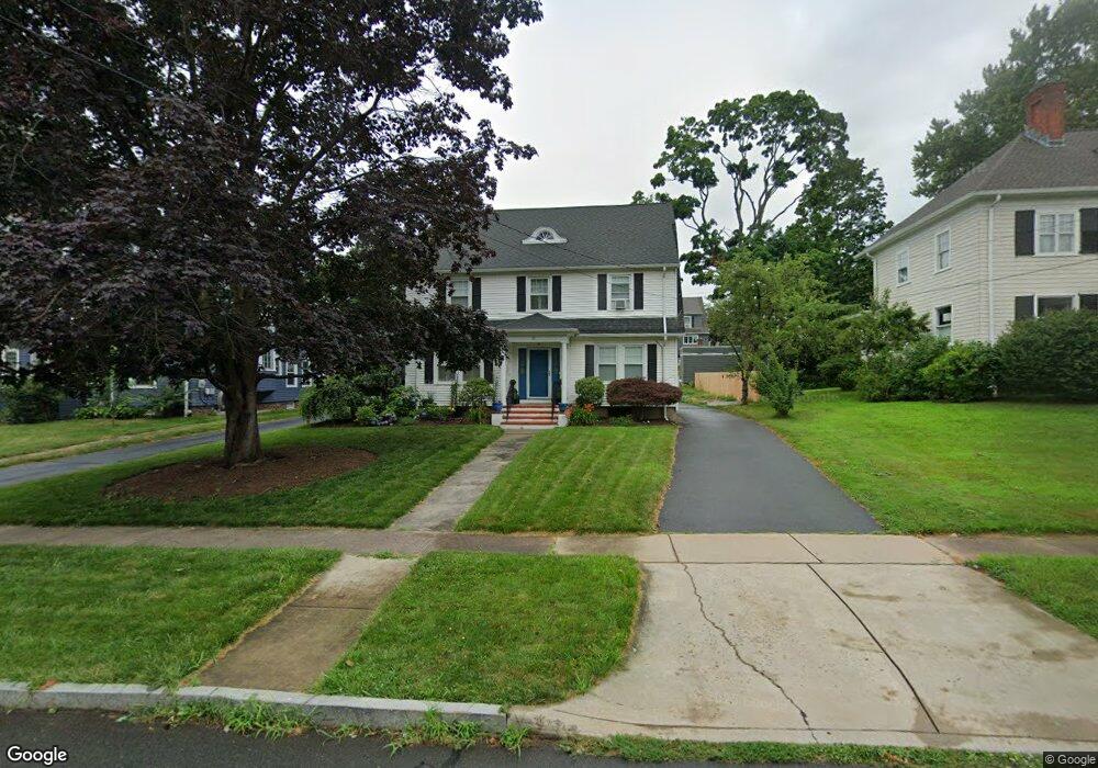
11 Beverly Rd West Hartford, CT 06119
Estimated Value: $572,000 - $682,000
4
Beds
3
Baths
2,310
Sq Ft
$273/Sq Ft
Est. Value
About This Home
This home is located at 11 Beverly Rd, West Hartford, CT 06119 and is currently estimated at $631,332, approximately $273 per square foot. 11 Beverly Rd is a home located in Hartford County with nearby schools including Whiting Lane School, Adams Elementary School, and King Philip Middle School.
Ownership History
Date
Name
Owned For
Owner Type
Purchase Details
Closed on
Feb 23, 2015
Sold by
Landino Christine
Bought by
Landino Anthony
Current Estimated Value
Home Financials for this Owner
Home Financials are based on the most recent Mortgage that was taken out on this home.
Original Mortgage
$280,000
Outstanding Balance
$157,772
Interest Rate
3.74%
Estimated Equity
$473,560
Purchase Details
Closed on
Apr 21, 2004
Sold by
Taylor Kenneth W and Taylor Joanne
Bought by
Landino Anthony and Landino Christine
Home Financials for this Owner
Home Financials are based on the most recent Mortgage that was taken out on this home.
Original Mortgage
$269,900
Interest Rate
4.87%
Create a Home Valuation Report for This Property
The Home Valuation Report is an in-depth analysis detailing your home's value as well as a comparison with similar homes in the area
Home Values in the Area
Average Home Value in this Area
Purchase History
| Date | Buyer | Sale Price | Title Company |
|---|---|---|---|
| Landino Anthony | -- | -- | |
| Landino Anthony | $337,000 | -- |
Source: Public Records
Mortgage History
| Date | Status | Borrower | Loan Amount |
|---|---|---|---|
| Open | Landino Anthony | $280,000 | |
| Previous Owner | Landino Anthony | $283,300 | |
| Previous Owner | Landino Anthony | $290,000 | |
| Previous Owner | Landino Anthony | $269,900 |
Source: Public Records
Tax History Compared to Growth
Tax History
| Year | Tax Paid | Tax Assessment Tax Assessment Total Assessment is a certain percentage of the fair market value that is determined by local assessors to be the total taxable value of land and additions on the property. | Land | Improvement |
|---|---|---|---|---|
| 2025 | $10,993 | $245,490 | $91,840 | $153,650 |
| 2024 | $10,397 | $245,490 | $91,840 | $153,650 |
| 2023 | $10,045 | $245,490 | $91,840 | $153,650 |
| 2022 | $9,907 | $243,530 | $91,840 | $151,690 |
| 2021 | $10,040 | $236,670 | $91,840 | $144,830 |
| 2020 | $9,507 | $227,430 | $87,010 | $140,420 |
| 2019 | $9,507 | $227,430 | $87,010 | $140,420 |
| 2018 | $9,325 | $227,430 | $87,010 | $140,420 |
| 2017 | $9,334 | $227,430 | $87,010 | $140,420 |
| 2016 | $9,207 | $233,030 | $87,150 | $145,880 |
| 2015 | $8,927 | $233,030 | $87,150 | $145,880 |
| 2014 | $8,708 | $233,030 | $87,150 | $145,880 |
Source: Public Records
Map
Nearby Homes
- 48 Walkley Rd
- 16 Lilley Rd
- 520 Prospect Ave
- 518 Prospect Ave
- 39 Fairlawn St
- 237 Fern St Unit 314
- 478 Prospect Ave
- 16 Lockwood Terrace
- 21 Warren Terrace
- 90-92 Rowe Ave
- 2 Rodney St
- 287 Whiting Ln
- 869 Farmington Ave Unit 305
- 30 Outlook Ave Unit 205
- 105 Ardmore Rd
- 126 Heath St
- 62 Whitney St
- 54 James St Unit 56
- 102 Oakwood Ave Unit B5
- 45 Warrenton Ave Unit 47