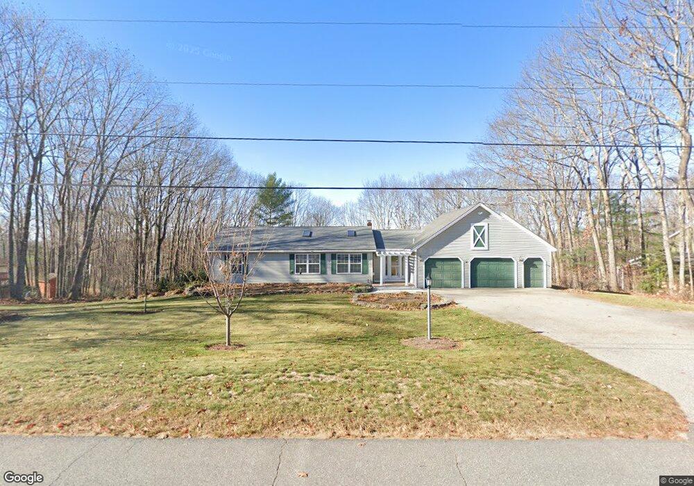
11 Birch Ridge Ave Topsham, ME 04086
Estimated Value: $452,000 - $502,000
3
Beds
3
Baths
2,170
Sq Ft
$220/Sq Ft
Est. Value
About This Home
This home is located at 11 Birch Ridge Ave, Topsham, ME 04086 and is currently estimated at $477,358, approximately $219 per square foot. 11 Birch Ridge Ave is a home located in Sagadahoc County with nearby schools including Mt Ararat High School and St. John's Catholic School.
Ownership History
Date
Name
Owned For
Owner Type
Purchase Details
Closed on
Aug 1, 2025
Sold by
Seder Norman H
Bought by
Seder Norman H
Current Estimated Value
Purchase Details
Closed on
Feb 5, 2010
Sold by
Kennedy-Seder Bonnie
Bought by
Seder Norman H
Purchase Details
Closed on
Aug 23, 2006
Sold by
Main Michelle C and Delguadio Mochelle C
Bought by
Seder Norman H and Seder Bonnie K
Home Financials for this Owner
Home Financials are based on the most recent Mortgage that was taken out on this home.
Original Mortgage
$85,400
Interest Rate
6.83%
Mortgage Type
Purchase Money Mortgage
Create a Home Valuation Report for This Property
The Home Valuation Report is an in-depth analysis detailing your home's value as well as a comparison with similar homes in the area
Home Values in the Area
Average Home Value in this Area
Purchase History
| Date | Buyer | Sale Price | Title Company |
|---|---|---|---|
| Seder Norman H | -- | -- | |
| Seder Norman H | -- | -- | |
| Seder Norman H | -- | -- | |
| Seder Norman H | -- | -- | |
| Seder Norman H | -- | -- | |
| Seder Norman H | -- | -- |
Source: Public Records
Mortgage History
| Date | Status | Borrower | Loan Amount |
|---|---|---|---|
| Previous Owner | Seder Norman H | $85,400 | |
| Previous Owner | Seder Norman H | $156,700 |
Source: Public Records
Tax History Compared to Growth
Tax History
| Year | Tax Paid | Tax Assessment Tax Assessment Total Assessment is a certain percentage of the fair market value that is determined by local assessors to be the total taxable value of land and additions on the property. | Land | Improvement |
|---|---|---|---|---|
| 2024 | $5,821 | $465,700 | $63,200 | $402,500 |
| 2023 | $5,523 | $406,700 | $60,100 | $346,600 |
| 2022 | $5,014 | $347,700 | $57,900 | $289,800 |
| 2021 | $4,991 | $314,500 | $53,100 | $261,400 |
| 2020 | $4,770 | $267,100 | $53,100 | $214,000 |
| 2019 | $4,789 | $250,100 | $53,100 | $197,000 |
| 2018 | $4,265 | $227,700 | $47,500 | $180,200 |
| 2017 | $4,126 | $227,700 | $47,500 | $180,200 |
| 2016 | $4,062 | $225,800 | $47,500 | $178,300 |
| 2015 | $3,949 | $219,900 | $47,500 | $172,400 |
| 2014 | $3,778 | $218,000 | $47,500 | $170,500 |
| 2013 | $3,630 | $218,000 | $47,500 | $170,500 |
Source: Public Records
Map
Nearby Homes
- Lot 12 Raspberry Ln
- Lot 11 Raspberry Ln
- 13 Raspberry Ln
- 14 Raspberry Ln
- 34 Compass Ln
- 2 Haskell Cir
- 87 River Rd
- 55 Munroe Ln
- 67 Forest Glen Ln
- 23 Forest Glen Ln
- 26 Union Park Rd
- 43 Forest Glen Ln
- 28 Forest Glen Ln
- 44 Forest Glen Ln
- 57 Winter St
- 4 Sadler Dr
- 19 Sadler Dr
- 118 Main St
- 4 Wilson St
- 3 Nugget Ln Unit 3
- 12 Birch Ridge Ave
- 13 Birch Ridge Ave
- 9 Birch Ridge Ave
- 10 Birch Ridge Ave
- 5 Rocky Ave
- 14 Birch Ridge Ave
- 3 Mayflower Ln
- 8 Birch Ridge Ave
- 7 Birch Ridge Ave
- 4 Rocky Ave
- 2 Mayflower Ln
- 2 Rocky Ave
- 6 Rocky Ave
- 5 Mayflower Ln
- 4 Mayflower Ln
- 16 Birch Ridge Ave
- 6 Birch Ridge Ave
- 8 Rocky Ave
- 5 Birch Ridge Ave
- 13 Smith Rd