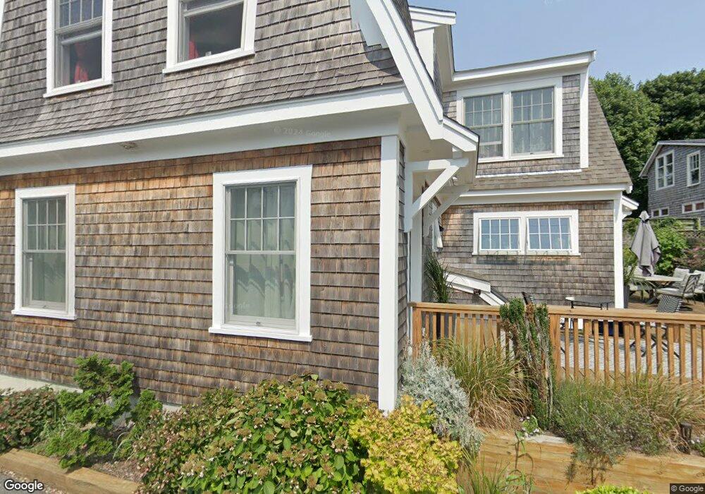
11 Brewster St Provincetown, MA 02657
Estimated Value: $1,930,000 - $1,981,000
3
Beds
3
Baths
2,616
Sq Ft
$748/Sq Ft
Est. Value
About This Home
This home is located at 11 Brewster St, Provincetown, MA 02657 and is currently estimated at $1,955,500, approximately $747 per square foot. 11 Brewster St is a home located in Barnstable County with nearby schools including Provincetown Schools.
Ownership History
Date
Name
Owned For
Owner Type
Purchase Details
Closed on
Jul 1, 2016
Sold by
Sullivan Christopher J and Peskin Barry
Bought by
Peskin Barry and Zoppa-Peskin Cynthia
Current Estimated Value
Purchase Details
Closed on
Jan 24, 2013
Sold by
P & M Mgmt Llc
Bought by
Moss Darel and Peskin Barry
Create a Home Valuation Report for This Property
The Home Valuation Report is an in-depth analysis detailing your home's value as well as a comparison with similar homes in the area
Home Values in the Area
Average Home Value in this Area
Purchase History
| Date | Buyer | Sale Price | Title Company |
|---|---|---|---|
| Peskin Barry | $333,000 | -- | |
| Peskin Barry | $333,000 | -- | |
| Moss Darel | -- | -- | |
| Moss Darel | -- | -- | |
| Moss Darel | -- | -- |
Source: Public Records
Mortgage History
| Date | Status | Borrower | Loan Amount |
|---|---|---|---|
| Previous Owner | Moss Darel | $1,150,000 | |
| Previous Owner | Moss Darel | $620,000 |
Source: Public Records
Tax History Compared to Growth
Tax History
| Year | Tax Paid | Tax Assessment Tax Assessment Total Assessment is a certain percentage of the fair market value that is determined by local assessors to be the total taxable value of land and additions on the property. | Land | Improvement |
|---|---|---|---|---|
| 2025 | $8,665 | $1,547,400 | $448,300 | $1,099,100 |
| 2024 | $8,295 | $1,486,600 | $427,200 | $1,059,400 |
| 2023 | $6,991 | $1,169,000 | $371,500 | $797,500 |
| 2022 | $6,936 | $1,041,500 | $347,200 | $694,300 |
| 2021 | $7,165 | $1,012,000 | $315,700 | $696,300 |
| 2020 | $3,620 | $546,800 | $311,800 | $235,000 |
| 2019 | $5,374 | $761,200 | $302,700 | $458,500 |
| 2018 | $4,890 | $656,400 | $295,600 | $360,800 |
| 2017 | $4,835 | $627,100 | $289,800 | $337,300 |
| 2016 | $4,837 | $620,100 | $281,300 | $338,800 |
| 2015 | $4,346 | $588,900 | $275,800 | $313,100 |
Source: Public Records
Map
Nearby Homes
- 167 Bradford St Unit B
- 404 Commercial St Unit 1
- 404 Commercial St Unit 2
- 405 Commercial St Unit 5
- 184 Bradford St Unit 1
- 5 Kiley Ct Unit 2
- 441 Commercial St Unit B
- 37 Pearl St
- 36 Pearl St Unit 2
- 36 Pearl St Unit 3
- 452 Commercial St Unit 3
- 15 Center St
- 361b Commercial St Unit U3
- 4 Center St
- 143 Bradford St Unit A
- 351A Commercial St Unit A1
- 46 Harry Kemp Way Unit 2
- 8 Priscilla Alden Rd
- 7 Brewster St
- 15 Brewster St
- 6 Priscilla Alden Rd
- 10 Brewster St
- 12 Brewster St
- 12 Brewster St Unit 1
- 12 Brewster St Unit 2
- 12 Brewster St Unit U2
- 8 Brewster St
- 8 Brewster St Unit B
- 8 Brewster St Unit 8
- 8 Brewster St Unit 2
- 8 Brewster St Unit 1
- 5 Brewster St Unit 3
- 5 Brewster St Unit 2
- 5 Brewster St Unit 1
- 14 Brewster St
- 17 Brewster St
- 4 Priscilla Alden Rd