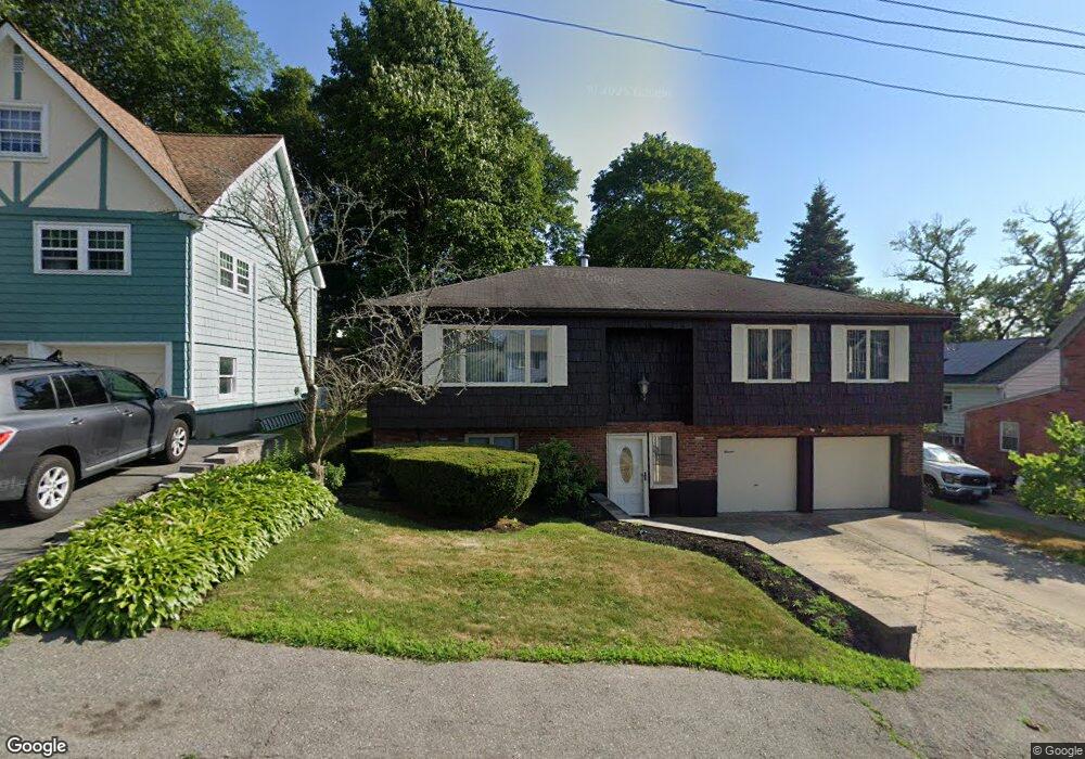
11 Bristol Ave Swampscott, MA 01907
Estimated Value: $753,430 - $810,000
3
Beds
3
Baths
2,053
Sq Ft
$384/Sq Ft
Est. Value
About This Home
This home is located at 11 Bristol Ave, Swampscott, MA 01907 and is currently estimated at $789,108, approximately $384 per square foot. 11 Bristol Ave is a home located in Essex County with nearby schools including Swampscott Middle School and Swampscott High School.
Ownership History
Date
Name
Owned For
Owner Type
Purchase Details
Closed on
Apr 29, 2021
Sold by
Hart Diane L and Hart Robert F
Bought by
Hart Ft and Smith
Current Estimated Value
Purchase Details
Closed on
Mar 15, 1976
Bought by
Hart Robert F and Hart Dane L
Create a Home Valuation Report for This Property
The Home Valuation Report is an in-depth analysis detailing your home's value as well as a comparison with similar homes in the area
Home Values in the Area
Average Home Value in this Area
Purchase History
| Date | Buyer | Sale Price | Title Company |
|---|---|---|---|
| Hart Ft | -- | None Available | |
| Hart Ft | -- | None Available | |
| Hart Ft | -- | None Available | |
| Hart Robert F | -- | -- |
Source: Public Records
Mortgage History
| Date | Status | Borrower | Loan Amount |
|---|---|---|---|
| Previous Owner | Hart Robert F | $32,000 | |
| Previous Owner | Hart Robert F | $30,000 | |
| Previous Owner | Hart Robert F | $30,000 |
Source: Public Records
Tax History
| Year | Tax Paid | Tax Assessment Tax Assessment Total Assessment is a certain percentage of the fair market value that is determined by local assessors to be the total taxable value of land and additions on the property. | Land | Improvement |
|---|---|---|---|---|
| 2025 | $7,171 | $625,200 | $270,500 | $354,700 |
| 2024 | $7,020 | $611,000 | $258,900 | $352,100 |
| 2023 | $6,762 | $576,000 | $247,300 | $328,700 |
| 2022 | $6,470 | $504,300 | $216,400 | $287,900 |
| 2021 | $6,507 | $471,500 | $200,900 | $270,600 |
| 2020 | $6,356 | $444,500 | $173,900 | $270,600 |
| 2019 | $6,110 | $402,000 | $131,400 | $270,600 |
| 2018 | $6,229 | $389,300 | $123,600 | $265,700 |
| 2017 | $6,427 | $368,300 | $115,900 | $252,400 |
| 2016 | $5,816 | $335,600 | $115,900 | $219,700 |
| 2015 | $5,623 | $327,900 | $108,200 | $219,700 |
| 2014 | $6,025 | $322,200 | $116,800 | $205,400 |
Source: Public Records
Map
Nearby Homes
- 8 Summit View Dr
- 64 Stetson Ave
- 441 Essex St Unit 302
- 3 Didio Dr
- 46 Stetson Ave
- 169 Walker Rd Unit 2
- 167-169 Walker Rd
- 48 Mountwood Rd
- 50 Mountwood Rd
- 106 Norfolk Ave
- 96 Burpee Rd Unit 1
- 80 Norfolk Ave Unit 1
- 37 Weatherly Dr
- 49 Weatherly Dr
- 30 Weatherly Dr
- 11 Weatherly Dr
- 60 Roy St
- 4 Valley Rd Unit 4
- 1004 Paradise Rd Unit 1K
- 1004 Paradise Rd Unit 1L
- 17 Bristol Ave
- 161 Stetson Ave
- 167 Stetson Ave
- 167 Stetson Ave Unit 2
- 167 Stetson Ave Unit 1
- 23 Bristol Ave
- 147 Stetson Ave
- 10 Duke St
- 16 Duke St
- 177 Stetson Ave
- 14 Bristol Ave
- 145 Stetson Ave
- 25 Bristol Ave
- 18 Bristol Ave
- 24 Bristol Ave
- 181 Stetson Ave
- 181 Stetson Ave Unit 1
- 181 Stetson Ave Unit 2
- 14 Nantucket Ave
- 29 Bristol Ave
Your Personal Tour Guide
Ask me questions while you tour the home.