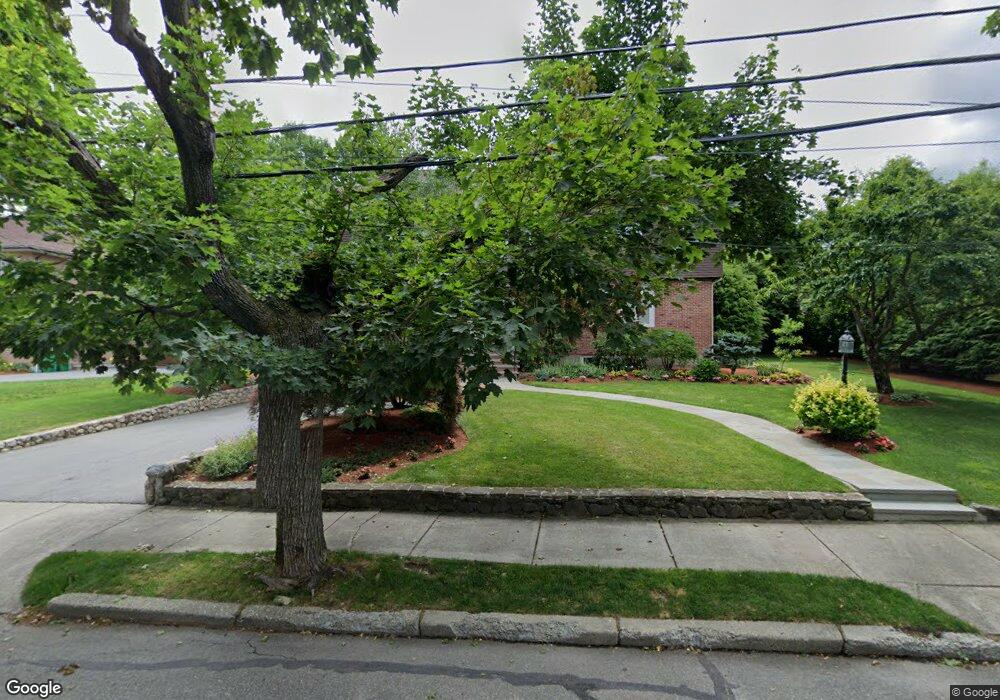
11 Broken Tree Rd Newton Center, MA 02459
Oak Hill NeighborhoodEstimated Value: $2,308,000 - $2,863,000
5
Beds
4
Baths
3,993
Sq Ft
$642/Sq Ft
Est. Value
About This Home
This home is located at 11 Broken Tree Rd, Newton Center, MA 02459 and is currently estimated at $2,564,612, approximately $642 per square foot. 11 Broken Tree Rd is a home located in Middlesex County with nearby schools including Memorial Spaulding Elementary School, Oak Hill Middle School, and Newton South High School.
Ownership History
Date
Name
Owned For
Owner Type
Purchase Details
Closed on
Oct 4, 2000
Sold by
Bamel Jonathan S
Bought by
Rimm Ilonna J and Madsen Joseph R
Current Estimated Value
Purchase Details
Closed on
Aug 2, 1995
Sold by
Stein Charlotte Est
Bought by
Bamel Jonathan S
Create a Home Valuation Report for This Property
The Home Valuation Report is an in-depth analysis detailing your home's value as well as a comparison with similar homes in the area
Home Values in the Area
Average Home Value in this Area
Purchase History
| Date | Buyer | Sale Price | Title Company |
|---|---|---|---|
| Rimm Ilonna J | $1,000,000 | -- | |
| Bamel Jonathan S | $364,000 | -- |
Source: Public Records
Mortgage History
| Date | Status | Borrower | Loan Amount |
|---|---|---|---|
| Open | Bamel Jonathan S | $721,000 | |
| Closed | Bamel Jonathan S | $750,000 |
Source: Public Records
Tax History Compared to Growth
Tax History
| Year | Tax Paid | Tax Assessment Tax Assessment Total Assessment is a certain percentage of the fair market value that is determined by local assessors to be the total taxable value of land and additions on the property. | Land | Improvement |
|---|---|---|---|---|
| 2025 | $21,881 | $2,232,800 | $1,210,600 | $1,022,200 |
| 2024 | $21,158 | $2,167,800 | $1,175,300 | $992,500 |
| 2023 | $20,367 | $2,000,700 | $919,200 | $1,081,500 |
| 2022 | $19,488 | $1,852,500 | $851,100 | $1,001,400 |
| 2021 | $18,804 | $1,747,600 | $802,900 | $944,700 |
| 2020 | $18,245 | $1,747,600 | $802,900 | $944,700 |
| 2019 | $17,731 | $1,696,700 | $779,500 | $917,200 |
| 2018 | $17,422 | $1,610,200 | $703,100 | $907,100 |
| 2017 | $16,892 | $1,519,100 | $663,300 | $855,800 |
| 2016 | $16,156 | $1,419,700 | $619,900 | $799,800 |
| 2015 | $15,404 | $1,326,800 | $579,300 | $747,500 |
Source: Public Records
Map
Nearby Homes
- 21 Broken Tree Rd
- 133 Oak Hill St
- 853 Dedham St
- 55 June Ln
- 544 Saw Mill Brook Pkwy
- 30 Esty Farm Rd
- 360 Brookline St
- 21 Lovett Rd
- 44 Lovett Rd
- 36 Ober Rd
- 191 Spiers Rd
- 131 Wiswall Rd
- 1307 Lagrange St Unit 1307
- 26 Cottonwood Rd
- 5 Kappius Path
- 1200 Lagrange St Unit 1206
- 27 Rosalie Rd
- 63 Drumlin Rd
- 139 Newfield St
- 579 Baker St Unit 579
- 5 Broken Tree Rd
- 912 Dedham St
- 8 Broken Tree Rd
- 18 Broken Tree Rd
- 31 Broken Tree Rd
- 131 Old Farm Rd
- 30 Broken Tree Rd
- 137 Oak Hill St
- 901 Dedham St
- 880 Dedham St
- 115 Old Farm Rd
- 895 Dedham St
- 922 Dedham St
- 907 Dedham St
- 141 Old Farm Rd
- 183 Oak Hill St Unit 307
- 183 Oak Hill St Unit 502
- 887 Dedham St
- 915 Dedham St
- 105 Old Farm Rd