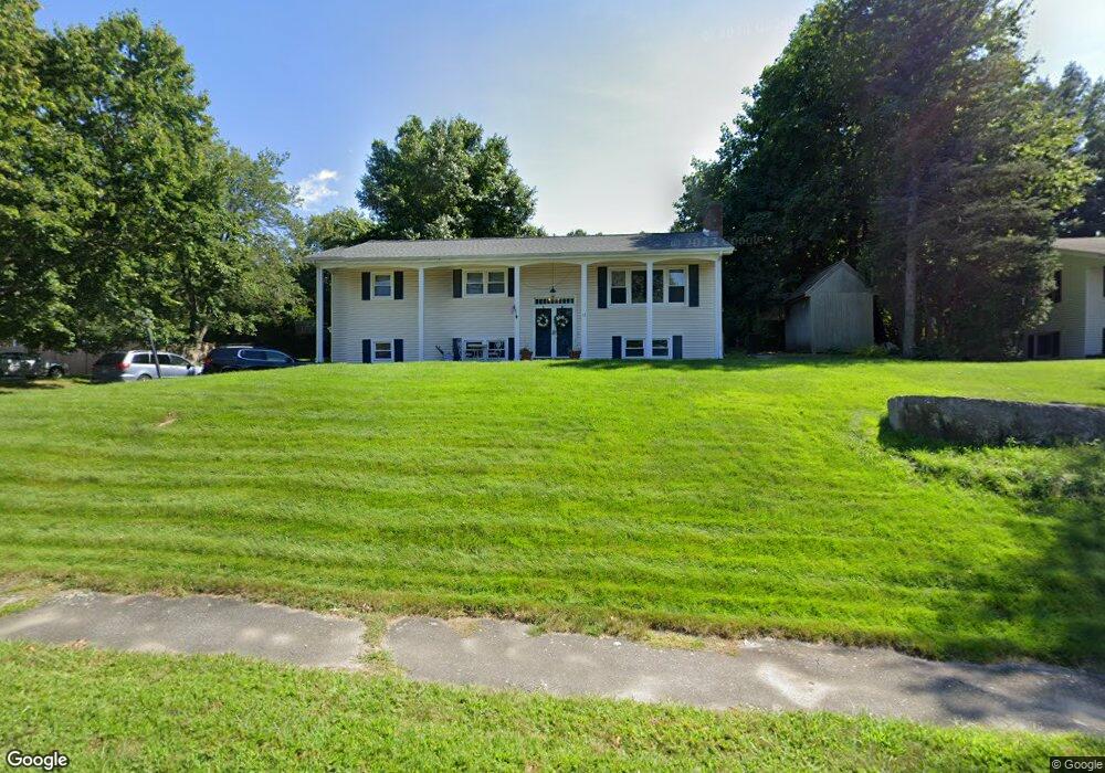
11 Bryant Ave Shrewsbury, MA 01545
Estimated Value: $647,594 - $781,000
4
Beds
2
Baths
2,232
Sq Ft
$320/Sq Ft
Est. Value
About This Home
This home is located at 11 Bryant Ave, Shrewsbury, MA 01545 and is currently estimated at $715,149, approximately $320 per square foot. 11 Bryant Ave is a home located in Worcester County with nearby schools including Walter J. Paton Elementary School, Sherwood Middle School, and Oak Middle School.
Ownership History
Date
Name
Owned For
Owner Type
Purchase Details
Closed on
May 10, 2024
Sold by
Leardi Lauren M
Bought by
Ggv Nt and Leardi
Current Estimated Value
Purchase Details
Closed on
Jul 10, 2009
Sold by
Obrien Howard W and Manley-Obrien Lisa Marie
Bought by
Leardi Robert and Leardi Lauren M
Home Financials for this Owner
Home Financials are based on the most recent Mortgage that was taken out on this home.
Original Mortgage
$340,735
Interest Rate
4.93%
Mortgage Type
Purchase Money Mortgage
Purchase Details
Closed on
Apr 3, 2000
Sold by
Burke Franz J
Bought by
Manley-Obrien Lisa M and Obrien Howard W
Purchase Details
Closed on
Jan 7, 1998
Sold by
Dauphinee Raymond
Bought by
Burke Franz J
Create a Home Valuation Report for This Property
The Home Valuation Report is an in-depth analysis detailing your home's value as well as a comparison with similar homes in the area
Home Values in the Area
Average Home Value in this Area
Purchase History
| Date | Buyer | Sale Price | Title Company |
|---|---|---|---|
| Ggv Nt | -- | None Available | |
| Ggv Nt | -- | None Available | |
| Ggv Nt | -- | None Available | |
| Leardi Robert | $352,500 | -- | |
| Leardi Robert | $352,500 | -- | |
| Manley-Obrien Lisa M | $204,000 | -- | |
| Burke Franz J | $165,000 | -- | |
| Leardi Robert | $352,500 | -- | |
| Manley-Obrien Lisa M | $204,000 | -- | |
| Burke Franz J | $165,000 | -- |
Source: Public Records
Mortgage History
| Date | Status | Borrower | Loan Amount |
|---|---|---|---|
| Previous Owner | Burke Franz J | $343,402 | |
| Previous Owner | Leardi Robert | $340,735 |
Source: Public Records
Tax History Compared to Growth
Tax History
| Year | Tax Paid | Tax Assessment Tax Assessment Total Assessment is a certain percentage of the fair market value that is determined by local assessors to be the total taxable value of land and additions on the property. | Land | Improvement |
|---|---|---|---|---|
| 2025 | $78 | $649,100 | $261,600 | $387,500 |
| 2024 | $7,200 | $581,600 | $249,100 | $332,500 |
| 2023 | $6,694 | $510,200 | $249,100 | $261,100 |
| 2022 | $6,565 | $465,300 | $249,100 | $216,200 |
| 2021 | $5,442 | $412,600 | $199,300 | $213,300 |
| 2020 | $4,929 | $395,300 | $199,300 | $196,000 |
| 2019 | $4,702 | $374,100 | $183,000 | $191,100 |
| 2018 | $4,696 | $370,900 | $175,800 | $195,100 |
| 2017 | $4,381 | $341,500 | $159,100 | $182,400 |
| 2016 | $4,232 | $325,500 | $149,100 | $176,400 |
| 2015 | $4,184 | $317,000 | $144,700 | $172,300 |
Source: Public Records
Map
Nearby Homes
- 20 Browning Rd
- 251 Boylston St Unit 253
- 20 Rawson Hill Dr
- 2 Applewood Cir
- 2 Burkhardt Cir Unit 5
- 313 Gulf St
- 17 Wilder Rd
- 11 Adin Dr
- 345 Sewall St
- 3 Merriam Ave
- 11 Cranbrook Rd
- 28 Sewall St
- 22 Ridge Rd
- 2 Morgan Cir Unit 16
- 70 Colonial Dr
- 291 Sewall St Unit 291
- 289 Sewall St Unit 289
- 281 Sewall St Unit 281
- 279 Sewall St Unit 279
- 7 Holman Heights Cir
- 9 Bryant Ave
- 13 Bryant Ave
- 44 Wachusett Ave
- 42 Wachusett Ave
- 12 Bryant Ave
- 46 Wachusett Ave
- 14 Bryant Ave
- 7 Bryant Ave
- 10 Bryant Ave
- 15 Bryant Ave
- 38 Wachusett Ave
- 43 Wachusett Ave
- 35 Longfellow Rd
- 8 Bryant Ave
- LOT 3 Holt Rd
- LOT 4 Holt Rd
- L223-1 Wendell St
- LOT 13 Redland Rd Extension
- LOT 11 Old Barn Rd
- LOT67A Bridal Path