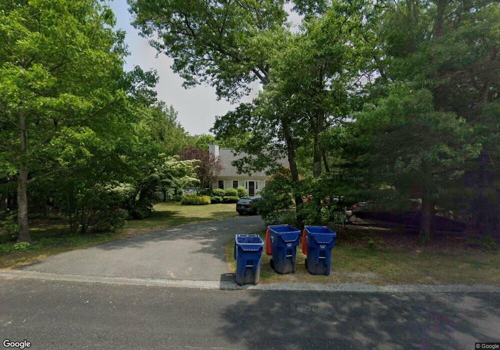
11 Cabot Cir Plymouth, MA 02360
Estimated Value: $560,000 - $585,000
3
Beds
2
Baths
1,344
Sq Ft
$426/Sq Ft
Est. Value
About This Home
This home is located at 11 Cabot Cir, Plymouth, MA 02360 and is currently estimated at $572,767, approximately $426 per square foot. 11 Cabot Cir is a home located in Plymouth County with nearby schools including South Elementary School, Plymouth South Middle School, and Plymouth South High School.
Ownership History
Date
Name
Owned For
Owner Type
Purchase Details
Closed on
Feb 25, 2005
Sold by
Fisher Paul F and Fisher Jennifer A
Bought by
Ball Keenan R and Ball Dawn M
Current Estimated Value
Home Financials for this Owner
Home Financials are based on the most recent Mortgage that was taken out on this home.
Original Mortgage
$330,800
Outstanding Balance
$169,038
Interest Rate
5.73%
Mortgage Type
Purchase Money Mortgage
Estimated Equity
$403,729
Purchase Details
Closed on
Apr 15, 1998
Sold by
Casale Rt and Marinilli Antonio V
Bought by
Fisher Paul F and Fisher Jennifer A
Create a Home Valuation Report for This Property
The Home Valuation Report is an in-depth analysis detailing your home's value as well as a comparison with similar homes in the area
Home Values in the Area
Average Home Value in this Area
Purchase History
| Date | Buyer | Sale Price | Title Company |
|---|---|---|---|
| Ball Keenan R | $331,300 | -- | |
| Fisher Paul F | $108,190 | -- |
Source: Public Records
Mortgage History
| Date | Status | Borrower | Loan Amount |
|---|---|---|---|
| Open | Fisher Paul F | $330,800 | |
| Closed | Fisher Paul F | $50,000 | |
| Previous Owner | Fisher Paul F | $154,000 |
Source: Public Records
Tax History Compared to Growth
Tax History
| Year | Tax Paid | Tax Assessment Tax Assessment Total Assessment is a certain percentage of the fair market value that is determined by local assessors to be the total taxable value of land and additions on the property. | Land | Improvement |
|---|---|---|---|---|
| 2025 | $5,782 | $455,600 | $205,000 | $250,600 |
| 2024 | $5,725 | $444,800 | $201,000 | $243,800 |
| 2023 | $5,528 | $403,200 | $177,000 | $226,200 |
| 2022 | $5,208 | $337,500 | $160,900 | $176,600 |
| 2021 | $5,021 | $310,700 | $160,900 | $149,800 |
| 2020 | $4,988 | $305,100 | $156,900 | $148,200 |
| 2019 | $4,803 | $290,400 | $140,900 | $149,500 |
| 2018 | $4,610 | $280,100 | $130,900 | $149,200 |
| 2017 | $4,375 | $263,900 | $130,900 | $133,000 |
| 2016 | $4,150 | $255,100 | $120,900 | $134,200 |
| 2015 | $3,980 | $256,100 | $120,900 | $135,200 |
| 2014 | $3,813 | $252,000 | $120,900 | $131,100 |
Source: Public Records
Map
Nearby Homes
- 8 Cabot Cir
- 756 Bourne Rd
- 810 Head of The Bay Rd
- 13 Hideaway Village Unit G
- 9 Hideaway Rd Unit F
- 32 Rickey Ln
- 47 Lake Dr
- 11 Thompson Rd Unit A
- 27 Baker Ln Unit 27
- 110 Packard St
- 32 Lake View Blvd
- 119 Lake Ave
- 167 Park Ave
- 901 Head of The Bay Rd
- 23 Pine Ridge Rd
- 7 Central Ave
- 73 Lewis Point Rd
- 65 Lewis Point Rd
- 19 Milford St
- 14 Buttonwood Ln
- 21 Cabot Cir
- 16 Cabot Cir
- 12 Whitmar Cir
- 29 Cabot Cir
- 20 Whitmar Cir
- 63 Bourne Hurst Dr
- 63 Bournehurst Dr
- 17 Bournehurst Dr
- 237 Bournehurst Dr
- 58 Bournehurst Dr
- 39 Cabot Cir
- 19 Whitmar Cir
- 236 Bournehurst Dr
- 229 Bournehurst Dr
- 44 Cabot Cir
- 24 Whitmar Cir
- 24 Whitmar Cir Unit 1
- 73 Bournehurst Dr
- 70 Bournehurst Dr
- 7 Bournehurst Dr