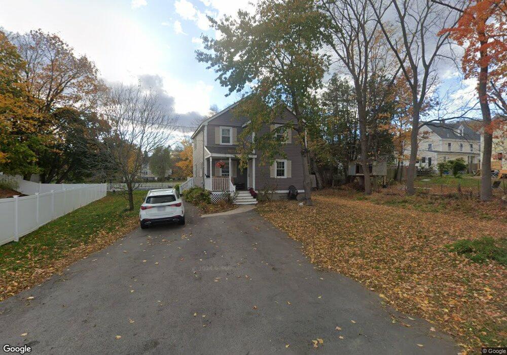
11 Cammetts Ct Amesbury, MA 01913
Estimated Value: $604,000 - $669,000
3
Beds
2
Baths
1,514
Sq Ft
$422/Sq Ft
Est. Value
About This Home
This home is located at 11 Cammetts Ct, Amesbury, MA 01913 and is currently estimated at $638,972, approximately $422 per square foot. 11 Cammetts Ct is a home located in Essex County with nearby schools including Amesbury High School and Amesbury Seventh-Day Adventist School.
Ownership History
Date
Name
Owned For
Owner Type
Purchase Details
Closed on
Aug 9, 2004
Sold by
Provost Karen J and Provost Lee E
Bought by
Win U Htain
Current Estimated Value
Purchase Details
Closed on
Sep 3, 2002
Sold by
Ring William S and Ring Dianna
Bought by
Provost Lee
Purchase Details
Closed on
Aug 11, 1995
Sold by
Koloski Gail A
Bought by
Provost Lee E and Provost Karen
Create a Home Valuation Report for This Property
The Home Valuation Report is an in-depth analysis detailing your home's value as well as a comparison with similar homes in the area
Home Values in the Area
Average Home Value in this Area
Purchase History
| Date | Buyer | Sale Price | Title Company |
|---|---|---|---|
| Win U Htain | $309,900 | -- | |
| Provost Lee | $25,000 | -- | |
| Provost Lee E | $120,000 | -- |
Source: Public Records
Mortgage History
| Date | Status | Borrower | Loan Amount |
|---|---|---|---|
| Open | Provost Lee E | $46,007 | |
| Open | Provost Lee E | $353,378 |
Source: Public Records
Tax History Compared to Growth
Tax History
| Year | Tax Paid | Tax Assessment Tax Assessment Total Assessment is a certain percentage of the fair market value that is determined by local assessors to be the total taxable value of land and additions on the property. | Land | Improvement |
|---|---|---|---|---|
| 2025 | $7,844 | $512,700 | $191,800 | $320,900 |
| 2024 | $8,019 | $512,700 | $214,900 | $297,800 |
| 2023 | $7,482 | $459,000 | $186,800 | $272,200 |
| 2022 | $7,028 | $405,900 | $162,400 | $243,500 |
| 2021 | $6,563 | $351,400 | $118,900 | $232,500 |
| 2020 | $5,864 | $329,300 | $114,300 | $215,000 |
| 2019 | $5,961 | $313,600 | $114,300 | $199,300 |
| 2018 | $5,838 | $298,700 | $108,800 | $189,900 |
| 2017 | $5,740 | $292,200 | $108,800 | $183,400 |
| 2016 | $5,204 | $256,600 | $84,600 | $172,000 |
Source: Public Records
Map
Nearby Homes
- 129 Friend St
- 19 Perkins St
- 31 Whitter Meadows Dr Unit 31
- 15 Sparhawk St Unit 3
- 17 Lincoln Ct
- 13 Lincoln Ct
- 4 Lincoln Ct
- 81 High St Unit 27
- 179 Lions Mouth Rd
- 49 W Greenwood St
- 37 Millyard Unit 204
- 5 Moncrief St Unit 1
- 188 Lions Mouth Rd
- 2 Hitching Post Ln
- 24 Aubin St Unit 2
- 43 Aubin St Unit 1
- 48 Orchard St
- 4 Greenwood St
- 17 Linwood Place
- 36 Hillside Ave
- 7 Cammetts Ct
- 9 Cammetts Ct Unit 9
- 10 Cammetts Ct
- 127 1/2 Friend St
- 5 Cammetts Ct
- 11 Whittier Ave
- 3-5 Cammetts Ct
- 8 Cammetts Ct
- 8 Cammetts Ct Unit Single
- 13 1/2 Whittier Ave
- 13 1/2 Whittier Ave Unit 1
- 9 Whittier Ave
- 4 Cammett's Ct Unit 4
- 6 Cammett's Ct Unit 6
- 15 Whittier Ave
- 13 Whittier Ave
- 6 Cammetts Ct
- 6 Cammetts Ct Unit 6
- 4 Cammetts Ct
- 127 Friend St