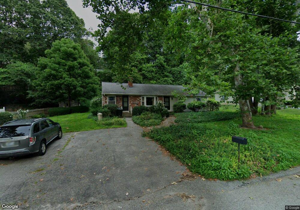
11 Cedar Way Cumberland, RI 02864
Ashton NeighborhoodEstimated Value: $422,000 - $549,000
3
Beds
2
Baths
1,512
Sq Ft
$322/Sq Ft
Est. Value
About This Home
This home is located at 11 Cedar Way, Cumberland, RI 02864 and is currently estimated at $486,700, approximately $321 per square foot. 11 Cedar Way is a home located in Providence County with nearby schools including Ashton Elementary School, Joseph L. McCourt Middle School, and Cumberland High School.
Ownership History
Date
Name
Owned For
Owner Type
Purchase Details
Closed on
May 28, 2021
Sold by
Mcnulty Joy I
Bought by
Sullivan Joy L
Current Estimated Value
Home Financials for this Owner
Home Financials are based on the most recent Mortgage that was taken out on this home.
Original Mortgage
$152,000
Outstanding Balance
$136,109
Interest Rate
2.9%
Mortgage Type
New Conventional
Estimated Equity
$350,591
Purchase Details
Closed on
Nov 4, 1981
Bought by
Mcnulty Marjorie F and Mcnulty Joy I
Create a Home Valuation Report for This Property
The Home Valuation Report is an in-depth analysis detailing your home's value as well as a comparison with similar homes in the area
Home Values in the Area
Average Home Value in this Area
Purchase History
| Date | Buyer | Sale Price | Title Company |
|---|---|---|---|
| Sullivan Joy L | -- | None Available | |
| Mcnulty Marjorie F | -- | -- |
Source: Public Records
Mortgage History
| Date | Status | Borrower | Loan Amount |
|---|---|---|---|
| Open | Sullivan Joy L | $152,000 | |
| Previous Owner | Mcnulty Marjorie F | $100,000 |
Source: Public Records
Tax History
| Year | Tax Paid | Tax Assessment Tax Assessment Total Assessment is a certain percentage of the fair market value that is determined by local assessors to be the total taxable value of land and additions on the property. | Land | Improvement |
|---|---|---|---|---|
| 2025 | $3,875 | $315,800 | $118,200 | $197,600 |
| 2024 | $3,774 | $315,800 | $118,200 | $197,600 |
| 2023 | $3,670 | $315,800 | $118,200 | $197,600 |
| 2022 | $3,662 | $244,300 | $91,300 | $153,000 |
| 2021 | $2,687 | $244,300 | $91,300 | $153,000 |
| 2020 | $2,610 | $244,300 | $91,300 | $153,000 |
| 2019 | $2,880 | $237,300 | $107,300 | $130,000 |
| 2018 | $416 | $237,300 | $107,300 | $130,000 |
| 2017 | $3,609 | $237,300 | $107,300 | $130,000 |
| 2016 | $3,515 | $205,800 | $108,000 | $97,800 |
| 2015 | $3,515 | $205,800 | $108,000 | $97,800 |
| 2014 | $2,664 | $205,800 | $108,000 | $97,800 |
| 2013 | $3,388 | $214,700 | $108,100 | $106,600 |
Source: Public Records
Map
Nearby Homes
- 97 Angell Rd
- 1 Barway Ln
- 1251 Mendon Rd
- 164 Scott Rd
- 140 Lippitt Ave
- 27 Oxford Rd
- 3 Barrett St
- 1504 Hunting Hill Dr
- 1502 Hunting Hill Dr
- 1503 Hunting Hill Dr
- 1501 Hunting Hill Dr
- 7 Hidden Valley Ln
- 64 Peacedale Rd
- 6 Cushing St
- 150 Leigh Rd
- 45 Leigh Rd
- 1302 Hunting Hill Dr
- 21 A St
- 20 Ferncrest Dr
- 30 Bear Hill Rd