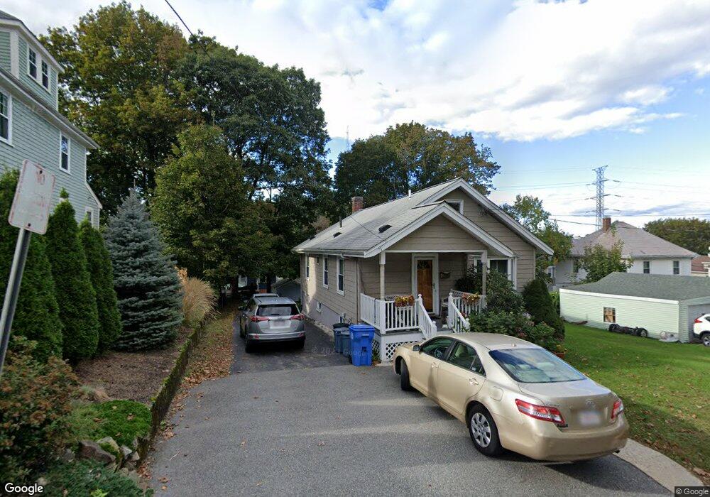
11 Colburn St Waltham, MA 02453
Estimated Value: $701,000 - $841,000
2
Beds
1
Bath
1,206
Sq Ft
$624/Sq Ft
Est. Value
About This Home
This home is located at 11 Colburn St, Waltham, MA 02453 and is currently estimated at $752,592, approximately $624 per square foot. 11 Colburn St is a home located in Middlesex County with nearby schools including Thomas R Plympton Elementary School, John F Kennedy Middle School, and Waltham Sr High School.
Ownership History
Date
Name
Owned For
Owner Type
Purchase Details
Closed on
May 31, 2006
Sold by
Orta Jorge E
Bought by
Greenglass Hugh
Current Estimated Value
Home Financials for this Owner
Home Financials are based on the most recent Mortgage that was taken out on this home.
Original Mortgage
$315,920
Outstanding Balance
$185,527
Interest Rate
6.55%
Mortgage Type
Purchase Money Mortgage
Estimated Equity
$567,065
Purchase Details
Closed on
Apr 22, 1999
Sold by
Chaisson Karen M and Mara Janet
Bought by
Orta Jorge E
Home Financials for this Owner
Home Financials are based on the most recent Mortgage that was taken out on this home.
Original Mortgage
$168,625
Interest Rate
7.02%
Mortgage Type
Purchase Money Mortgage
Create a Home Valuation Report for This Property
The Home Valuation Report is an in-depth analysis detailing your home's value as well as a comparison with similar homes in the area
Home Values in the Area
Average Home Value in this Area
Purchase History
| Date | Buyer | Sale Price | Title Company |
|---|---|---|---|
| Greenglass Hugh | $394,900 | -- | |
| Orta Jorge E | $177,500 | -- |
Source: Public Records
Mortgage History
| Date | Status | Borrower | Loan Amount |
|---|---|---|---|
| Open | Greenglass Hugh | $315,920 | |
| Previous Owner | Orta Jorge E | $50,000 | |
| Previous Owner | Orta Jorge E | $168,625 | |
| Previous Owner | Orta Jorge E | $50,000 |
Source: Public Records
Tax History Compared to Growth
Tax History
| Year | Tax Paid | Tax Assessment Tax Assessment Total Assessment is a certain percentage of the fair market value that is determined by local assessors to be the total taxable value of land and additions on the property. | Land | Improvement |
|---|---|---|---|---|
| 2025 | $5,939 | $604,800 | $378,000 | $226,800 |
| 2024 | $5,736 | $595,000 | $371,000 | $224,000 |
| 2023 | $5,679 | $550,300 | $336,000 | $214,300 |
| 2022 | $5,719 | $513,400 | $308,000 | $205,400 |
| 2021 | $5,695 | $503,100 | $308,000 | $195,100 |
| 2020 | $5,565 | $465,700 | $287,000 | $178,700 |
| 2019 | $5,368 | $424,000 | $270,600 | $153,400 |
| 2018 | $4,777 | $378,800 | $250,600 | $128,200 |
| 2017 | $4,476 | $356,400 | $228,200 | $128,200 |
| 2016 | $4,311 | $352,200 | $224,000 | $128,200 |
| 2015 | $4,194 | $319,400 | $196,000 | $123,400 |
Source: Public Records
Map
Nearby Homes
- 15 Dorchester St
- 145 Virginia Rd
- 202 Bear Hill Rd
- 5 Cunningham Cir
- 45 Forest Ridge Rd
- 31 Weston St Unit 2
- 17 Lexington St
- 79-81 Vernon St
- 12-14 Elson Rd
- 948 Main St Unit 209
- 948 Main St Unit 105
- 15 Banks St Unit 4
- 15 Hobbs Brook Rd
- 43-45 Welligton Unit 3
- 91 Prentice St
- 30 Page Rd
- 215 Boston Post Rd
- 39 Floyd St Unit 2
- 37 Summit St
- 15 Howard St