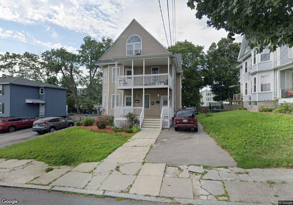
11 Custer St Lawrence, MA 01841
Prospect Hill-Back Bay NeighborhoodEstimated Value: $888,000 - $921,000
5
Beds
3
Baths
3,762
Sq Ft
$242/Sq Ft
Est. Value
About This Home
This home is located at 11 Custer St, Lawrence, MA 01841 and is currently estimated at $908,667, approximately $241 per square foot. 11 Custer St is a home located in Essex County with nearby schools including School For Exceptional Studies, Community Day Charter Public School - Gateway, and Esperanza Academy School of Hope.
Ownership History
Date
Name
Owned For
Owner Type
Purchase Details
Closed on
Oct 12, 1995
Sold by
Vallario Andrew R
Bought by
Rosario Clemencia
Current Estimated Value
Home Financials for this Owner
Home Financials are based on the most recent Mortgage that was taken out on this home.
Original Mortgage
$79,950
Interest Rate
7.71%
Mortgage Type
Purchase Money Mortgage
Create a Home Valuation Report for This Property
The Home Valuation Report is an in-depth analysis detailing your home's value as well as a comparison with similar homes in the area
Home Values in the Area
Average Home Value in this Area
Purchase History
| Date | Buyer | Sale Price | Title Company |
|---|---|---|---|
| Rosario Clemencia | $80,000 | -- |
Source: Public Records
Mortgage History
| Date | Status | Borrower | Loan Amount |
|---|---|---|---|
| Open | Rosario Clemencia | $115,150 | |
| Closed | Rosario Clemencia | $79,950 | |
| Previous Owner | Rosario Clemencia | $20,000 | |
| Previous Owner | Rosario Clemencia | $33,000 |
Source: Public Records
Tax History
| Year | Tax Paid | Tax Assessment Tax Assessment Total Assessment is a certain percentage of the fair market value that is determined by local assessors to be the total taxable value of land and additions on the property. | Land | Improvement |
|---|---|---|---|---|
| 2025 | $7,488 | $850,900 | $156,800 | $694,100 |
| 2024 | $7,709 | $833,400 | $116,000 | $717,400 |
| 2023 | $7,912 | $778,700 | $113,100 | $665,600 |
| 2022 | $7,660 | $669,600 | $113,100 | $556,500 |
| 2021 | $7,229 | $589,200 | $113,100 | $476,100 |
| 2020 | $7,146 | $574,900 | $101,800 | $473,100 |
| 2019 | $6,882 | $503,100 | $91,400 | $411,700 |
| 2018 | $6,503 | $454,100 | $78,600 | $375,500 |
| 2017 | $6,138 | $400,100 | $77,800 | $322,300 |
| 2016 | $5,720 | $368,800 | $56,700 | $312,100 |
| 2015 | $5,283 | $349,400 | $56,700 | $292,700 |
Source: Public Records
Map
Nearby Homes
- 25-27 Bicknell Ave
- 14 Court St
- 5 Kendrick St
- 39 Swan Ave
- 129-131 Lexington St
- 12 Annette St
- 192 Union St
- 106 Leroy Ave
- 18 Erhardt Terrace
- 173 Jackson St
- 7 Erhardt Terrace
- 109 Ferry St
- 65 Arthur St
- 131A Lawrence St Unit 40
- 2 Leslie St
- 264 E Haverhill St Unit 2
- 7-9 Bennington St
- 37 Albion St
- 32 Josephine Ave
- 89 Newbury St Unit 89B
- 9 Custer St
- 15 Custer St Unit 2
- 15 Custer St
- 14 Custer St
- 20 Knox St Unit 44
- 20 Knox St Unit 42
- 20 Knox St Unit 41
- 20 Knox St Unit 40
- 20 Knox St Unit 39
- 20 Knox St Unit 38
- 20 Knox St Unit 37
- 20 Knox St Unit 36
- 20 Knox St Unit 35
- 20 Knox St Unit 34
- 20 Knox St Unit 33
- 20 Knox St Unit 32
- 20 Knox St Unit 31
- 20 Knox St Unit 30
- 20 Knox St Unit 29
- 20 Knox St Unit 28
Your Personal Tour Guide
Ask me questions while you tour the home.