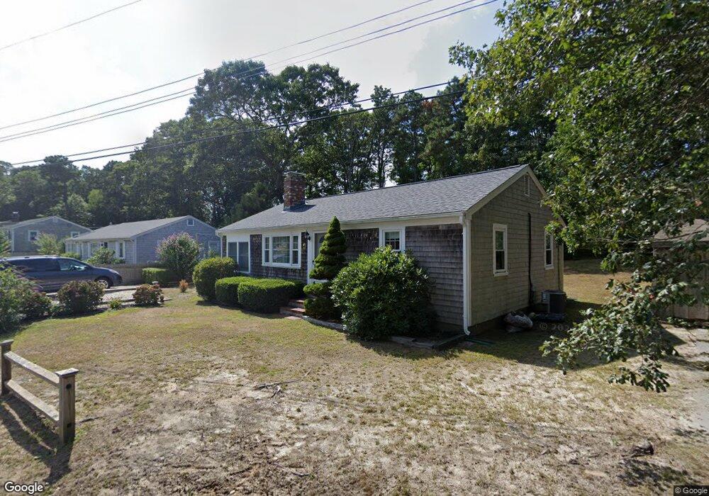
11 Cynthia Ln Dennis Port, MA 02639
Dennis Port NeighborhoodEstimated Value: $500,000 - $582,115
3
Beds
1
Bath
1,001
Sq Ft
$548/Sq Ft
Est. Value
About This Home
This home is located at 11 Cynthia Ln, Dennis Port, MA 02639 and is currently estimated at $548,779, approximately $548 per square foot. 11 Cynthia Ln is a home located in Barnstable County with nearby schools including Dennis-Yarmouth Regional High School and St. Pius X. School.
Ownership History
Date
Name
Owned For
Owner Type
Purchase Details
Closed on
Apr 28, 2003
Sold by
Hudson Michael R and Hudson Carmel A
Bought by
Ameli Ali R and Kyser Lori R
Current Estimated Value
Home Financials for this Owner
Home Financials are based on the most recent Mortgage that was taken out on this home.
Original Mortgage
$188,000
Outstanding Balance
$80,815
Interest Rate
5.64%
Mortgage Type
Purchase Money Mortgage
Estimated Equity
$467,964
Purchase Details
Closed on
Dec 3, 1999
Sold by
Oconnor William F and Oconnor Claire T
Bought by
Hudson Michael R and Hudson Carmel A
Home Financials for this Owner
Home Financials are based on the most recent Mortgage that was taken out on this home.
Original Mortgage
$101,200
Interest Rate
7.86%
Mortgage Type
Purchase Money Mortgage
Create a Home Valuation Report for This Property
The Home Valuation Report is an in-depth analysis detailing your home's value as well as a comparison with similar homes in the area
Home Values in the Area
Average Home Value in this Area
Purchase History
| Date | Buyer | Sale Price | Title Company |
|---|---|---|---|
| Ameli Ali R | $235,000 | -- | |
| Hudson Michael R | $126,500 | -- |
Source: Public Records
Mortgage History
| Date | Status | Borrower | Loan Amount |
|---|---|---|---|
| Open | Hudson Michael R | $188,000 | |
| Closed | Hudson Michael R | $23,130 | |
| Previous Owner | Hudson Michael R | $101,200 | |
| Previous Owner | Hudson Michael R | $80,000 |
Source: Public Records
Tax History Compared to Growth
Tax History
| Year | Tax Paid | Tax Assessment Tax Assessment Total Assessment is a certain percentage of the fair market value that is determined by local assessors to be the total taxable value of land and additions on the property. | Land | Improvement |
|---|---|---|---|---|
| 2025 | $2,195 | $506,900 | $198,700 | $308,200 |
| 2024 | $2,049 | $466,700 | $191,100 | $275,600 |
| 2023 | $1,982 | $424,400 | $173,700 | $250,700 |
| 2022 | $1,908 | $340,800 | $156,500 | $184,300 |
| 2021 | $1,972 | $327,000 | $175,400 | $151,600 |
| 2020 | $1,776 | $291,100 | $153,400 | $137,700 |
| 2019 | $1,684 | $273,000 | $150,400 | $122,600 |
| 2018 | $1,624 | $256,100 | $143,200 | $112,900 |
| 2017 | $1,491 | $242,400 | $133,000 | $109,400 |
| 2016 | $1,545 | $236,600 | $143,200 | $93,400 |
| 2015 | $1,514 | $236,600 | $143,200 | $93,400 |
| 2014 | $1,373 | $216,200 | $122,800 | $93,400 |
Source: Public Records
Map
Nearby Homes
- 19 Standish Way
- 4 Coffey Ln
- 125 Main St Unit 3
- 22 Wixon Rd
- 71 Main St
- 72 Bassett Ln
- 268 Main St
- 31 Easy St
- 80 Michaels Ave
- 12 Spoonbill Rd
- 95 Center St
- 15 Woodside Park Rd
- 78 Upper County Rd Unit A&B
- 78 Upper County Rd
- 12 Candlewood Ln Unit 2-9
- 26 Center St
- 22 Ferncliff Rd
- 24 Indian Trail
- 20 Aunt Debbys Rd
- 37 Ocean Dr Unit 2
- 17 Cynthia Ln
- 82 Lower County Rd Unit 5
- 82 Lower County Rd Unit 23
- 82 Lower County Rd Unit 2
- 10 Cynthia Ln
- 73 Shad Hole Rd Unit 1
- 73U Shad Hole Rd Unit 2
- 73 Shad Hole Rd Unit 4
- 73 Shad Hole Rd
- 73 Shad Hole Rd Unit 2
- 73 Shad Hole Rd Unit 5
- 73 Shad Hole Rd Unit 3
- 71 Shad Hole Rd Unit 5
- 71 Shad Hole Rd Unit 4
- 71 Shad Hole Rd Unit 3
- 71 Shad Hole Rd Unit 2
- 71 Shad Hole Rd Unit 1
- 71 Shad Hole Rd
- 134 Kibby Ln
- 128 Kibby Ln