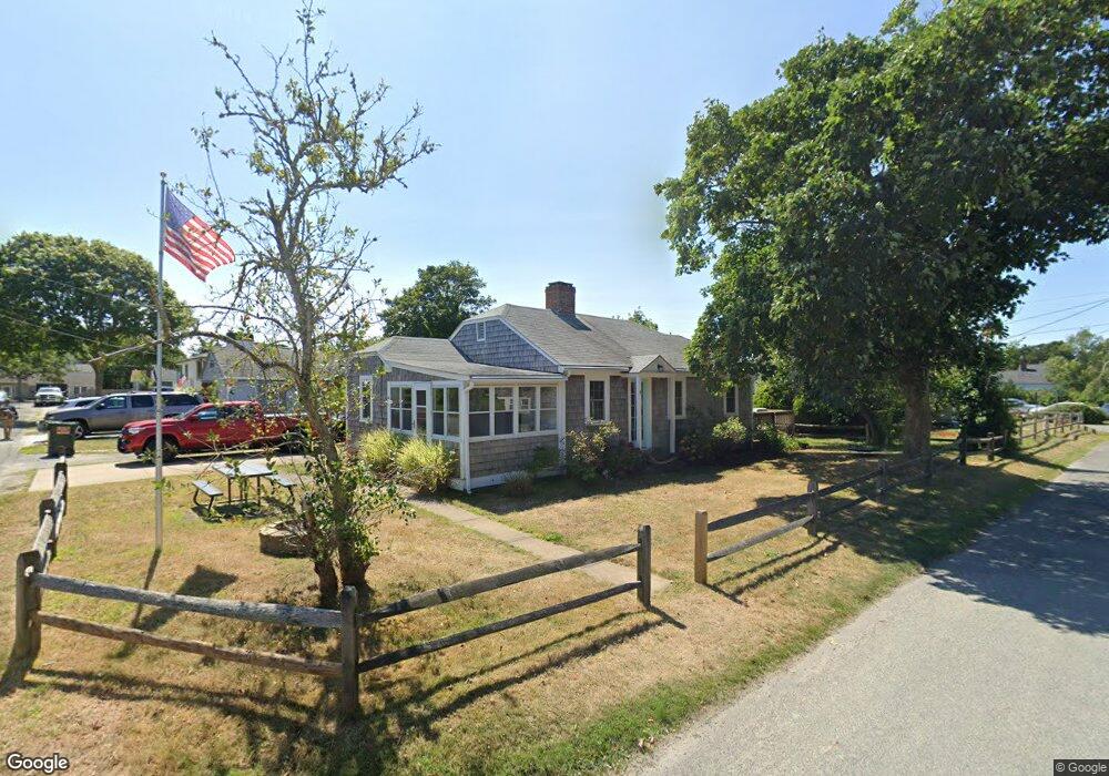
11 Dean Rd Dennis Port, MA 02639
Dennis Port NeighborhoodEstimated Value: $391,000 - $539,000
2
Beds
1
Bath
535
Sq Ft
$881/Sq Ft
Est. Value
About This Home
This home is located at 11 Dean Rd, Dennis Port, MA 02639 and is currently estimated at $471,481, approximately $881 per square foot. 11 Dean Rd is a home located in Barnstable County with nearby schools including Dennis-Yarmouth Regional High School and St. Pius X. School.
Ownership History
Date
Name
Owned For
Owner Type
Purchase Details
Closed on
May 23, 2017
Sold by
Lucey Janet M and Oneil Daniel
Bought by
Oneil Peter J and Oneil Paul G
Current Estimated Value
Purchase Details
Closed on
Mar 24, 2017
Sold by
Dean West Ret
Bought by
Lucey Janet M and Oneil Daniel
Purchase Details
Closed on
Dec 19, 2006
Sold by
Oneil Christopher J and Oneil Daniel R
Bought by
Dean West Re T
Create a Home Valuation Report for This Property
The Home Valuation Report is an in-depth analysis detailing your home's value as well as a comparison with similar homes in the area
Home Values in the Area
Average Home Value in this Area
Purchase History
| Date | Buyer | Sale Price | Title Company |
|---|---|---|---|
| Oneil Peter J | $134,856 | -- | |
| Lucey Janet M | -- | -- | |
| Dean West Re T | -- | -- |
Source: Public Records
Tax History Compared to Growth
Tax History
| Year | Tax Paid | Tax Assessment Tax Assessment Total Assessment is a certain percentage of the fair market value that is determined by local assessors to be the total taxable value of land and additions on the property. | Land | Improvement |
|---|---|---|---|---|
| 2025 | $1,741 | $402,100 | $258,400 | $143,700 |
| 2024 | $1,623 | $369,700 | $248,500 | $121,200 |
| 2023 | $1,570 | $336,100 | $225,900 | $110,200 |
| 2022 | $1,478 | $263,900 | $178,100 | $85,800 |
| 2021 | $5,578 | $243,100 | $174,600 | $68,500 |
| 2020 | $4,509 | $236,700 | $174,600 | $62,100 |
| 2019 | $4,643 | $240,800 | $185,800 | $55,000 |
| 2018 | $1,438 | $226,800 | $176,900 | $49,900 |
| 2017 | $4,047 | $211,200 | $162,900 | $48,300 |
| 2016 | $1,266 | $193,900 | $153,600 | $40,300 |
| 2015 | $1,241 | $193,900 | $153,600 | $40,300 |
| 2014 | $1,172 | $184,600 | $144,300 | $40,300 |
Source: Public Records
Map
Nearby Homes
- 402 Old Wharf Rd
- 402 Old Wharf Rd
- 11 Ocean Park W
- 405 Old Wharf Rd Unit B204
- 405 Old Wharf Rd Unit B204
- 102 Sea St
- 9 Chase Ave Unit 6
- 26 Manning Rd
- 22 Ferncliff Rd
- 12 Cross St
- 159 Center St Unit 22
- 1 E Belmont Unit 630
- 37-A Beach Hills Rd
- 1 Belmont Rd Unit 630
- 1 Belmont Rd Unit 513
- 37 Beach Hills Rd
- 262 Old Wharf Rd Unit 67
- 262 Old Wharf Rd Unit 5
- 262 Old Wharf Rd Unit 5
- 262 Old Wharf Rd Unit 20