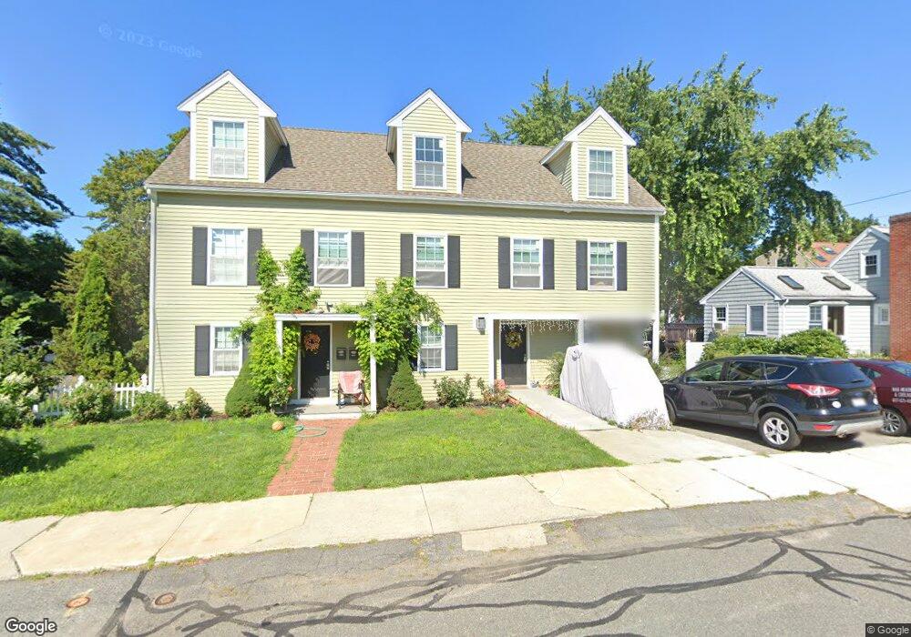
11 Dean St Stoneham, MA 02180
Nobility Hill NeighborhoodEstimated Value: $778,000 - $1,265,233
3
Beds
1
Bath
1,577
Sq Ft
$687/Sq Ft
Est. Value
About This Home
This home is located at 11 Dean St, Stoneham, MA 02180 and is currently estimated at $1,083,058, approximately $686 per square foot. 11 Dean St is a home located in Middlesex County with nearby schools including Stoneham High School, St. Patrick Elementary School, and Greater Boston Academy.
Ownership History
Date
Name
Owned For
Owner Type
Purchase Details
Closed on
May 30, 2008
Sold by
Nadolny Edward
Bought by
Omalley Theresa
Current Estimated Value
Home Financials for this Owner
Home Financials are based on the most recent Mortgage that was taken out on this home.
Original Mortgage
$243,000
Outstanding Balance
$154,812
Interest Rate
5.91%
Mortgage Type
Purchase Money Mortgage
Estimated Equity
$928,246
Purchase Details
Closed on
Feb 29, 2008
Sold by
Wells Fargo Bk
Bought by
Nadolny Edward
Home Financials for this Owner
Home Financials are based on the most recent Mortgage that was taken out on this home.
Original Mortgage
$259,740
Interest Rate
5.8%
Mortgage Type
Purchase Money Mortgage
Purchase Details
Closed on
Feb 26, 2008
Sold by
Tine Michael
Bought by
Wells Fargo Bk
Home Financials for this Owner
Home Financials are based on the most recent Mortgage that was taken out on this home.
Original Mortgage
$259,740
Interest Rate
5.8%
Mortgage Type
Purchase Money Mortgage
Purchase Details
Closed on
Nov 7, 2005
Sold by
Mannke Joshua P and Dimare Toni A
Bought by
Tine Michael and Tine Tammy
Home Financials for this Owner
Home Financials are based on the most recent Mortgage that was taken out on this home.
Original Mortgage
$320,000
Interest Rate
5.85%
Mortgage Type
Purchase Money Mortgage
Purchase Details
Closed on
Aug 16, 2002
Sold by
Conway Leslie A
Bought by
Dimare Toni A and Mannke Joshua P
Home Financials for this Owner
Home Financials are based on the most recent Mortgage that was taken out on this home.
Original Mortgage
$284,050
Interest Rate
6.61%
Mortgage Type
Purchase Money Mortgage
Purchase Details
Closed on
Oct 3, 2000
Sold by
Daniels Robert J and Daniels Kathleen R
Bought by
Conway Richard H and Conway Leslie A
Home Financials for this Owner
Home Financials are based on the most recent Mortgage that was taken out on this home.
Original Mortgage
$130,000
Interest Rate
7.94%
Mortgage Type
Purchase Money Mortgage
Create a Home Valuation Report for This Property
The Home Valuation Report is an in-depth analysis detailing your home's value as well as a comparison with similar homes in the area
Home Values in the Area
Average Home Value in this Area
Purchase History
| Date | Buyer | Sale Price | Title Company |
|---|---|---|---|
| Omalley Theresa | $347,500 | -- | |
| Nadolny Edward | $288,600 | -- | |
| Wells Fargo Bk | $389,184 | -- | |
| Tine Michael | $400,000 | -- | |
| Dimare Toni A | $299,000 | -- | |
| Conway Richard H | $250,000 | -- |
Source: Public Records
Mortgage History
| Date | Status | Borrower | Loan Amount |
|---|---|---|---|
| Open | Omalley Theresa | $243,000 | |
| Previous Owner | Nadolny Edward | $259,740 | |
| Previous Owner | Tine Michael | $320,000 | |
| Previous Owner | Dimare Toni A | $284,050 | |
| Previous Owner | Conway Richard H | $130,000 | |
| Previous Owner | Conway Richard H | $15,000 |
Source: Public Records
Tax History Compared to Growth
Tax History
| Year | Tax Paid | Tax Assessment Tax Assessment Total Assessment is a certain percentage of the fair market value that is determined by local assessors to be the total taxable value of land and additions on the property. | Land | Improvement |
|---|---|---|---|---|
| 2025 | $10,765 | $1,052,300 | $345,200 | $707,100 |
| 2024 | $10,516 | $993,000 | $318,000 | $675,000 |
| 2023 | $10,255 | $923,900 | $290,700 | $633,200 |
| 2022 | $8,961 | $860,800 | $263,400 | $597,400 |
| 2021 | $9,028 | $834,400 | $245,300 | $589,100 |
| 2020 | $8,782 | $813,900 | $234,000 | $579,900 |
| 2019 | $8,503 | $757,800 | $220,000 | $537,800 |
| 2018 | $8,213 | $701,400 | $198,000 | $503,400 |
| 2017 | $8,564 | $691,200 | $185,500 | $505,700 |
| 2016 | $8,400 | $661,400 | $185,500 | $475,900 |
| 2015 | $8,131 | $627,400 | $167,900 | $459,500 |
| 2014 | $3,772 | $279,600 | $141,400 | $138,200 |
Source: Public Records
Map
Nearby Homes
- 146 Marble St Unit 408
- 7 Carol St
- 20 Pond St
- 5 Rockville Park
- 5-9 Rockville Park
- 12 Cottage St
- 200 Ledgewood Dr Unit 505
- 100 Ledgewood Dr Unit 117
- 588 Main St Unit 3C
- 6 Stratton Dr Unit 307
- 6 Stratton Dr Unit 208
- 6 Stratton Dr Unit 303
- 2 Mason Way Unit 6524
- 6 Mason Way Unit 6324
- 19 Mason Way Unit 75
- 17 Mason Way Unit 74
- 49 Butler Ave
- 35 Grape St
- 137 Franklin St Unit 102
- 13 Fremont St Unit 13