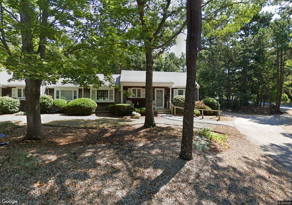
11 Debs Way Unit B Yarmouth Port, MA 02675
Yarmouth Port NeighborhoodEstimated Value: $454,806 - $522,000
2
Beds
2
Baths
1,180
Sq Ft
$412/Sq Ft
Est. Value
About This Home
This home is located at 11 Debs Way Unit B, Yarmouth Port, MA 02675 and is currently estimated at $485,702, approximately $411 per square foot. 11 Debs Way Unit B is a home located in Barnstable County with nearby schools including Dennis-Yarmouth Regional High School and St. Pius X. School.
Ownership History
Date
Name
Owned For
Owner Type
Purchase Details
Closed on
Mar 21, 2023
Sold by
Clarke April L Est
Bought by
Fluffs T
Current Estimated Value
Purchase Details
Closed on
Apr 26, 2011
Sold by
Imondi Teresa R
Bought by
Clarke April L
Home Financials for this Owner
Home Financials are based on the most recent Mortgage that was taken out on this home.
Original Mortgage
$237,650
Interest Rate
4.9%
Mortgage Type
Purchase Money Mortgage
Purchase Details
Closed on
Sep 21, 2006
Sold by
Cancellaro Jennifer
Bought by
Imondi Teresa R
Home Financials for this Owner
Home Financials are based on the most recent Mortgage that was taken out on this home.
Original Mortgage
$225,000
Interest Rate
6.59%
Mortgage Type
Purchase Money Mortgage
Purchase Details
Closed on
Oct 29, 1997
Sold by
Warren Lorraine M and Miller Durward J
Bought by
Cancellaro Rocco J and Cancellaro Jennifer
Create a Home Valuation Report for This Property
The Home Valuation Report is an in-depth analysis detailing your home's value as well as a comparison with similar homes in the area
Home Values in the Area
Average Home Value in this Area
Purchase History
| Date | Buyer | Sale Price | Title Company |
|---|---|---|---|
| Fluffs T | -- | None Available | |
| Clarke April L | $245,000 | -- | |
| Imondi Teresa R | $299,000 | -- | |
| Cancellaro Rocco J | $122,500 | -- |
Source: Public Records
Mortgage History
| Date | Status | Borrower | Loan Amount |
|---|---|---|---|
| Previous Owner | Clarke April L | $237,650 | |
| Previous Owner | Imondi Teresa R | $225,000 |
Source: Public Records
Tax History Compared to Growth
Tax History
| Year | Tax Paid | Tax Assessment Tax Assessment Total Assessment is a certain percentage of the fair market value that is determined by local assessors to be the total taxable value of land and additions on the property. | Land | Improvement |
|---|---|---|---|---|
| 2025 | $2,871 | $405,500 | $0 | $405,500 |
| 2024 | $3,143 | $425,900 | $0 | $425,900 |
| 2023 | $3,013 | $371,500 | $0 | $371,500 |
| 2022 | $2,449 | $266,800 | $0 | $266,800 |
| 2021 | $2,614 | $273,400 | $0 | $273,400 |
| 2020 | $2,637 | $263,700 | $0 | $263,700 |
| 2019 | $2,347 | $232,400 | $0 | $232,400 |
| 2018 | $2,311 | $224,600 | $0 | $224,600 |
| 2017 | $2,250 | $224,600 | $0 | $224,600 |
| 2016 | $2,008 | $201,200 | $0 | $201,200 |
| 2015 | $2,117 | $210,900 | $0 | $210,900 |
Source: Public Records
Map
Nearby Homes
- 11 Debs Way
- 9 Debs Way
- 84 Deb's Hill Unit 48A
- 34 Deb's Hill Unit 4B
- 34 Deb's Hill Unit 3496
- 233 W Great Western Rd
- 231 W Great Western Rd
- 231 W Great Western Rd Unit A
- 233 W Great Western Rd Unit B
- 12 Deb's Unit 44A
- 20 Deb's Hill Unit B
- 46 Debs Hill Rd
- 48 Debs Hill Rd
- 46 Debs Hill Rd Unit 2B
- 48 Debs Hill Rd Unit 2A
- 51 Debs Hill Rd
- 10 Debs Way
- 12 Debs Way
- 10 Debs Way Unit 10
- 10 Debs Way Unit 44B