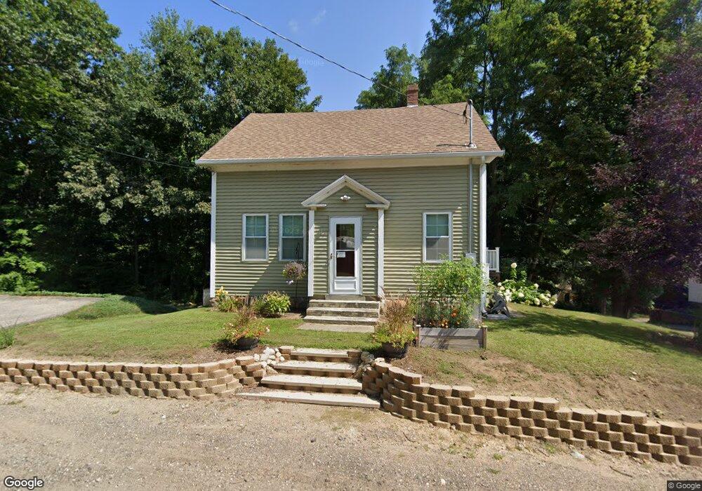
11 Dell Ave Laconia, NH 03246
Estimated Value: $359,000 - $392,000
About This Home
This home is located at 11 Dell Ave, Laconia, NH 03246 and is currently estimated at $376,964, approximately $289 per square foot. 11 Dell Ave is a home located in Belknap County with nearby schools including Laconia Middle School, Laconia High School, and Holy Trinity Catholic School.
Ownership History
We collect this data history from publicly available records. To have your information removed, we recommend requesting removal directly through your county’s website.
Purchase Details
Home Financials for this Owner
Home Financials are based on the most recent Mortgage that was taken out on this home.Home Values in the Area
Average Home Value in this Area
Purchase History
We collect this data history from publicly available records. To have your information removed, we recommend requesting removal directly through your county’s website.
| Date | Buyer | Sale Price | Title Company |
|---|---|---|---|
| $120,000 | -- |
Mortgage History
We collect this data history from publicly available records. To have your information removed, we recommend requesting removal directly through your county’s website.
| Date | Status | Borrower | Loan Amount |
|---|---|---|---|
| Open | $90,000 |
Tax History
We collect this data history from publicly available records. To have your information removed, we recommend requesting removal directly through your county’s website.
| Year | Tax Paid | Tax Assessment Tax Assessment Total Assessment is a certain percentage of the fair market value that is determined by local assessors to be the total taxable value of land and additions on the property. | Land | Improvement |
|---|---|---|---|---|
| 2025 | $4,274 | $329,300 | $172,200 | $157,100 |
| 2024 | $4,224 | $309,900 | $159,400 | $150,500 |
| 2023 | $4,048 | $291,000 | $146,000 | $145,000 |
| 2022 | $3,546 | $238,800 | $114,000 | $124,800 |
| 2021 | $3,429 | $181,800 | $75,100 | $106,700 |
| 2020 | $3,366 | $170,700 | $64,000 | $106,700 |
| 2019 | $3,399 | $165,100 | $58,400 | $106,700 |
| 2018 | $3,367 | $161,500 | $56,800 | $104,700 |
| 2017 | $2,961 | $140,800 | $55,600 | $85,200 |
| 2016 | $2,955 | $133,100 | $55,600 | $77,500 |
| 2015 | $3,019 | $136,000 | $58,500 | $77,500 |
| 2014 | $3,002 | $134,000 | $58,300 | $75,700 |
| 2013 | $2,890 | $130,900 | $55,200 | $75,700 |
Map
- 00 North St Unit 43.1
- 127 Belvidere St
- 178 School St
- 21 Arlington St
- 388 Elm St
- 436 Elm St
- 23 Starboard Way
- 49 Brian Ln
- 43 Clark Ave
- 29 Port Way
- 61 Chapin Terrace
- 51 Elm St Unit 206
- 51 Elm St Unit 308
- 51 Elm St Unit 304
- 51 Elm St Unit 309
- 51 Elm St Unit 204
- 51 Elm St Unit 205
- 51 Elm St Unit 305
- 51 Elm St Unit 302
- 51 Elm St Unit 310
Ask me questions while you tour the home.