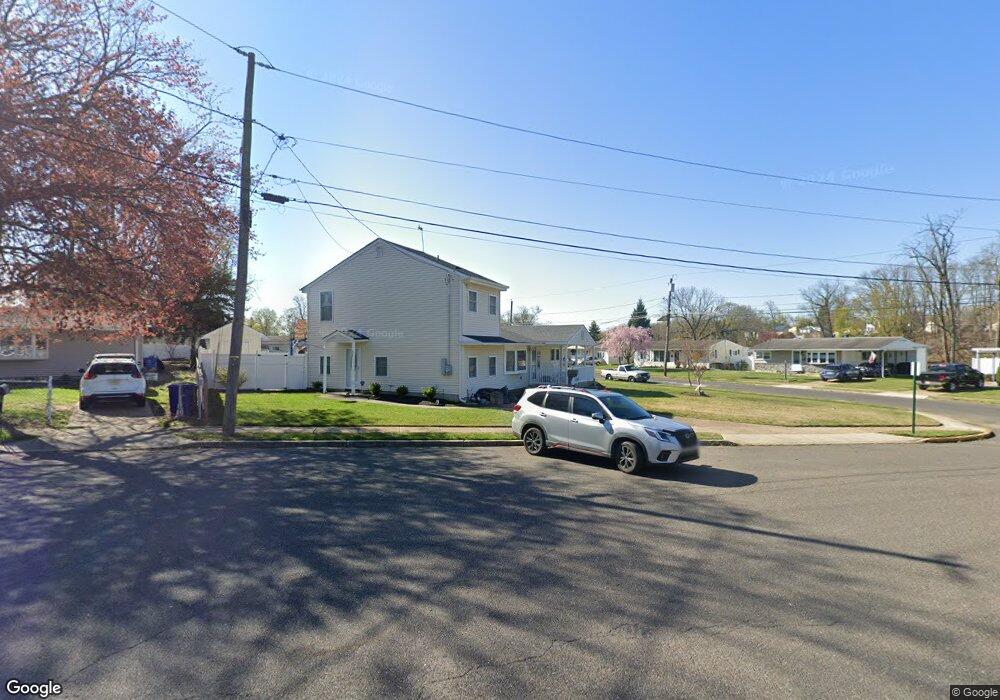
11 Devon Ct Maple Shade, NJ 08052
Estimated Value: $299,475 - $406,000
Studio
--
Bath
1,524
Sq Ft
$232/Sq Ft
Est. Value
About This Home
This home is located at 11 Devon Ct, Maple Shade, NJ 08052 and is currently estimated at $352,869, approximately $231 per square foot. 11 Devon Ct is a home located in Burlington County with nearby schools including Ralph J Steinhauer Elementary School, Maude M. Wilkins Elementary School, and Howard R Yocum School.
Ownership History
Date
Name
Owned For
Owner Type
Purchase Details
Closed on
Feb 11, 2009
Sold by
Cobb Jason A and Cobb Kelly A
Bought by
Cobb Jason A and Cobb Kelly A
Current Estimated Value
Home Financials for this Owner
Home Financials are based on the most recent Mortgage that was taken out on this home.
Original Mortgage
$192,307
Outstanding Balance
$121,301
Interest Rate
5.06%
Mortgage Type
FHA
Estimated Equity
$231,568
Purchase Details
Closed on
Apr 27, 2007
Sold by
Cresong Patricia M
Bought by
Cobb Jason A and Cresong Kelly A
Home Financials for this Owner
Home Financials are based on the most recent Mortgage that was taken out on this home.
Original Mortgage
$152,250
Interest Rate
6.23%
Mortgage Type
FHA
Purchase Details
Closed on
Mar 28, 2006
Sold by
Zobel Frances R
Bought by
Cresong Patricia M
Create a Home Valuation Report for This Property
The Home Valuation Report is an in-depth analysis detailing your home's value as well as a comparison with similar homes in the area
Home Values in the Area
Average Home Value in this Area
Purchase History
| Date | Buyer | Sale Price | Title Company |
|---|---|---|---|
| Cobb Jason A | -- | None Available | |
| Cobb Jason A | $195,000 | None Available | |
| Cresong Patricia M | -- | None Available |
Source: Public Records
Mortgage History
| Date | Status | Borrower | Loan Amount |
|---|---|---|---|
| Open | Cobb Jason A | $192,307 | |
| Closed | Cobb Jason A | $152,250 |
Source: Public Records
Tax History
| Year | Tax Paid | Tax Assessment Tax Assessment Total Assessment is a certain percentage of the fair market value that is determined by local assessors to be the total taxable value of land and additions on the property. | Land | Improvement |
|---|---|---|---|---|
| 2025 | $6,647 | $175,100 | $48,900 | $126,200 |
| 2024 | $6,454 | $175,100 | $48,900 | $126,200 |
| 2023 | $6,454 | $175,100 | $48,900 | $126,200 |
| 2022 | $6,354 | $175,100 | $48,900 | $126,200 |
| 2021 | $6,293 | $175,100 | $48,900 | $126,200 |
| 2020 | $6,311 | $175,100 | $48,900 | $126,200 |
| 2019 | $6,079 | $175,100 | $48,900 | $126,200 |
| 2018 | $5,974 | $175,100 | $48,900 | $126,200 |
| 2017 | $5,904 | $175,100 | $48,900 | $126,200 |
| 2016 | $5,817 | $175,100 | $48,900 | $126,200 |
| 2015 | $5,691 | $175,100 | $48,900 | $126,200 |
| 2014 | $5,517 | $175,100 | $48,900 | $126,200 |
Source: Public Records
Map
Nearby Homes
- 27 Indian Queen Ln
- 331 Collins Ln
- 3444 New Jersey Ave
- 2819 Haddonfield Rd
- 2905 Powell Ave
- 400 N Forklanding Rd
- 8539 Bryn Mawr Ave
- 8661 Wyndam Rd
- 2569 Hadley Dr
- 8323 Maple Ave
- 3220 Gladwyn Ave
- 106 Avignon Way
- 3002 Gladwyn Ave
- 7775 Marion Ave
- 2 Wyndale Ave
- 12 Overbrook Ave
- 2561 Burning Tree Rd
- 7487 Githens Ave
- 7665 Rudderow Ave
- 9 Woodbine Ave
- 621 Windsor Ave
- 15 Devon Ct
- 617 Windsor Ave
- 636 Windsor Ave
- 640 Windsor Ave
- 19 Devon Ct
- 31 Devon Ct
- 632 Windsor Ave
- 644 Windsor Ave
- 613 Windsor Ave
- 10 Cambridge Cir
- 23 Devon Ct
- 628 Windsor Ave
- 648 Windsor Ave
- 27 Devon Ct
- 14 Cambridge Cir
- 625 Windsor Ave
- 652 Windsor Ave
- 18 Cambridge Cir
- 624 Windsor Ave
Your Personal Tour Guide
Ask me questions while you tour the home.