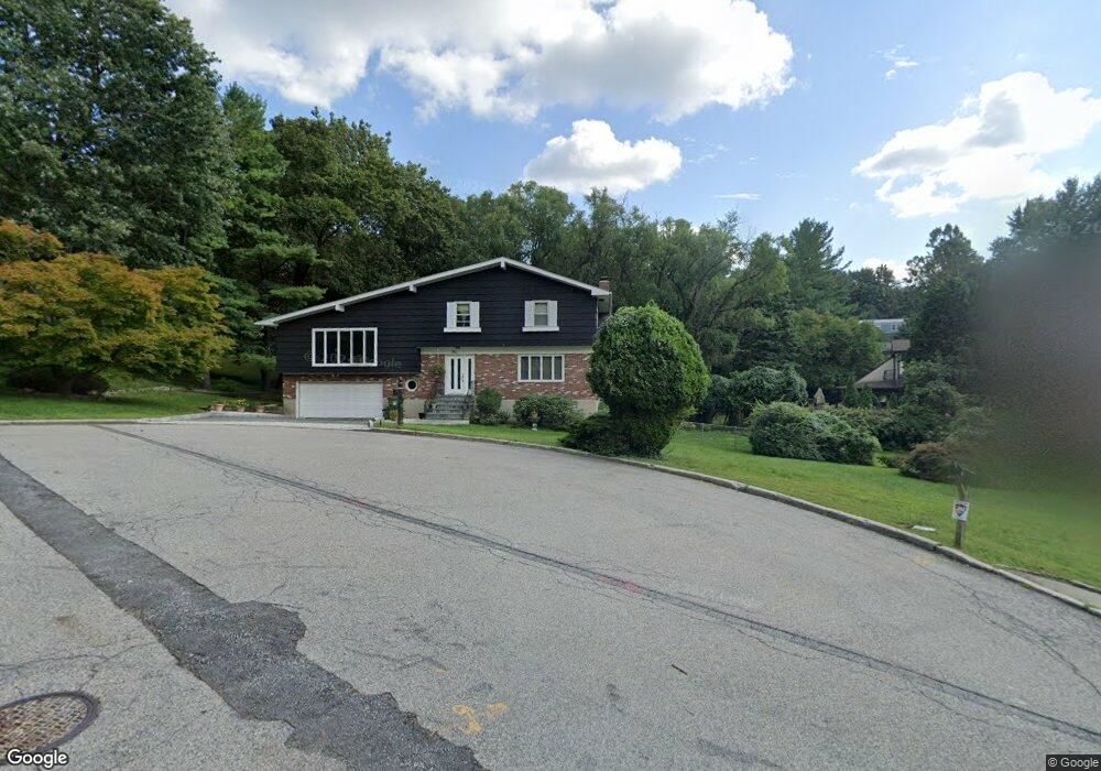
11 Doris Ln Tarrytown, NY 10591
Estimated Value: $1,055,000 - $1,327,062
--
Bed
--
Bath
--
Sq Ft
0.35
Acres
About This Home
This home is located at 11 Doris Ln, Tarrytown, NY 10591 and is currently estimated at $1,176,766. 11 Doris Ln is a home located in Westchester County with nearby schools including Washington Irving Interm School, John Paulding School, and W L Morse School.
Ownership History
Date
Name
Owned For
Owner Type
Purchase Details
Closed on
Dec 9, 1998
Sold by
Bank United
Bought by
Garro John and Garro Elizabeth
Current Estimated Value
Home Financials for this Owner
Home Financials are based on the most recent Mortgage that was taken out on this home.
Original Mortgage
$225,000
Outstanding Balance
$51,373
Interest Rate
6.84%
Estimated Equity
$1,125,393
Purchase Details
Closed on
Feb 4, 1998
Sold by
Killoran Joan T and Killoran Ruth C
Bought by
Bank United Of Texas Fsb
Purchase Details
Closed on
May 16, 1994
Sold by
Killoran John T
Bought by
Killoran John T and Killoran Ruth C
Create a Home Valuation Report for This Property
The Home Valuation Report is an in-depth analysis detailing your home's value as well as a comparison with similar homes in the area
Home Values in the Area
Average Home Value in this Area
Purchase History
| Date | Buyer | Sale Price | Title Company |
|---|---|---|---|
| Garro John | $305,000 | First American Title Ins Co | |
| Bank United Of Texas Fsb | $243,218 | -- | |
| Killoran John T | -- | Chicago Title Insurance Co |
Source: Public Records
Mortgage History
| Date | Status | Borrower | Loan Amount |
|---|---|---|---|
| Open | Garro John | $225,000 |
Source: Public Records
Tax History Compared to Growth
Tax History
| Year | Tax Paid | Tax Assessment Tax Assessment Total Assessment is a certain percentage of the fair market value that is determined by local assessors to be the total taxable value of land and additions on the property. | Land | Improvement |
|---|---|---|---|---|
| 2024 | $26,736 | $1,055,300 | $334,400 | $720,900 |
| 2023 | $24,668 | $899,500 | $295,900 | $603,600 |
| 2022 | $23,687 | $830,900 | $295,900 | $535,000 |
| 2021 | $23,606 | $754,700 | $295,900 | $458,800 |
| 2020 | $23,438 | $731,000 | $295,900 | $435,100 |
| 2019 | $24,379 | $731,000 | $295,900 | $435,100 |
| 2018 | $26,881 | $717,900 | $295,900 | $422,000 |
| 2017 | $12,335 | $684,900 | $295,900 | $389,000 |
| 2016 | $486,219 | $658,600 | $295,900 | $362,700 |
| 2015 | -- | $21,850 | $2,900 | $18,950 |
| 2014 | -- | $21,850 | $2,900 | $18,950 |
| 2013 | $14,775 | $21,850 | $2,900 | $18,950 |
Source: Public Records
Map
Nearby Homes
- 20 Benedict Ave
- 497 Martling Ave
- 154 Martling Ave Unit 5-J6
- 19 S Broadway Unit 4A
- 300 S Broadway Unit 1C
- 12 Hendrick Ln Unit 43E
- 94 Barnes Rd
- 14 Croton Ave
- 320 S Broadway Unit N9
- 320 S Broadway Unit T2
- 320 S Broadway Unit P8
- 320 S Broadway Unit R12
- 18 N Broadway Unit 411
- 330 S Broadway Unit H4
- 26 Bridge St
- 43 Putnam Ave
- 102 Legend Dr Unit 101
- 93 Carrollwood Dr Unit 93
- 29 Dixon St
- 29 Woodland Ave