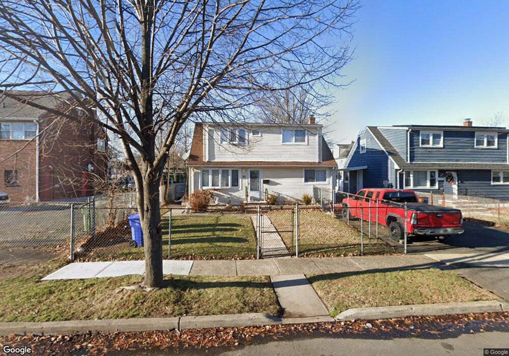
11 E 20th St Linden, NJ 07036
Estimated Value: $465,229 - $491,000
4
Beds
1
Bath
1,152
Sq Ft
$413/Sq Ft
Est. Value
About This Home
This home is located at 11 E 20th St, Linden, NJ 07036 and is currently estimated at $475,807, approximately $413 per square foot. 11 E 20th St is a home located in Union County with nearby schools including School No. 2, Myles J. McManus Middle School, and Linden High School.
Ownership History
Date
Name
Owned For
Owner Type
Purchase Details
Closed on
May 8, 2018
Sold by
Pcnny Mac Loan Service Llc
Bought by
Naj 24 Llc
Current Estimated Value
Purchase Details
Closed on
Mar 22, 2018
Sold by
Pennymac Holdings Llc
Bought by
Pmc Reo Trust 2015 1
Purchase Details
Closed on
Jun 8, 2016
Sold by
Union County Sheriff
Bought by
Pennymac Holdings Llc
Purchase Details
Closed on
Sep 29, 2000
Sold by
Johnson Bessie E
Bought by
Johnson Bessie E and Johnson Betsy
Create a Home Valuation Report for This Property
The Home Valuation Report is an in-depth analysis detailing your home's value as well as a comparison with similar homes in the area
Home Values in the Area
Average Home Value in this Area
Purchase History
| Date | Buyer | Sale Price | Title Company |
|---|---|---|---|
| Naj 24 Llc | $127,000 | None Available | |
| Pmc Reo Trust 2015 1 | -- | None Available | |
| Pennymac Holdings Llc | $1,000 | -- | |
| Johnson Bessie E | -- | -- |
Source: Public Records
Tax History
| Year | Tax Paid | Tax Assessment Tax Assessment Total Assessment is a certain percentage of the fair market value that is determined by local assessors to be the total taxable value of land and additions on the property. | Land | Improvement |
|---|---|---|---|---|
| 2025 | $7,243 | $103,000 | $43,600 | $59,400 |
| 2024 | $7,084 | $103,000 | $43,600 | $59,400 |
| 2023 | $7,084 | $103,000 | $43,600 | $59,400 |
| 2022 | $7,121 | $103,000 | $43,600 | $59,400 |
| 2021 | $6,463 | $93,000 | $43,600 | $49,400 |
| 2020 | $6,428 | $93,000 | $43,600 | $49,400 |
| 2019 | $7,096 | $103,000 | $43,600 | $59,400 |
| 2018 | $7,094 | $103,000 | $43,600 | $59,400 |
| 2017 | $6,940 | $103,000 | $43,600 | $59,400 |
| 2016 | $6,722 | $103,000 | $43,600 | $59,400 |
| 2015 | $6,465 | $103,000 | $43,600 | $59,400 |
| 2014 | $6,340 | $103,000 | $43,600 | $59,400 |
Source: Public Records
Map
Nearby Homes
- 1930 S Wood Ave
- 1713 S Wood Ave Unit 2
- 108 W 18th St
- 116 W 17th St Unit 2
- 1519 Winans Ave
- 111 E 13th St
- 119 E 13th St
- 11 W 12th St
- 112 E 12th St
- 111 E 10th St
- 210 Buchanan St
- 21 Main St
- 3202 Tremley Point Rd
- 214 Irene St
- 317 Mitchell Ave
- 12 Belmont Place
- 14 Arlington Place
- 221 Jefferson Ave
- 212 W Morris Ave
- 120 S Stiles St