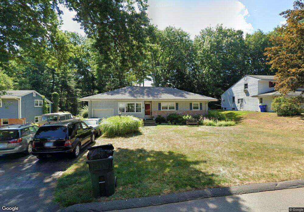
11 E Maxwell Dr West Hartford, CT 06107
Estimated Value: $422,000 - $480,000
3
Beds
2
Baths
1,517
Sq Ft
$293/Sq Ft
Est. Value
About This Home
This home is located at 11 E Maxwell Dr, West Hartford, CT 06107 and is currently estimated at $444,988, approximately $293 per square foot. 11 E Maxwell Dr is a home located in Hartford County with nearby schools including Braeburn School, Sedgwick Middle School, and Conard High School.
Ownership History
Date
Name
Owned For
Owner Type
Purchase Details
Closed on
Jul 25, 1990
Sold by
Thomas Elizabeth
Bought by
Thomas Dana
Current Estimated Value
Home Financials for this Owner
Home Financials are based on the most recent Mortgage that was taken out on this home.
Original Mortgage
$79,000
Interest Rate
10.01%
Create a Home Valuation Report for This Property
The Home Valuation Report is an in-depth analysis detailing your home's value as well as a comparison with similar homes in the area
Home Values in the Area
Average Home Value in this Area
Purchase History
| Date | Buyer | Sale Price | Title Company |
|---|---|---|---|
| Thomas Dana | $103,500 | -- |
Source: Public Records
Mortgage History
| Date | Status | Borrower | Loan Amount |
|---|---|---|---|
| Closed | Thomas Dana | $92,000 | |
| Closed | Thomas Dana | $10,000 | |
| Closed | Thomas Dana | $79,000 |
Source: Public Records
Tax History Compared to Growth
Tax History
| Year | Tax Paid | Tax Assessment Tax Assessment Total Assessment is a certain percentage of the fair market value that is determined by local assessors to be the total taxable value of land and additions on the property. | Land | Improvement |
|---|---|---|---|---|
| 2025 | $8,526 | $190,400 | $80,150 | $110,250 |
| 2024 | $8,063 | $190,400 | $80,150 | $110,250 |
| 2023 | $7,791 | $190,400 | $80,150 | $110,250 |
| 2022 | $7,745 | $190,400 | $80,150 | $110,250 |
| 2021 | $7,480 | $176,330 | $80,150 | $96,180 |
| 2020 | $7,011 | $167,720 | $74,900 | $92,820 |
| 2019 | $7,011 | $167,720 | $74,900 | $92,820 |
| 2018 | $6,877 | $167,720 | $74,900 | $92,820 |
| 2017 | $6,883 | $167,720 | $74,900 | $92,820 |
| 2016 | $6,931 | $175,420 | $75,600 | $99,820 |
| 2015 | $6,720 | $175,420 | $75,600 | $99,820 |
| 2014 | $6,555 | $175,420 | $75,600 | $99,820 |
Source: Public Records
Map
Nearby Homes
- 37 W Normandy Dr
- 26 Berwyn Rd
- 47 Hillsboro Dr
- 56 Fox Chase Ln
- 269 Mountain Rd
- 41 Soby Dr
- 132 N Main St
- 170 Hunter Dr
- 183 Loomis Dr Unit 109
- 186 Hunter Dr
- 2 Arapahoe Rd Unit 313
- 2 Arapahoe Rd Unit 308
- 2 Arapahoe Rd Unit 611
- 2 Arapahoe Rd Unit 601
- 2 Arapahoe Rd Unit 510
- 2 Arapahoe Rd Unit 505
- 2 Arapahoe Rd Unit 604
- 2 Arapahoe Rd Unit 609
- 2 Arapahoe Rd Unit 607
- 2 Arapahoe Rd Unit 312
- 17 E Maxwell Dr
- 9 E Maxwell Dr
- Lot 9 (7 E Maxwell Dr
- 20 Country Ln
- 21 E Maxwell Dr
- 5 E Maxwell Dr
- 23 Country Ln
- 8 E Maxwell Dr
- 12 E Maxwell Dr
- 16 Country Ln
- 16 E Maxwell Dr
- LOT #3 E Maxwell Dr
- 25 E Maxwell Dr
- 20 E Maxwell Dr
- 19 Country Ln
- 40 Gallaudet Dr
- 1 E Maxwell Dr
- 17 Fernbel Ln
- 46 Gallaudet Dr
- 32 Gallaudet Dr