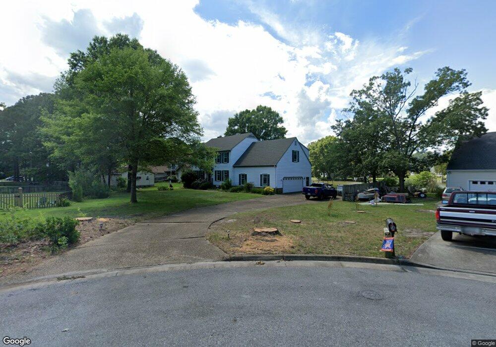
11 Ebb Tide Landing Poquoson, VA 23662
Poquoson Shores NeighborhoodEstimated Value: $649,871 - $754,000
4
Beds
3
Baths
2,967
Sq Ft
$237/Sq Ft
Est. Value
About This Home
This home is located at 11 Ebb Tide Landing, Poquoson, VA 23662 and is currently estimated at $703,968, approximately $237 per square foot. 11 Ebb Tide Landing is a home located in Poquoson City with nearby schools including Emmanuel Lutheran School and Summit Christian Academy - Upper School.
Ownership History
Date
Name
Owned For
Owner Type
Purchase Details
Closed on
Jun 17, 2019
Sold by
Kniskern Wayne R and Kniskern Diane E
Bought by
Kniskern Wayne R and Kniskern Diane E
Current Estimated Value
Purchase Details
Closed on
Jan 31, 2002
Sold by
Beckman Frank J
Bought by
Kniskern Wayne R
Home Financials for this Owner
Home Financials are based on the most recent Mortgage that was taken out on this home.
Original Mortgage
$256,000
Outstanding Balance
$106,377
Interest Rate
7.13%
Mortgage Type
New Conventional
Estimated Equity
$597,591
Create a Home Valuation Report for This Property
The Home Valuation Report is an in-depth analysis detailing your home's value as well as a comparison with similar homes in the area
Home Values in the Area
Average Home Value in this Area
Purchase History
| Date | Buyer | Sale Price | Title Company |
|---|---|---|---|
| Kniskern Wayne R | -- | None Available | |
| Kniskern Wayne R | $320,000 | -- |
Source: Public Records
Mortgage History
| Date | Status | Borrower | Loan Amount |
|---|---|---|---|
| Open | Kniskern Wayne R | $256,000 |
Source: Public Records
Tax History Compared to Growth
Tax History
| Year | Tax Paid | Tax Assessment Tax Assessment Total Assessment is a certain percentage of the fair market value that is determined by local assessors to be the total taxable value of land and additions on the property. | Land | Improvement |
|---|---|---|---|---|
| 2024 | $6,238 | $547,200 | $203,200 | $344,000 |
| 2023 | $6,074 | $547,200 | $203,200 | $344,000 |
| 2022 | $5,638 | $498,900 | $203,200 | $295,700 |
| 2021 | $5,638 | $498,900 | $203,200 | $295,700 |
| 2020 | $0 | $475,100 | $203,200 | $271,900 |
| 2019 | -- | $475,100 | $203,200 | $271,900 |
| 2018 | -- | $459,800 | $203,200 | $256,600 |
| 2017 | -- | $444,600 | $203,200 | $241,400 |
| 2016 | -- | $444,600 | $203,200 | $241,400 |
| 2015 | -- | $444,600 | $203,200 | $241,400 |
| 2013 | -- | $444,600 | $203,200 | $241,400 |
Source: Public Records
Map
Nearby Homes
- 41 W Sandy Point Rd
- 28 Pasture Rd
- 15+AC Browns Neck Rd
- 8 Wornom Farm Rd
- 1 Phillips Rd
- 29 River Rd
- 35 River Rd
- 102 Blue Crab Dr
- 11 Dorothy Dr
- 105 Rens Rd Unit 30
- 105 Rens Rd Unit 2
- 105 Rens Rd Unit 74
- 105 Rens Rd Unit Lot 48
- 108 Rens Rd
- 40 Valmoore Dr
- 6 Lessies Dr
- 11 Bull Run
- 240 Hunts Neck Rd
- 21 Rens Rd
- 62 Rens Rd
- 14 Ebb Tide Landing
- 12 Bennett Farm Rd
- 9 Ebb Tide Landing
- 10 Bennett Farm Rd
- 12 Ebb Tide Landing
- 14 Bennett Farm Rd
- 10 Ebb Tide Landing
- 7 Ebb Tide Landing
- 8 Bennett Farm Rd
- 8 Ebb Tide Landing
- 9 Bennett Farm Rd
- 42 Pasture Rd
- 42 Pasture Rd
- 42 Pasture Rd Unit C
- 42 Pasture Rd Unit A
- 42 Pasture Rd
- 5 Ebb Tide Landing
- 2 Letts Point Landing
- 6 Bennett Farm Rd
- 6 Ebb Tide Landing