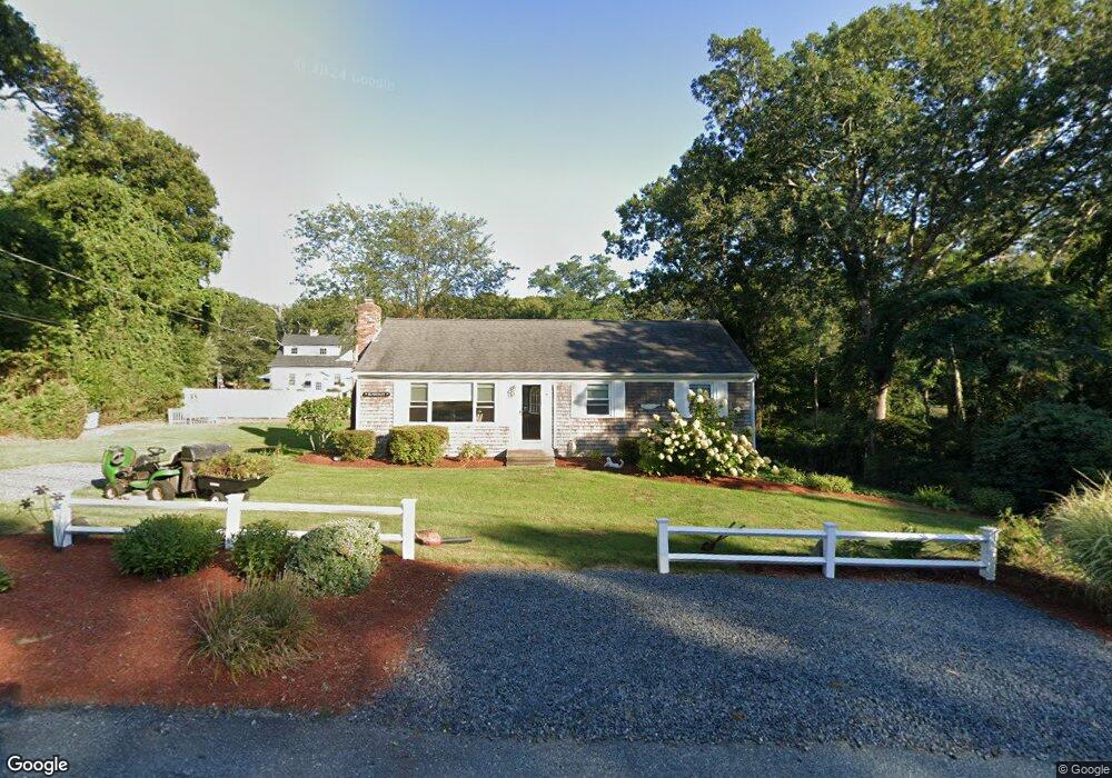
11 Embassy St Yarmouth Port, MA 02675
Yarmouth Port NeighborhoodEstimated Value: $540,000 - $652,000
3
Beds
2
Baths
1,144
Sq Ft
$514/Sq Ft
Est. Value
About This Home
This home is located at 11 Embassy St, Yarmouth Port, MA 02675 and is currently estimated at $588,335, approximately $514 per square foot. 11 Embassy St is a home located in Barnstable County with nearby schools including Dennis-Yarmouth Regional High School.
Ownership History
Date
Name
Owned For
Owner Type
Purchase Details
Closed on
Jan 30, 2024
Sold by
Blakesley Elena L
Bought by
Blakesley Ft and Jasak
Current Estimated Value
Purchase Details
Closed on
Mar 17, 2014
Sold by
Blakesly Thomas M and Blakesley Elena L
Bought by
Blakesly Elena L
Purchase Details
Closed on
Jan 30, 1990
Sold by
Blakesley Donald W
Bought by
Blakesley Thomas M
Home Financials for this Owner
Home Financials are based on the most recent Mortgage that was taken out on this home.
Original Mortgage
$30,000
Interest Rate
9.67%
Mortgage Type
Purchase Money Mortgage
Create a Home Valuation Report for This Property
The Home Valuation Report is an in-depth analysis detailing your home's value as well as a comparison with similar homes in the area
Home Values in the Area
Average Home Value in this Area
Purchase History
| Date | Buyer | Sale Price | Title Company |
|---|---|---|---|
| Blakesley Ft | -- | None Available | |
| Blakesley Ft | -- | None Available | |
| Blakesly Elena L | -- | -- | |
| Blakesley Thomas M | $120,000 | -- | |
| Blakesly Elena L | -- | -- | |
| Blakesley Thomas M | $120,000 | -- |
Source: Public Records
Mortgage History
| Date | Status | Borrower | Loan Amount |
|---|---|---|---|
| Previous Owner | Blakesley Thomas M | $30,000 |
Source: Public Records
Tax History Compared to Growth
Tax History
| Year | Tax Paid | Tax Assessment Tax Assessment Total Assessment is a certain percentage of the fair market value that is determined by local assessors to be the total taxable value of land and additions on the property. | Land | Improvement |
|---|---|---|---|---|
| 2025 | $3,527 | $498,100 | $169,700 | $328,400 |
| 2024 | $3,314 | $449,000 | $147,600 | $301,400 |
| 2023 | $3,259 | $401,900 | $134,100 | $267,800 |
| 2022 | $3,126 | $340,500 | $128,000 | $212,500 |
| 2021 | $2,940 | $307,500 | $128,000 | $179,500 |
| 2020 | $2,952 | $295,200 | $135,400 | $159,800 |
| 2019 | $2,742 | $271,500 | $135,400 | $136,100 |
| 2018 | $2,561 | $248,900 | $112,800 | $136,100 |
| 2017 | $2,441 | $243,600 | $112,800 | $130,800 |
| 2016 | $2,341 | $234,600 | $103,800 | $130,800 |
| 2015 | $2,180 | $217,100 | $99,300 | $117,800 |
Source: Public Records
Map
Nearby Homes
- 59 Main St Unit 19-2
- 59 Route 6a Unit 29-4
- 51 Bray Farm Rd N
- 268 Main St
- 6 Nimble Hill Dr
- 42 John Hall Cartway Unit 42
- 64 Kates Path
- 50 John Hall Cartway
- 50 John Hall Cartway Unit 50
- 44 Stratford Ln
- 34 Kates Path
- 34 Kates Path Unit 34
- 228 Kates Path
- 17 Kates Path Unit A
- 13 Covey Dr
- 43 Canterbury Rd
- 6 Thomas Ct
- 15 Signal Hill Dr
- 7 Forest Gate Unit 7
- 30 W Woods
- 1014 Route 6a
- 9 Embassy Ln
- 9 Embassy St
- 19 Embassy Ln
- 19 Embassy St
- 10 Embassy Ln
- 10 Embassy St
- 1 Bray Farm Rd N
- 2 Longfellow Dr
- 1020 Route 6a
- 20 Longfellow Dr
- 59 Cranberry Knoll Condo St Unit U1-2
- 59 Cranberry Knoll Condo St Unit U41-2
- 11 Longfellow Dr
- 1 Longfellow Dr
- 25 Embassy St
- 568 Route 6a
- 25 Embassy Ln
- 120 Route 6a
- 1616 Main St