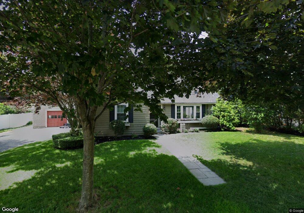
11 Fiske St Natick, MA 01760
Estimated Value: $1,013,508 - $1,172,000
5
Beds
3
Baths
2,576
Sq Ft
$416/Sq Ft
Est. Value
About This Home
This home is located at 11 Fiske St, Natick, MA 01760 and is currently estimated at $1,070,377, approximately $415 per square foot. 11 Fiske St is a home located in Middlesex County with nearby schools including Natick High School, Johnson Elementary School, and J F Kennedy Middle School.
Ownership History
Date
Name
Owned For
Owner Type
Purchase Details
Closed on
Oct 1, 2003
Sold by
Brogan Daniel R and Brogan Sherrie R
Bought by
Landry Sean and Landry Kathleen
Current Estimated Value
Purchase Details
Closed on
Jun 28, 1996
Sold by
Chervincky Michael A
Bought by
Brogan Daniel R and Brogan Sherrie R
Create a Home Valuation Report for This Property
The Home Valuation Report is an in-depth analysis detailing your home's value as well as a comparison with similar homes in the area
Home Values in the Area
Average Home Value in this Area
Purchase History
| Date | Buyer | Sale Price | Title Company |
|---|---|---|---|
| Landry Sean | $389,000 | -- | |
| Brogan Daniel R | $172,500 | -- |
Source: Public Records
Mortgage History
| Date | Status | Borrower | Loan Amount |
|---|---|---|---|
| Open | Brogan Daniel R | $353,000 | |
| Closed | Brogan Daniel R | $356,000 | |
| Closed | Brogan Daniel R | $300,000 |
Source: Public Records
Tax History Compared to Growth
Tax History
| Year | Tax Paid | Tax Assessment Tax Assessment Total Assessment is a certain percentage of the fair market value that is determined by local assessors to be the total taxable value of land and additions on the property. | Land | Improvement |
|---|---|---|---|---|
| 2025 | $9,373 | $783,700 | $428,500 | $355,200 |
| 2024 | $9,010 | $734,900 | $403,300 | $331,600 |
| 2023 | $8,825 | $698,200 | $387,900 | $310,300 |
| 2022 | $8,312 | $623,100 | $352,300 | $270,800 |
| 2021 | $4,972 | $586,900 | $332,200 | $254,700 |
| 2020 | $4,819 | $571,800 | $317,100 | $254,700 |
| 2019 | $25,953 | $571,800 | $317,100 | $254,700 |
| 2018 | $7,247 | $555,300 | $302,000 | $253,300 |
| 2017 | $6,829 | $506,200 | $257,500 | $248,700 |
| 2016 | $6,554 | $483,000 | $236,500 | $246,500 |
| 2015 | $6,392 | $462,500 | $236,500 | $226,000 |
Source: Public Records
Map
Nearby Homes
- 91 Speen St
- 1 Fern St
- 4 Sylvia Ave
- 40 Silver Hill Ln Unit 4
- 2 Lodge Rd
- 46 Silver Hill Ln Unit 1
- 9 Silver Hill Ln Unit 19
- 32 Silver Hill Ln Unit 1
- 16 West St
- 26 Walden Dr Unit 4
- 12 Walden Dr Unit 19
- 10 Kelsey Rd
- 25 Forest Ave
- 38 Ranger Rd
- 47 High St
- 57 Village Brook Ln Unit 5
- 50 Village Brook Ln Unit 4
- 216-218 S Main St
- 58 W Central St
- 8 Pitts St