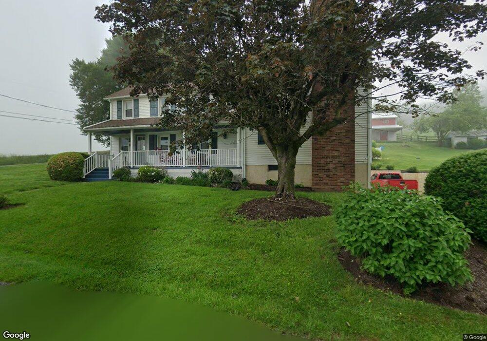
11 Ford Rd Nottingham, PA 19362
Little Britain NeighborhoodEstimated Value: $561,000 - $897,000
4
Beds
3
Baths
2,860
Sq Ft
$244/Sq Ft
Est. Value
About This Home
This home is located at 11 Ford Rd, Nottingham, PA 19362 and is currently estimated at $696,562, approximately $243 per square foot. 11 Ford Rd is a home located in Lancaster County with nearby schools including Smith Middle School and Solanco High School.
Ownership History
Date
Name
Owned For
Owner Type
Purchase Details
Closed on
Jul 21, 2008
Sold by
Kozakowski John J and Kozakowski Patricia J
Bought by
Quear Michael D and Hancsak George A
Current Estimated Value
Home Financials for this Owner
Home Financials are based on the most recent Mortgage that was taken out on this home.
Original Mortgage
$398,400
Outstanding Balance
$262,436
Interest Rate
6.49%
Mortgage Type
Purchase Money Mortgage
Estimated Equity
$434,126
Create a Home Valuation Report for This Property
The Home Valuation Report is an in-depth analysis detailing your home's value as well as a comparison with similar homes in the area
Home Values in the Area
Average Home Value in this Area
Purchase History
| Date | Buyer | Sale Price | Title Company |
|---|---|---|---|
| Quear Michael D | $498,000 | Conestoga Title Insurance Co |
Source: Public Records
Mortgage History
| Date | Status | Borrower | Loan Amount |
|---|---|---|---|
| Open | Quear Michael D | $398,400 |
Source: Public Records
Tax History
| Year | Tax Paid | Tax Assessment Tax Assessment Total Assessment is a certain percentage of the fair market value that is determined by local assessors to be the total taxable value of land and additions on the property. | Land | Improvement |
|---|---|---|---|---|
| 2025 | $4,640 | $299,700 | $129,100 | $170,600 |
| 2024 | $4,640 | $299,700 | $129,100 | $170,600 |
| 2023 | $4,498 | $299,700 | $129,100 | $170,600 |
| 2022 | $4,362 | $299,700 | $129,100 | $170,600 |
| 2021 | $4,207 | $299,700 | $129,100 | $170,600 |
| 2020 | $4,207 | $299,700 | $129,100 | $170,600 |
| 2019 | $4,097 | $299,700 | $129,100 | $170,600 |
| 2018 | $963 | $299,700 | $129,100 | $170,600 |
| 2017 | $3,524 | $212,600 | $61,200 | $151,400 |
| 2016 | $3,524 | $212,600 | $61,200 | $151,400 |
| 2015 | $877 | $212,600 | $61,200 | $151,400 |
| 2014 | $2,437 | $212,600 | $61,200 | $151,400 |
Source: Public Records
Map
Nearby Homes
- 380 Glen Roy Rd
- 194 Long Ln
- 15 Phillip Dr
- 0 Wickmere Street #F - Empire Unit PACT2103136
- 94 Green Ln
- 106 Circle Dr
- 5 Reid Dr
- 10 Circle Dr
- 475 W Christine Rd
- 397 Jackson Rd
- Wickmere Street #B - Cortland
- Wickmere Street #C- Braeburn
- 0 Wickmere Street #F Juniper Unit PACT2063554
- 0 Wickmere Street #A - Hemlock Unit PACT2054880
- 0 Wickmere Street #E Limerick Unit PACT2063574
- Wickmere Street #D- Fletcher
- 310 Wickmere St
- 373 Wickmere Street #B - Cortland
- 370 Wickmere Street #C- Braeburn Lot 43
- 222 Buckingham St
- 15 Ford Rd
- 328 Pine Grove Rd
- 331 Pine Grove Rd
- 332 Pine Grove Rd
- 25 Ford Rd
- 341 Pine Grove Rd
- 342 Pine Grove Rd
- 347 Pine Grove Rd
- 35 Ford Rd
- 350 Pine Grove Rd
- 369 Pine Grove Rd
- 377 Pine Grove Rd
- 382 Pine Grove Rd
- 49 Ford Rd
- 1002 Hart Rd
- 390 Pine Grove Rd
- 398 Pine Grove Rd
- 908 Hart Rd
- 952 Hart Rd
- 414 Pine Grove Rd
Your Personal Tour Guide
Ask me questions while you tour the home.