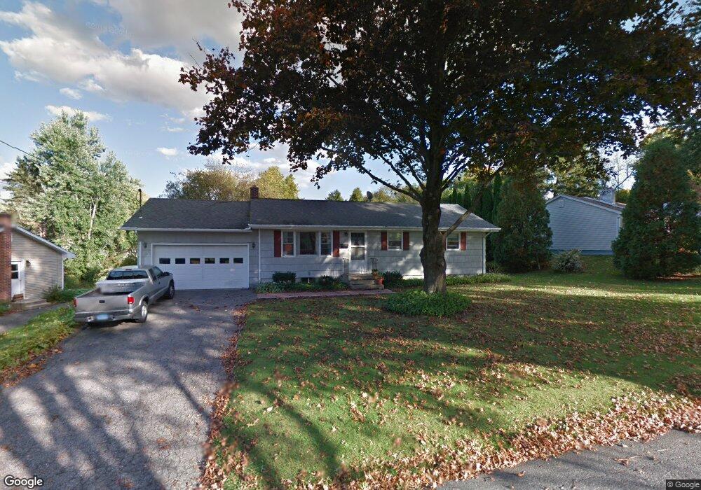
11 Goodhill Rd New Milford, CT 06776
Estimated Value: $375,000 - $469,000
3
Beds
1
Bath
1,008
Sq Ft
$430/Sq Ft
Est. Value
About This Home
This home is located at 11 Goodhill Rd, New Milford, CT 06776 and is currently estimated at $433,045, approximately $429 per square foot. 11 Goodhill Rd is a home located in Litchfield County with nearby schools including Northville Elementary School, Sarah Noble Intermediate School, and Schaghticoke Middle School.
Ownership History
Date
Name
Owned For
Owner Type
Purchase Details
Closed on
Jun 7, 2010
Sold by
Washington Linda J
Bought by
Washington Gary E and Washington Linda J
Current Estimated Value
Purchase Details
Closed on
Jun 1, 1998
Sold by
Terenzio Victor
Bought by
Rapp John and Rapp Linda
Create a Home Valuation Report for This Property
The Home Valuation Report is an in-depth analysis detailing your home's value as well as a comparison with similar homes in the area
Home Values in the Area
Average Home Value in this Area
Purchase History
| Date | Buyer | Sale Price | Title Company |
|---|---|---|---|
| Washington Gary E | -- | -- | |
| Rapp John | $139,500 | -- |
Source: Public Records
Mortgage History
| Date | Status | Borrower | Loan Amount |
|---|---|---|---|
| Previous Owner | Rapp John | $212,000 | |
| Previous Owner | Rapp John | $152,050 | |
| Previous Owner | Rapp John | $149,650 |
Source: Public Records
Tax History Compared to Growth
Tax History
| Year | Tax Paid | Tax Assessment Tax Assessment Total Assessment is a certain percentage of the fair market value that is determined by local assessors to be the total taxable value of land and additions on the property. | Land | Improvement |
|---|---|---|---|---|
| 2025 | $8,828 | $289,450 | $59,220 | $230,230 |
| 2024 | $5,368 | $180,320 | $45,570 | $134,750 |
| 2023 | $5,226 | $180,320 | $45,570 | $134,750 |
| 2022 | $5,112 | $180,320 | $45,570 | $134,750 |
| 2021 | $5,044 | $180,320 | $45,570 | $134,750 |
| 2020 | $4,730 | $164,920 | $48,020 | $116,900 |
| 2019 | $3,889 | $135,520 | $48,020 | $87,500 |
| 2018 | $3,818 | $135,520 | $48,020 | $87,500 |
| 2017 | $3,693 | $135,520 | $48,020 | $87,500 |
| 2016 | $3,628 | $135,520 | $48,020 | $87,500 |
| 2015 | $3,811 | $142,450 | $48,020 | $94,430 |
| 2014 | $3,746 | $142,450 | $48,020 | $94,430 |
Source: Public Records
Map
Nearby Homes
- 59 Carlson Ridge Rd
- 0 Chestnut Land Rd Unit 24024843
- 0 Chestnut Land Rd Unit 24024823
- 74 Park Lane Rd
- 61 Park Lane Rd
- 3 Belair Dr Unit 3
- 2 Chatfield Rd
- 12 Wells Rd
- 18 Bayberry Ln
- 87 Aspetuck Village
- 1 Tall Oaks Dr
- 1 Canterbury Arms
- 11 Tall Oaks Dr Unit 11
- 57 Second Hill Rd
- 14 Heacock Crossbrook Rd
- 5 Delivery Ln
- 71 Upper Reservoir Rd
- 9 Glen Ridge Ct Unit 9
- 80 Glen Ridge Ct
- 5 N Brook Hollow Dr S