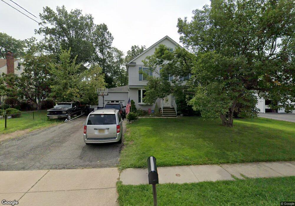
11 Grove Place Whippany, NJ 07981
Estimated Value: $731,908 - $852,000
--
Bed
--
Bath
2,090
Sq Ft
$383/Sq Ft
Est. Value
About This Home
This home is located at 11 Grove Place, Whippany, NJ 07981 and is currently estimated at $799,727, approximately $382 per square foot. 11 Grove Place is a home located in Morris County with nearby schools including Whippany Park High School, Arrow Academy, and The Morristown-Beard School.
Ownership History
Date
Name
Owned For
Owner Type
Purchase Details
Closed on
Jun 30, 1999
Sold by
Henris Lois E
Bought by
Willans Steven D and Willans Joanne J
Current Estimated Value
Home Financials for this Owner
Home Financials are based on the most recent Mortgage that was taken out on this home.
Original Mortgage
$150,000
Interest Rate
7.8%
Purchase Details
Closed on
Aug 21, 1996
Sold by
Henris Charles H and Henris Lois E
Bought by
Henris Charles H and Henris Lois E
Create a Home Valuation Report for This Property
The Home Valuation Report is an in-depth analysis detailing your home's value as well as a comparison with similar homes in the area
Home Values in the Area
Average Home Value in this Area
Purchase History
| Date | Buyer | Sale Price | Title Company |
|---|---|---|---|
| Willans Steven D | $232,000 | -- | |
| Henris Charles H | -- | -- |
Source: Public Records
Mortgage History
| Date | Status | Borrower | Loan Amount |
|---|---|---|---|
| Previous Owner | Willans Steven D | $150,000 |
Source: Public Records
Tax History Compared to Growth
Tax History
| Year | Tax Paid | Tax Assessment Tax Assessment Total Assessment is a certain percentage of the fair market value that is determined by local assessors to be the total taxable value of land and additions on the property. | Land | Improvement |
|---|---|---|---|---|
| 2025 | $8,851 | $419,900 | $204,300 | $215,600 |
| 2024 | $8,814 | $419,900 | $204,300 | $215,600 |
| 2023 | $8,814 | $419,900 | $204,300 | $215,600 |
| 2022 | $8,062 | $419,900 | $204,300 | $215,600 |
| 2021 | $7,945 | $419,900 | $204,300 | $215,600 |
| 2020 | $7,919 | $419,900 | $204,300 | $215,600 |
| 2019 | $7,945 | $419,900 | $204,300 | $215,600 |
| 2018 | $7,806 | $419,900 | $204,300 | $215,600 |
| 2017 | $7,575 | $419,900 | $204,300 | $215,600 |
| 2016 | $7,466 | $419,900 | $204,300 | $215,600 |
| 2015 | $7,168 | $419,900 | $204,300 | $215,600 |
| 2014 | $7,012 | $419,900 | $204,300 | $215,600 |
Source: Public Records
Map
Nearby Homes
- 26 David Dr
- 45 Polhemus Terrace
- 11 Nemic Ln
- 00 Algonquin Pkwy
- 39 Lefke Ln
- 74 Preston Rd
- 96 Parsippany Rd
- 2003 Vermont Terrace Unit 2003
- 26 Gladstone Ct
- 42 Gladstone Ct
- 34 Gladstone Ct
- 14 Gladstone Ct
- Monterey Plan at The Grove - The Monterey Collection
- Pershing Plan at The Grove - The Pershing Collection
- 92 Sunrise Dr
- 72 Schindler Ct
- 89 Schindler Ct
- 53 Westminster Dr
- 709 Brook Hollow Dr Unit 709
- 3306 Appleton Way
- 13 Grove Place
- 9 Grove Place
- 15 Grove Place
- 9 Magnolia Dr
- 17 Grove Place
- 93 Troy Hills Rd
- 7 Magnolia Dr
- 91 Troy Hills Rd
- 95 Troy Hills Rd
- 11 Magnolia Dr
- 10 Grove Place
- 12 Grove Place
- 8 Grove Place
- 19 Grove Place
- 15 Magnolia Dr
- 14 Grove Place
- 99 Troy Hills Rd
- 17 Magnolia Dr
- 18 Grove Place
- 21 Grove Place