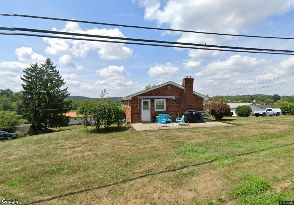
11 Hanover Ln New Cumberland, WV 26047
Estimated Value: $118,938 - $154,000
3
Beds
1
Bath
904
Sq Ft
$156/Sq Ft
Est. Value
About This Home
This home is located at 11 Hanover Ln, New Cumberland, WV 26047 and is currently estimated at $140,985, approximately $155 per square foot. 11 Hanover Ln is a home located in Hancock County.
Ownership History
Date
Name
Owned For
Owner Type
Purchase Details
Closed on
Sep 13, 2019
Sold by
Wilson Patrick R and Wilson Deborah L
Bought by
Bondarenok Dustin S and Bondarenok Lacey
Current Estimated Value
Home Financials for this Owner
Home Financials are based on the most recent Mortgage that was taken out on this home.
Original Mortgage
$99,680
Outstanding Balance
$87,490
Interest Rate
3.7%
Mortgage Type
New Conventional
Estimated Equity
$53,495
Create a Home Valuation Report for This Property
The Home Valuation Report is an in-depth analysis detailing your home's value as well as a comparison with similar homes in the area
Home Values in the Area
Average Home Value in this Area
Purchase History
| Date | Buyer | Sale Price | Title Company |
|---|---|---|---|
| Bondarenok Dustin S | $112,000 | None Available |
Source: Public Records
Mortgage History
| Date | Status | Borrower | Loan Amount |
|---|---|---|---|
| Open | Bondarenok Dustin S | $99,680 |
Source: Public Records
Tax History Compared to Growth
Tax History
| Year | Tax Paid | Tax Assessment Tax Assessment Total Assessment is a certain percentage of the fair market value that is determined by local assessors to be the total taxable value of land and additions on the property. | Land | Improvement |
|---|---|---|---|---|
| 2024 | $578 | $43,870 | $6,430 | $37,440 |
| 2023 | $560 | $43,030 | $5,590 | $37,440 |
| 2022 | $567 | $43,690 | $5,590 | $38,100 |
| 2021 | $556 | $42,670 | $5,590 | $37,080 |
| 2020 | $466 | $35,950 | $5,590 | $30,360 |
| 2019 | $198 | $35,050 | $5,590 | $29,460 |
| 2018 | $195 | $34,750 | $5,590 | $29,160 |
| 2017 | $182 | $33,610 | $5,590 | $28,020 |
| 2016 | $189 | $34,140 | $5,580 | $28,560 |
| 2015 | $109 | $32,820 | $5,580 | $27,240 |
| 2014 | $109 | $30,120 | $3,720 | $26,400 |
Source: Public Records
Map
Nearby Homes
- 134 Hanover Ln
- 1788 Rolling Acres Rd
- 51 Buckeye Dr
- 98 Whispering Pines Ln
- 1711 Hardins Run Rd
- 93 Canfield Dr
- 425 Straight St
- 202 N Chester St
- 302 Filmore St
- 209 S Chester St
- 606 Ridge Ave
- 2463 Frankfort Rd
- 810 2nd Ave
- 76 Edison Ln
- 000 Florence Rd
- 900 Ridge Ave
- 916 S Chestnut St
- 4711 Veterans Blvd
- 94 Kensington Dr
- 298 Chapman Rd
- 2261 Rolling Acres Rd
- 42 Hanover Ln
- 56 Cherry Lake Rd
- 37 Hanover Ln
- 60 Hanover Ln
- 2237 Rolling Acres Rd
- 2361 Rolling Acres Rd
- 2356 Rolling Acres Rd
- 82 Hanover Ln
- 85 Hanover Ln
- 104 Hanover Ln
- 2391 Rolling Acres Rd
- 2223 Rolling Acres Rd
- 2423 Rolling Acres Rd
- 60 Magnolia Dr
- 124 Hanover Ln
- 2388 Rolling Acres Rd
- 10 Magnolia Dr
- 2445 Rolling Acres Rd
- 70 Magnolia Dr