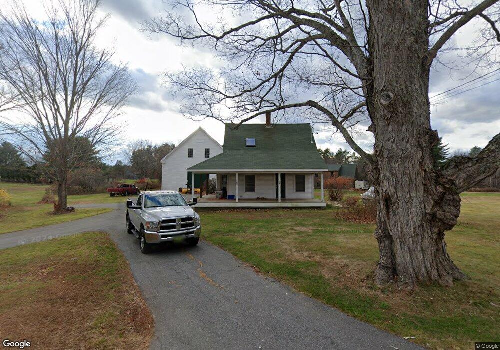
11 Harding Bridge Rd Gorham, ME 04038
Estimated Value: $383,000 - $414,000
4
Beds
3
Baths
1,270
Sq Ft
$312/Sq Ft
Est. Value
About This Home
This home is located at 11 Harding Bridge Rd, Gorham, ME 04038 and is currently estimated at $396,560, approximately $312 per square foot. 11 Harding Bridge Rd is a home located in Cumberland County with nearby schools including Great Falls Elementary School, Gorham Middle School, and Gorham High School.
Ownership History
Date
Name
Owned For
Owner Type
Purchase Details
Closed on
Jun 27, 2008
Sold by
Drown Wayne R and Drown Lucinda L
Bought by
Drwon Kimberly A
Current Estimated Value
Home Financials for this Owner
Home Financials are based on the most recent Mortgage that was taken out on this home.
Original Mortgage
$173,925
Interest Rate
6.06%
Mortgage Type
FHA
Purchase Details
Closed on
Jul 28, 2005
Sold by
Drown Wayne R and Drown Lucinda L
Bought by
Drown Wayne R and Drown Lucinda L
Home Financials for this Owner
Home Financials are based on the most recent Mortgage that was taken out on this home.
Original Mortgage
$176,000
Interest Rate
5.67%
Mortgage Type
Purchase Money Mortgage
Create a Home Valuation Report for This Property
The Home Valuation Report is an in-depth analysis detailing your home's value as well as a comparison with similar homes in the area
Home Values in the Area
Average Home Value in this Area
Purchase History
We collect this data history from publicly available records. To have your information removed, we recommend requesting removal directly through your county’s website.
| Date | Buyer | Sale Price | Title Company |
|---|---|---|---|
| Drwon Kimberly A | -- | -- | |
| Drown Wayne R | -- | -- |
Source: Public Records
Mortgage History
We collect this data history from publicly available records. To have your information removed, we recommend requesting removal directly through your county’s website.
| Date | Status | Borrower | Loan Amount |
|---|---|---|---|
| Closed | Drwon Kimberly A | $173,925 | |
| Previous Owner | Drown Wayne R | $176,000 |
Source: Public Records
Tax History
| Year | Tax Paid | Tax Assessment Tax Assessment Total Assessment is a certain percentage of the fair market value that is determined by local assessors to be the total taxable value of land and additions on the property. | Land | Improvement |
|---|---|---|---|---|
| 2025 | $4,348 | $293,800 | $97,500 | $196,300 |
| 2024 | $4,319 | $293,800 | $97,500 | $196,300 |
| 2023 | $4,040 | $293,800 | $97,500 | $196,300 |
| 2022 | $4,192 | $326,200 | $97,500 | $228,700 |
| 2021 | $3,054 | $157,400 | $77,200 | $80,200 |
| 2020 | $2,991 | $157,400 | $77,200 | $80,200 |
| 2019 | $5,102 | $157,400 | $77,200 | $80,200 |
| 2018 | $2,710 | $148,900 | $77,200 | $71,700 |
| 2017 | $2,546 | $148,900 | $77,200 | $71,700 |
| 2016 | $2,535 | $149,100 | $77,400 | $71,700 |
| 2015 | $2,430 | $149,100 | $77,400 | $71,700 |
| 2014 | $2,462 | $141,500 | $70,800 | $70,700 |
| 2013 | $2,448 | $141,500 | $70,800 | $70,700 |
Source: Public Records
Map
Nearby Homes
- 139 Harding Bridge Rd
- 32 Fairway Commons Dr Unit 11
- 168 Harding Bridge Rd
- 50 Canal St
- 42 Main St
- 0 Libby Ave
- 35 Longmeadow Dr
- 110 Gordon Farms Rd
- 81 Queen St
- 315 River Rd
- 19 Windswept Dr Unit 5
- 18 Dolley Farm Rd Unit 8
- 12 Dolley Farm Rd Unit 6
- 23 Pennywhistle Dr
- 18 Cosmic Way Unit 18
- 33 Meredith Dr
- 32 Pennywhistle Dr
- 193 Falcon Crest Dr Unit 33
- 195 Falcon Crest Dr Unit 34
- 17 Betty Ln
- 116 Huston Rd
- 112 Huston Rd
- 0 Lot 12 Harding Bridge Farm
- 17 Fearon Farm Rd
- 24 Harding Bridge Rd
- 108 Huston Rd
- 130 Huston Rd
- 3 Harding Bridge Rd
- 129 Huston Rd
- 0 Harding Bridge Farms
- 00 Harding Bridge Rd
- 91 Wards Hill Rd
- 14 Dyer Rd
- 32 Harding Bridge Rd
- 11 Sleepy Hollow Dr
- 39 Harding Bridge Rd
- 83 Huston Rd
- 70 Harding Bridge Rd
- 3 Sleepy Hollow Dr
- 23 Sleepy Hollow Dr
Your Personal Tour Guide
Ask me questions while you tour the home.