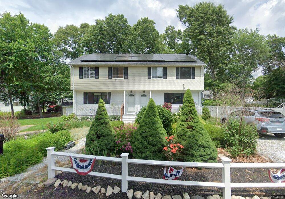
11 Harding Rd Natick, MA 01760
Estimated Value: $735,000 - $912,000
6
Beds
4
Baths
2,200
Sq Ft
$390/Sq Ft
Est. Value
About This Home
This home is located at 11 Harding Rd, Natick, MA 01760 and is currently estimated at $858,868, approximately $390 per square foot. 11 Harding Rd is a home located in Middlesex County with nearby schools including Natick High School, J F Kennedy Middle School, and Brown Elementary School.
Ownership History
Date
Name
Owned For
Owner Type
Purchase Details
Closed on
Apr 29, 2011
Sold by
Alpha-1 Rt
Bought by
Reid Andrew and Swanson Kristina
Current Estimated Value
Home Financials for this Owner
Home Financials are based on the most recent Mortgage that was taken out on this home.
Original Mortgage
$318,400
Outstanding Balance
$220,046
Interest Rate
4.76%
Mortgage Type
Purchase Money Mortgage
Estimated Equity
$638,822
Create a Home Valuation Report for This Property
The Home Valuation Report is an in-depth analysis detailing your home's value as well as a comparison with similar homes in the area
Home Values in the Area
Average Home Value in this Area
Purchase History
| Date | Buyer | Sale Price | Title Company |
|---|---|---|---|
| Reid Andrew | $404,000 | -- |
Source: Public Records
Mortgage History
| Date | Status | Borrower | Loan Amount |
|---|---|---|---|
| Open | Reid Andrew | $318,400 |
Source: Public Records
Tax History
| Year | Tax Paid | Tax Assessment Tax Assessment Total Assessment is a certain percentage of the fair market value that is determined by local assessors to be the total taxable value of land and additions on the property. | Land | Improvement |
|---|---|---|---|---|
| 2025 | $9,257 | $774,000 | $417,700 | $356,300 |
| 2024 | $9,034 | $736,900 | $402,100 | $334,800 |
| 2023 | $8,868 | $701,600 | $379,500 | $322,100 |
| 2022 | $8,676 | $650,400 | $346,900 | $303,500 |
| 2021 | $8,294 | $609,400 | $326,200 | $283,200 |
| 2020 | $7,898 | $580,300 | $310,600 | $269,700 |
| 2019 | $7,376 | $580,300 | $310,600 | $269,700 |
| 2018 | $6,847 | $524,700 | $310,600 | $214,100 |
| 2017 | $6,452 | $478,300 | $268,300 | $210,000 |
| 2016 | $6,180 | $455,400 | $247,300 | $208,100 |
| 2015 | $5,527 | $399,900 | $247,300 | $152,600 |
Source: Public Records
Map
Nearby Homes
- 27 Stillman St
- 29 Village Rock Ln Unit 6
- 23 Village Rock Ln Unit 22
- 52 Village Brook Ln Unit 14
- 150 2nd St Unit 310
- 21 Village Rock Ln Unit 4
- 9 Village Hill Ln Unit 15
- 5 Village Rock Ln Unit 24
- 4 Village Rock Ln Unit 9
- 34 Walden Dr Unit 5
- 8 Walden Dr Unit 13
- 4 Village Brook Ln
- 50 Village Brook Ln Unit 4
- 57 Village Brook Ln Unit 5
- 7 Weld St Unit 50
- 7 Weld St Unit 29
- 126 Beaver St Unit 121
- 126 Beaver St Unit 5
- 11 Weld St Unit 37
- 3 Silver Hill Ln Unit 6
- 11 Harding Rd Unit DUPLEX
- 11 Harding Rd Unit 1
- 11 Harding Rd Unit 11
- 13 Harding Rd Unit 13
- 13 Harding Rd Unit (DUPLEX)
- 19 Stillman Cir
- 17 Stillman Cir
- 10 Harding Rd
- 7 Harding Rd Unit DUPLEX
- 7 Harding Rd
- 9 Harding Rd
- 9 Harding Rd Unit DUPLEX
- 8 Harding Rd
- 8 Harding Rd Unit 8
- 6 Harding Rd Unit 1
- 6 Harding Rd
- 8 Harding Rd Unit 1
- 6 Harding Rd
- 15 Stillman Cir
- 13 Stillman Cir
Your Personal Tour Guide
Ask me questions while you tour the home.