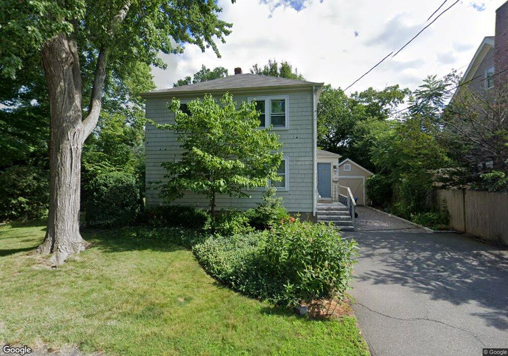
11 Hawthorne St Natick, MA 01760
Estimated Value: $735,744 - $848,000
3
Beds
1
Bath
1,248
Sq Ft
$634/Sq Ft
Est. Value
About This Home
This home is located at 11 Hawthorne St, Natick, MA 01760 and is currently estimated at $790,936, approximately $633 per square foot. 11 Hawthorne St is a home located in Middlesex County with nearby schools including Natick High School, Wilson Middle School, and Bennett-Hemenway (Ben-Hem) Elementary School.
Ownership History
Date
Name
Owned For
Owner Type
Purchase Details
Closed on
Dec 1, 1998
Sold by
Lombardi Michael W and Lombardi Carolyn L
Bought by
Dillon Linda P
Current Estimated Value
Purchase Details
Closed on
Jun 3, 1994
Sold by
Wilson A Timothy and Zimmerman Trudy A
Bought by
Lombardi Michael W and Lombardi Carolyn L
Home Financials for this Owner
Home Financials are based on the most recent Mortgage that was taken out on this home.
Original Mortgage
$125,000
Interest Rate
8.49%
Mortgage Type
Purchase Money Mortgage
Purchase Details
Closed on
Sep 27, 1990
Sold by
Arcaro John D
Bought by
Wilson A Timothy
Home Financials for this Owner
Home Financials are based on the most recent Mortgage that was taken out on this home.
Original Mortgage
$140,000
Interest Rate
9.95%
Mortgage Type
Purchase Money Mortgage
Create a Home Valuation Report for This Property
The Home Valuation Report is an in-depth analysis detailing your home's value as well as a comparison with similar homes in the area
Home Values in the Area
Average Home Value in this Area
Purchase History
| Date | Buyer | Sale Price | Title Company |
|---|---|---|---|
| Dillon Linda P | $227,000 | -- | |
| Lombardi Michael W | $167,400 | -- | |
| Wilson A Timothy | $147,450 | -- |
Source: Public Records
Mortgage History
| Date | Status | Borrower | Loan Amount |
|---|---|---|---|
| Previous Owner | Wilson A Timothy | $125,000 | |
| Previous Owner | Wilson A Timothy | $132,000 | |
| Previous Owner | Wilson A Timothy | $140,000 |
Source: Public Records
Tax History Compared to Growth
Tax History
| Year | Tax Paid | Tax Assessment Tax Assessment Total Assessment is a certain percentage of the fair market value that is determined by local assessors to be the total taxable value of land and additions on the property. | Land | Improvement |
|---|---|---|---|---|
| 2025 | $6,866 | $574,100 | $443,000 | $131,100 |
| 2024 | $6,650 | $542,400 | $418,400 | $124,000 |
| 2023 | $6,685 | $528,900 | $393,700 | $135,200 |
| 2022 | $6,427 | $481,800 | $359,300 | $122,500 |
| 2021 | $6,176 | $453,800 | $339,600 | $114,200 |
| 2020 | $6,157 | $452,400 | $324,800 | $127,600 |
| 2019 | $5,750 | $452,400 | $324,800 | $127,600 |
| 2018 | $5,364 | $411,000 | $295,300 | $115,700 |
| 2017 | $5,169 | $383,200 | $260,900 | $122,300 |
| 2016 | $4,983 | $367,200 | $245,900 | $121,300 |
| 2015 | $4,939 | $357,400 | $245,900 | $111,500 |
Source: Public Records
Map
Nearby Homes
- 12 Linden St
- 7 Jackson Ct Unit B
- 287 Bacon St
- 293 Bacon St Unit A
- 8 Flynn St
- 8 Stanley St
- 13 Sheffield Rd
- 7 Sheffield Rd
- 4 Richard Rd
- 58 N Main St Unit 304
- 38 Westlake Rd
- 278 N Main St
- 4 Willow St
- 34 N Main St Unit 2
- 2 Yuba Place
- 17 Harwood Rd
- 19 Harwood Rd
- 26 Walnut St
- 20 Florence St Unit B
- 8 Liberty St
- 9 Hawthorne St
- 15 Hawthorne St
- 11 Wight Farm Rd
- 13 Wight Farm Rd
- 10 Hawthorne St
- 8 Hawthorne St
- 7 Hawthorne St
- 9 Wight Farm Rd
- 17 Hawthorne St
- 6 Linden St
- 6 Hawthorne St
- 15 Wight Farm Rd
- 5 Lupine Rd
- 7 Wight Farm Rd
- 4 Lupine Rd
- 8 Wight Farm Rd
- 10 Wight Farm Rd
- 73 Park Ave
- 71 Park Ave
- 12 Wight Farm Rd